
Sent from my motorola razr plus 2023 using Tapatalk
Moderator: S2k Moderators


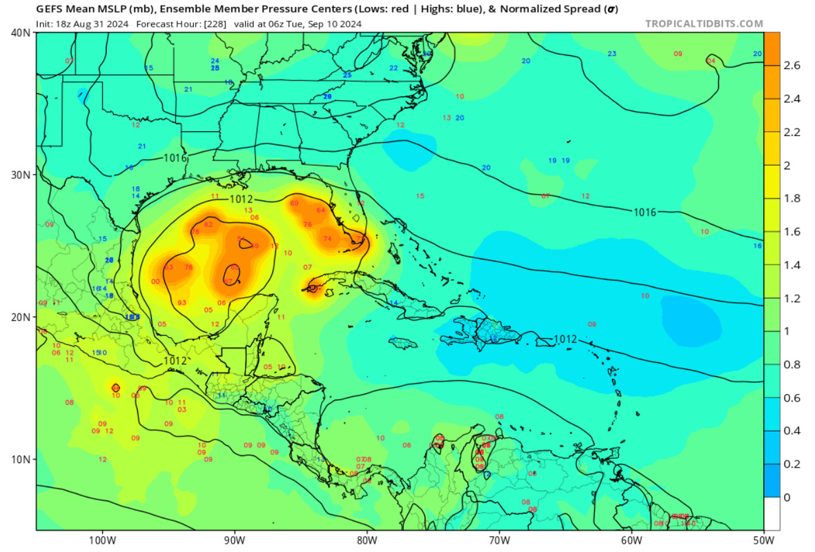
Ivanhater wrote:Ensembles mostly Louisiana to east of Florida
https://uploads.tapatalk-cdn.com/20240901/01680edb4040a81eecd37df7f74f9900.jpg
Sent from my motorola razr plus 2023 using Tapatalk


Blown Away wrote:[url]https://i.postimg.cc/jjRTdsxp/IMG-0032.jpg [/url]
If you consider the entire GOM as consistency, than 18z GEFS are correct. Flopping from MX, TX, LA, Panhandle, and throw in a few open wave runs, not very telling to me…

Blown Away wrote:[url]https://i.postimg.cc/jjRTdsxp/IMG-0032.jpg [/url]
If you consider the entire GOM as consistency, than 18z GEFS are correct. Flopping from MX, TX, LA, Panhandle, and throw in a few open wave runs, not very telling to me…
Teban54 wrote:Tropical Tidbits has loaded 18z EC-Fast out to 72 hrs. It doesn't look like the system is notably better organized than 12z Euro, but EC-Fast does have lower resolution that make the vorticity more washed out than the full-res runs would suggest. Without having access to the full run myself, I'd guess it would show vorticity a hair better than 12z, but nothing compared to the drastic difference between 18z and 12z GFS.
I wouldn't say being weak in the Caribbean rules out a strong hurricane in the Gulf, though. Recent model runs seem to suggest that if the system emerges over the Gulf as a coherent TC (even just a TS), it will bomb out. Scenarios in which this doesn't happen include if a TC still had not formed by the time it enters the Gulf, or if the system gets pushed west and crashes into Central America (low intensity can result in this, but so can a strong ridge). However, neither precludes a mid-range TS from entering the Gulf on a NW track and intensifying, even if the starting point isn't nearly as high as 18z GFS.


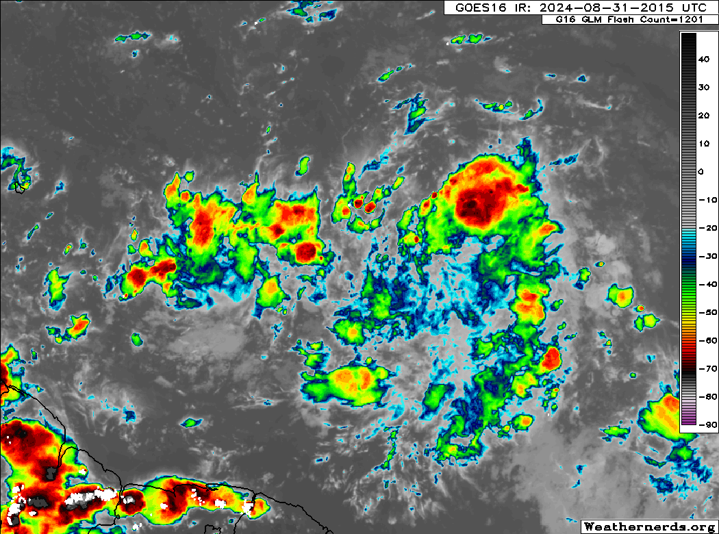
chaser1 wrote:Show me the money 'cuz I'm still not seeing it
1) Is it slightly better organized? Perhaps but it's nominal organization lacks consistency.
2) CDO?
3) Model support? Not the type I'm looking for. Show me 4 GFS model runs minimumly depicting a TD in the Caribbean, and one or more other corroborating global model output for it to mean something.
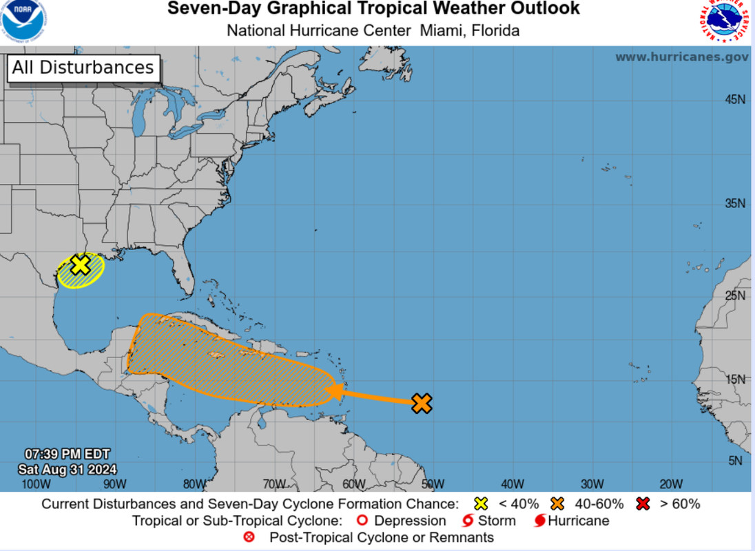
Tomorrow it may prove its worth its NHC 50% chance of development- or it could go poof


Users browsing this forum: No registered users and 117 guests


