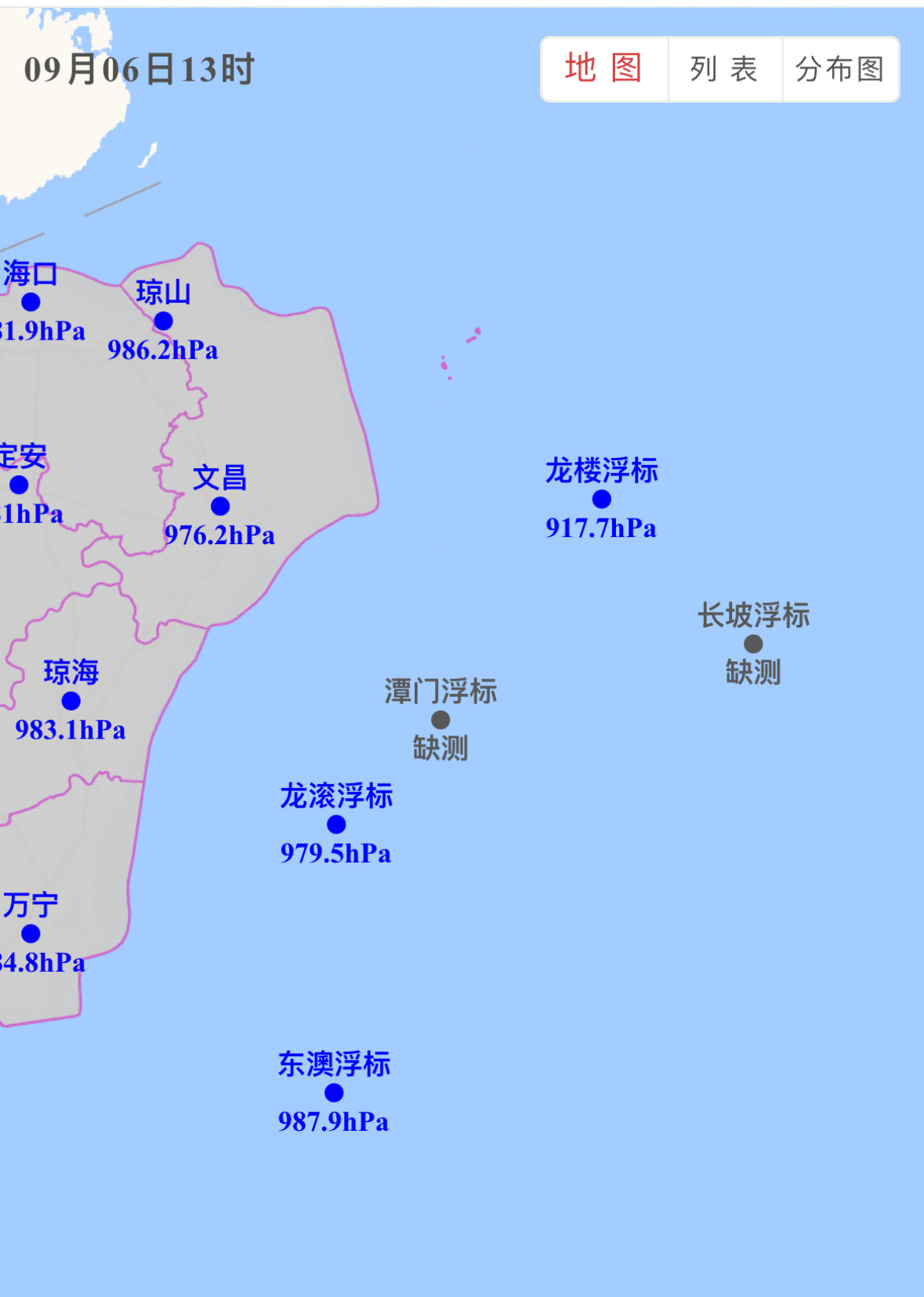
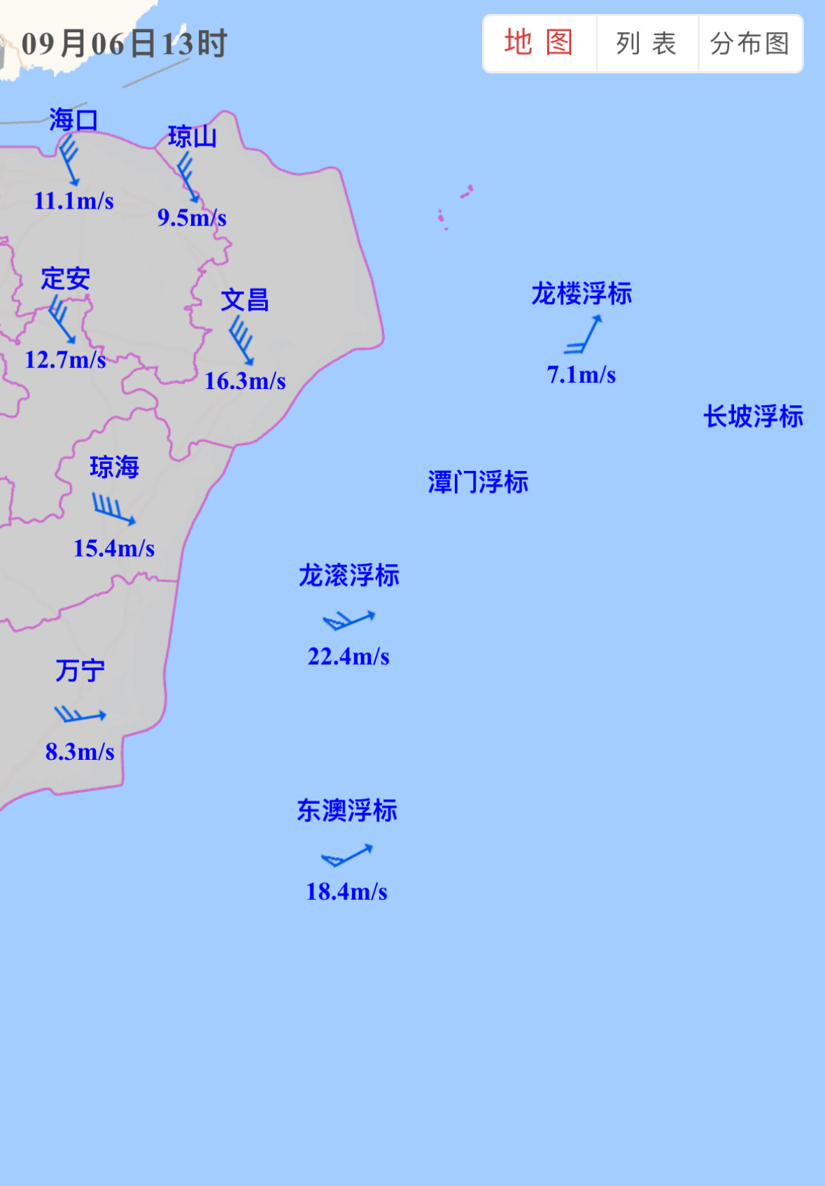
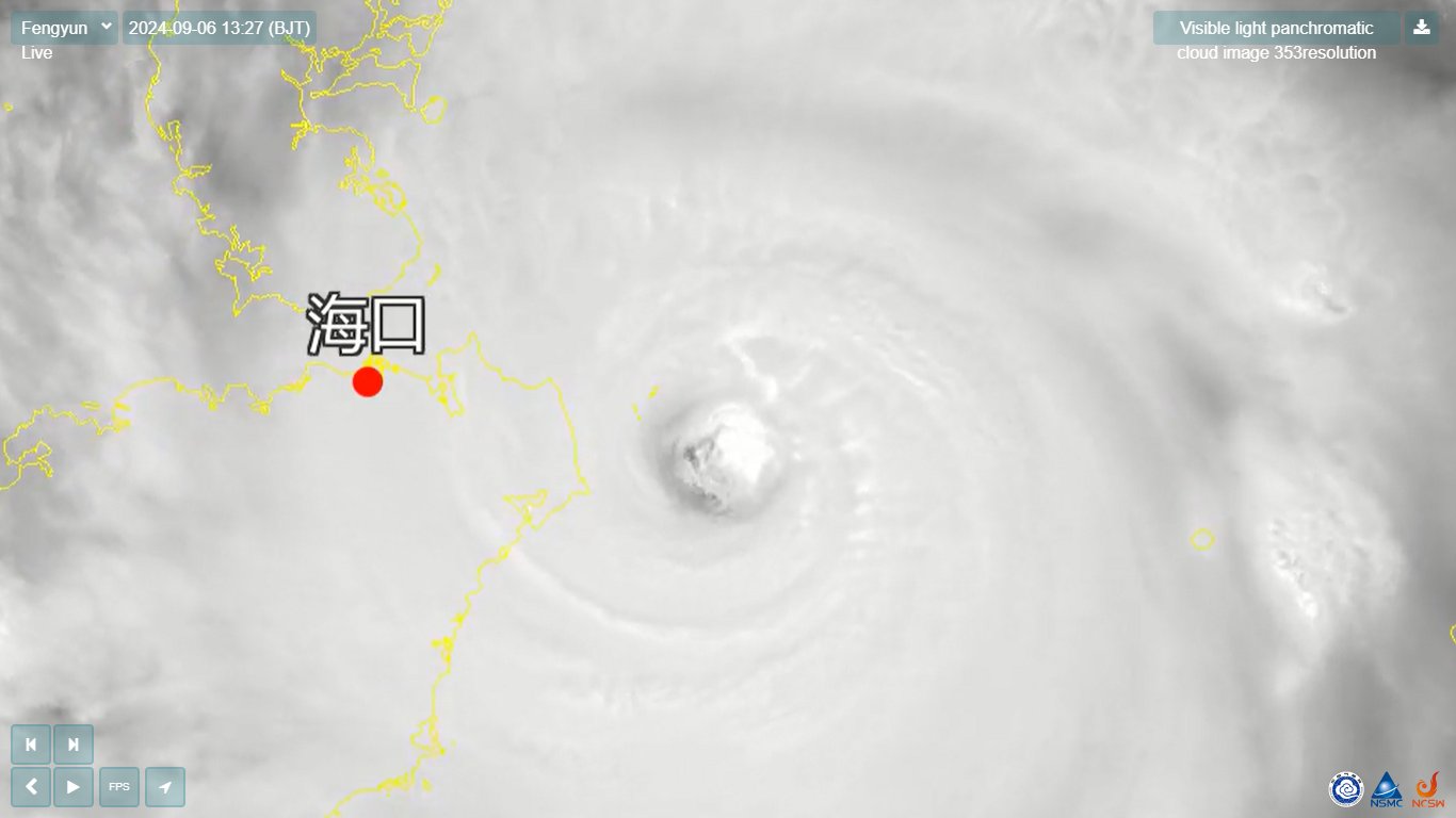
TPPN11 PGTW 051516
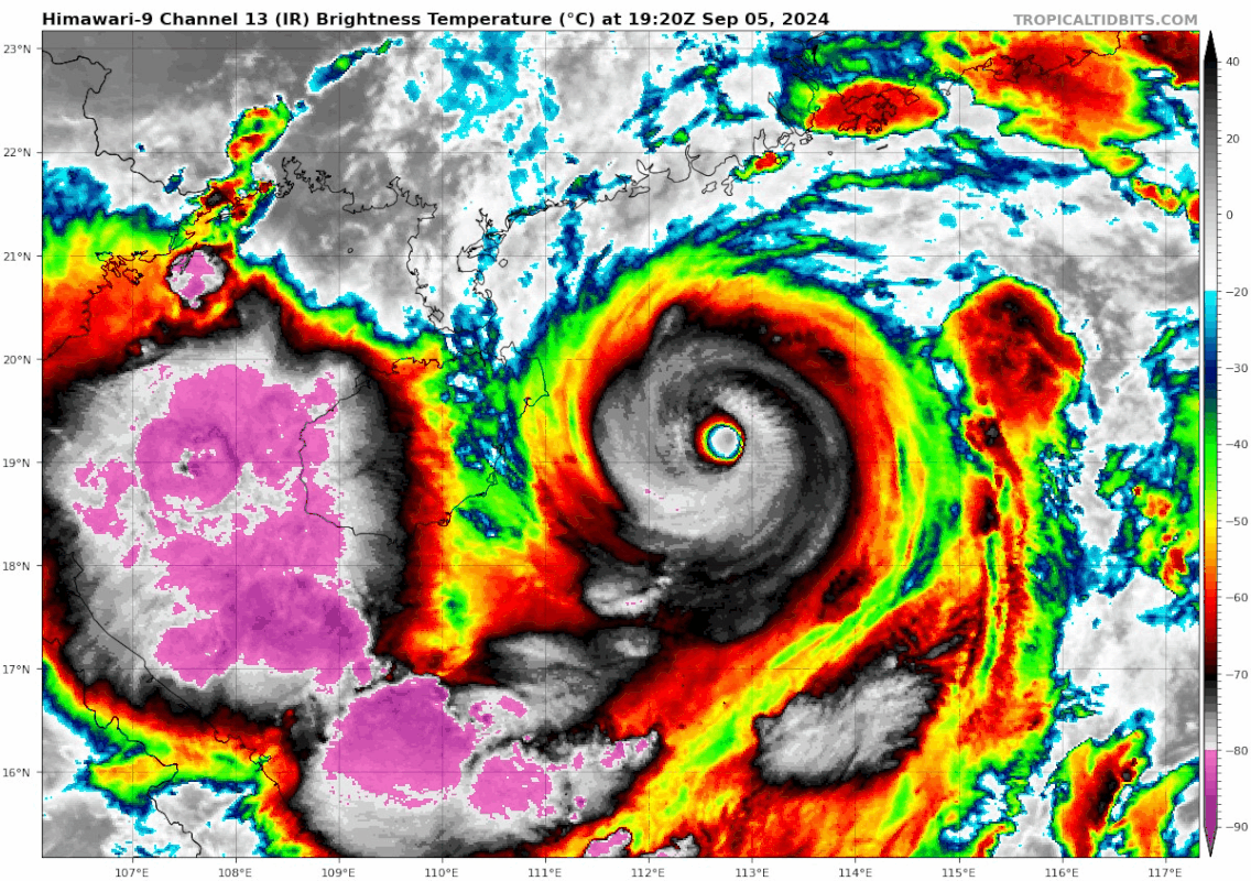
A. SUPER TYPHOON 12W (YAGI)
B. 05/1430Z
C. 19.23N
D. 113.68E
E. ONE/GK2A
F. T7.0/7.0/D1.0/24HRS STT: D0.5/03HRS
G. IR/EIR
H. REMARKS: 01A/PBO EYE/ANMTN. WMG EYE SURROUNDED BY W YIELDS AN E#
OF 6.0. ADDED 1.0 EYE ADJUSTMENT FOR CMG, TO YIELD A DT OF 7.0. MET
AND PT AGREE. DBO DT.
I. ADDITIONAL POSITIONS:
05/1031Z 19.25N 114.42E WSFM
05/1046Z 19.23N 114.38E SSMS
RAE