https://ftp.nhc.noaa.gov/atcf/btk/bal932024.dat
ATL: GORDON - Remnants - Discussion
Moderator: S2k Moderators
- cycloneye
- Admin
- Posts: 143865
- Age: 68
- Joined: Thu Oct 10, 2002 10:54 am
- Location: San Juan, Puerto Rico
ATL: GORDON - Remnants - Discussion
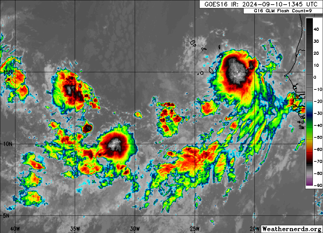
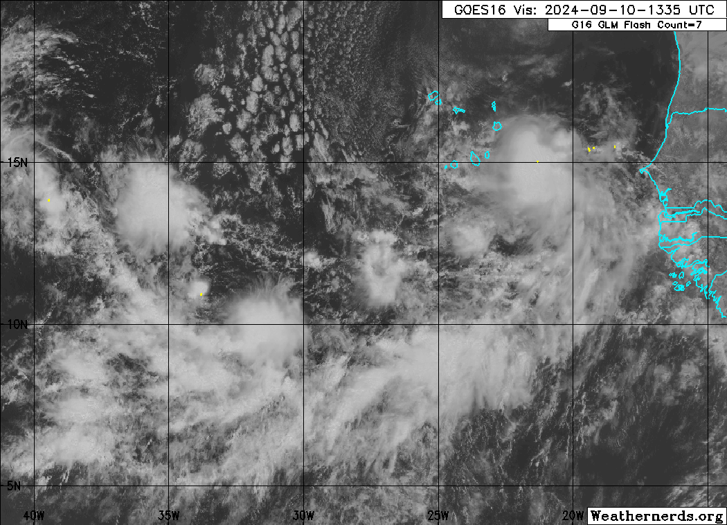
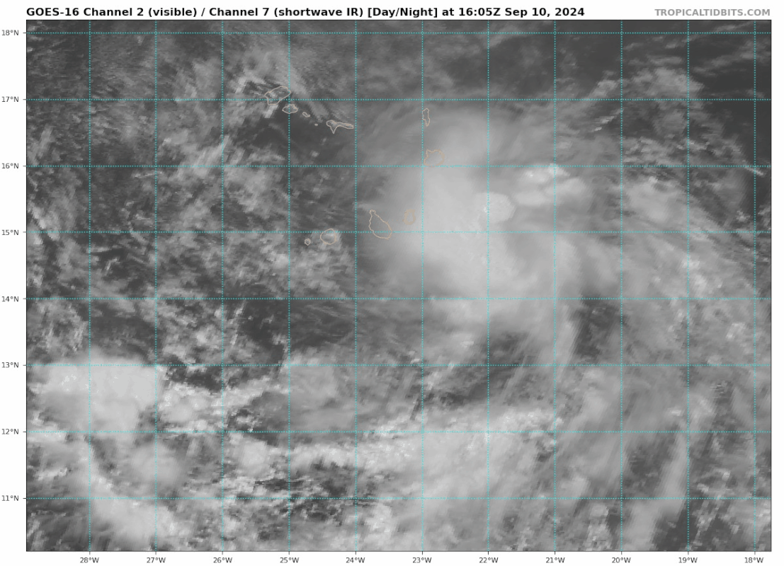
AL, 93, 2024091018, , BEST, 0, 140N, 225W, 20, 1009, DB
https://ftp.nhc.noaa.gov/atcf/btk/bal932024.dat
0 likes
Visit the Caribbean-Central America Weather Thread where you can find at first post web cams,radars
and observations from Caribbean basin members Click Here
- ElectricStorm
- Category 5
- Posts: 5017
- Age: 24
- Joined: Tue Aug 13, 2019 11:23 pm
- Location: Skiatook, OK / Norman, OK
Re: ATL: INVEST 93L - Discussion
Would be nice if we could get a good recurving ACE-producer but considering how dry/stable the MDR has been this season I wouldn't be surprised if it waits until the subtropics to get going. Fingers crossed we finally get a storm that doesn't affect any land areas, but still too early to know for sure.
1 likes
I am in no way a professional. Take what I say with a grain of salt as I could be totally wrong. Please refer to the NHC, NWS, or SPC for official information.
Boomer Sooner!
Boomer Sooner!
Re: ATL: INVEST 93L - Discussion
Right now, the system has two components: A vigorous wave SE of Cabo Verde that almost looks like a TD, and part of a monsoon trough near 35W with a weak LLC and some convective bursts (just east of 92L). The former is what NHC tagged. If the Euro is right, the wave will become less defined in the next few days, mainly because it does a Fujiwhara with the trough. That will take some time to consolidate, and the key to development is how smooth this process goes.


0 likes
Re: ATL: INVEST 93L - Discussion
ElectricStorm wrote:Would be nice if we could get a good recurving ACE-producer but considering how dry/stable the MDR has been this season I wouldn't be surprised if it waits until the subtropics to get going. Fingers crossed we finally get a storm that doesn't affect any land areas, but still too early to know for sure.
Most models that develop this do seem to only start significant intensification once the system is already on the recurve. I don't think that's entirely because of hostile conditions in the MDR, though (if at all): it's a combination of the merger that delays consolidation, and the timing of the trough right when genesis can take place and/or conditions become more favorable.
More generally, while I haven't verified this myself, my gut instinct is that more CV storms reach their peak north of 20N than people think. MDR is Main Development Region, not Main Intensification Region.
3 likes
- cycloneye
- Admin
- Posts: 143865
- Age: 68
- Joined: Thu Oct 10, 2002 10:54 am
- Location: San Juan, Puerto Rico
Re: ATL: INVEST 93L - Discussion
Wave looks good with a good circulation.


1 likes
Visit the Caribbean-Central America Weather Thread where you can find at first post web cams,radars
and observations from Caribbean basin members Click Here
- cycloneye
- Admin
- Posts: 143865
- Age: 68
- Joined: Thu Oct 10, 2002 10:54 am
- Location: San Juan, Puerto Rico
Re: ATL: INVEST 93L - Discussion

0 likes
Visit the Caribbean-Central America Weather Thread where you can find at first post web cams,radars
and observations from Caribbean basin members Click Here
- Blown Away
- S2K Supporter
- Posts: 10140
- Joined: Wed May 26, 2004 6:17 am
Re: ATL: INVEST 93L - Discussion
Is 93L part of the red cone?
0 likes
Hurricane Eye Experience: David 79, Irene 99, Frances 04, Jeanne 04, Wilma 05... EYE COMING MY WAY IN 2024…
Hurricane Brush Experience: Andrew 92, Erin 95, Floyd 99, Matthew 16, Irma 17, Ian 22, Nicole 22…
- cycloneye
- Admin
- Posts: 143865
- Age: 68
- Joined: Thu Oct 10, 2002 10:54 am
- Location: San Juan, Puerto Rico
Re: ATL: INVEST 93L - Discussion
Blown Away wrote:Is 93L part of the red cone?
Yes it is.
0 likes
Visit the Caribbean-Central America Weather Thread where you can find at first post web cams,radars
and observations from Caribbean basin members Click Here
Re: ATL: INVEST 93L - Discussion
This is the best-looking eastern MDR wave that we've seen this season.


3 likes
- cycloneye
- Admin
- Posts: 143865
- Age: 68
- Joined: Thu Oct 10, 2002 10:54 am
- Location: San Juan, Puerto Rico
Re: ATL: INVEST 93L - Discussion
Eastern and Central Tropical Atlantic (AL93):
Showers and thunderstorms are showing signs of organization with a
tropical wave located a few hundred miles to the west-southwest of
the Cabo Verde Islands. Environmental conditions appear favorable
for additional development of this system, and a tropical depression
is likely to form over the next few days as the system moves
west-northwestward at 10 to 15 mph into the central Tropical
Atlantic.
* Formation chance through 48 hours...medium...50 percent.
* Formation chance through 7 days...high...90 percent.
0 likes
Visit the Caribbean-Central America Weather Thread where you can find at first post web cams,radars
and observations from Caribbean basin members Click Here
- cycloneye
- Admin
- Posts: 143865
- Age: 68
- Joined: Thu Oct 10, 2002 10:54 am
- Location: San Juan, Puerto Rico
Re: ATL: INVEST 93L - Discussion
Looks liike a TD.


1 likes
Visit the Caribbean-Central America Weather Thread where you can find at first post web cams,radars
and observations from Caribbean basin members Click Here
- cycloneye
- Admin
- Posts: 143865
- Age: 68
- Joined: Thu Oct 10, 2002 10:54 am
- Location: San Juan, Puerto Rico
Re: ATL: INVEST 93L - Discussion
Eastern and Central Tropical Atlantic (AL93):
Updated: Recent satellite-wind data indicates that the system
located a few hundred miles to the west-southwest of the Cabo Verde
Islands has developed a well-defined circulation. In addition,
showers and thunderstorms continue to show signs of organization,
and if these trends continue, advisories will be issued on a
tropical depression later this morning. The system is moving to the
west-northwest at 10 to 15 mph and will be moving into the central
Tropical Atlantic by the end of the week.
* Formation chance through 48 hours...high...90 percent.
* Formation chance through 7 days...high...90 percent.
4 likes
Visit the Caribbean-Central America Weather Thread where you can find at first post web cams,radars
and observations from Caribbean basin members Click Here
Re: ATL: INVEST 93L - Discussion= Special Tropical Weather Outlook issued
Will almost certainly become a TD later today, probably already is one now. None of the models showed this system consolidating this quickly as far as I know. Very interested what will happen to future-Gordon.
3 likes
Re: ATL: SEVEN - Tropical Depression - Discussion
AL, 07, 2024091112, , BEST, 0, 158N, 279W, 30, 1007, TD, 34, NEQ, 0, 0, 0, 0, 1010, 100, 15, 0, 0, L, 0, , 0, 0, SEVEN, S, 0, , 0, 0, 0, 0, genesis-num, 020, TRANSITIONED, alC32024 to al072024,
https://www.ssd.noaa.gov/PS/TROP/DATA/A ... 072024.dat
3 likes
- Kazmit
- Category 5
- Posts: 2124
- Age: 22
- Joined: Mon Jul 25, 2016 8:49 am
- Location: Williamsburg, VA / Bermuda
Re: ATL: INVEST 93L - Discussion= Special Tropical Weather Outlook issued
Lol, and the GFS said it would never develop.
1 likes
Igor 2010, Sandy 2012, Fay 2014, Gonzalo 2014, Joaquin 2015, Nicole 2016, Humberto 2019
I am only a tropical weather enthusiast. My predictions are not official and may or may not be backed by sound meteorological data. For official information, please refer to the NHC and NWS products.
-
- Category 5
- Posts: 8903
- Age: 39
- Joined: Thu Jul 06, 2017 1:51 am
Re: ATL: INVEST 93L - Discussion= Special Tropical Weather Outlook issued
NHC will initiate advisories on Tropical Depression Seven, located to the west of the Cabo Verde Islands in the eastern Tropical Atlantic, at 1100 AM AST (1500 UTC).
6 likes
Re: ATL: INVEST 93L - Discussion= Special Tropical Weather Outlook issued
Cyclogenesis in 2024's eastern MDR that's plagued with dry, stable air? Impossible!
3 likes
Re: ATL: SEVEN - Tropical Depression - Discussion
So we can basically throw the latest model runs for this out of the window since it's already a TD? This one has me intrigued, now clue what will happen now.
Last edited by kevin on Wed Sep 11, 2024 9:30 am, edited 1 time in total.
0 likes
Who is online
Users browsing this forum: No registered users and 3 guests