
caneman wrote:When is the origination area supposed to start taking place. How long until we see it on the map?
Looks like Friday based on the Canadian, which has been the most bullish
Moderator: S2k Moderators

caneman wrote:When is the origination area supposed to start taking place. How long until we see it on the map?

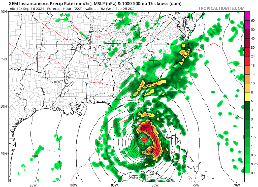
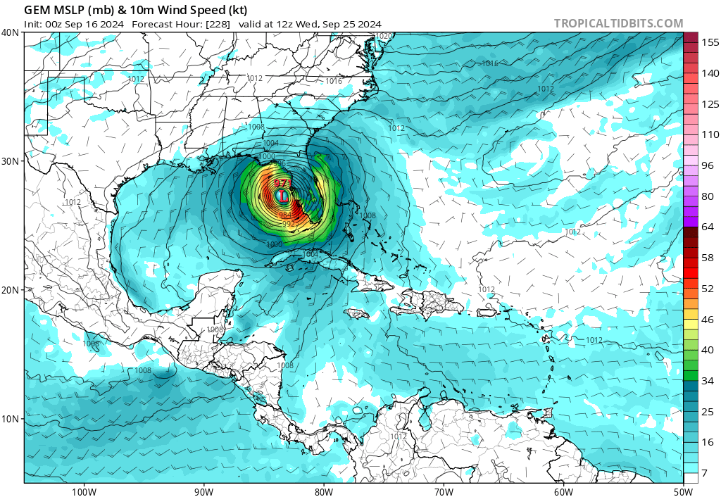
talk about a worse case scenario......


Stormlover70 wrote:talk about a worse case scenario......

otowntiger wrote:Stormlover70 wrote:talk about a worse case scenario......
Definitely a bad, if not worst case as you say for location, but for it to be worst case overall the storm would need to be a lot more intense. I think 971 MB would potentially equate to cat, if I’m not mistaken


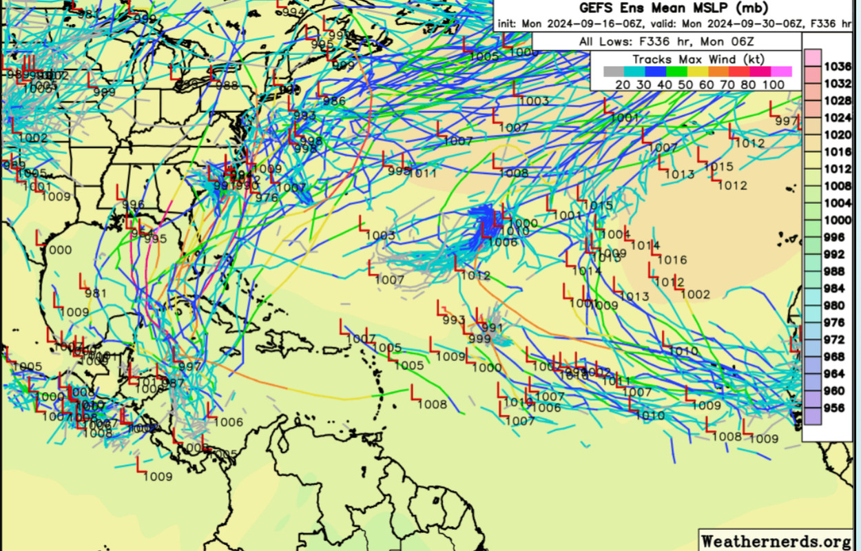
The year I started tracking storms. With barometer bob.WaveBreaking wrote:00Z AIFS shows a massive storm with an Isidore-like track into the GOM and a minimum pressure of 965mb at the end of the run.
https://i.imgur.com/0c25zRg.gif
The main cause for this track is an omega block that the AIFS develops about a week from now. Also, the trough that most models show scooping the storm up to Florida instead stalls out in the Great Plains due to a stronger ridge.
https://i.imgur.com/se0zY1c.jpeg


WaveBreaking wrote:00Z AIFS shows a massive storm with an Isidore-like track into the GOM and a minimum pressure of 965mb at the end of the run.
https://i.imgur.com/0c25zRg.gif
The main cause for this track is an omega block that the AIFS develops about a week from now. Also, the trough that most models show scooping the storm up to Florida instead stalls out in the Great Plains due to a stronger ridge.
https://i.imgur.com/se0zY1c.jpeg


WaveBreaking wrote:WaveBreaking wrote:00Z AIFS shows a massive storm with an Isidore-like track into the GOM and a minimum pressure of 965mb at the end of the run.
https://i.imgur.com/0c25zRg.gif
The main cause for this track is an omega block that the AIFS develops about a week from now. Also, the trough that most models show scooping the storm up to Florida instead stalls out in the Great Plains due to a stronger ridge.
https://i.imgur.com/se0zY1c.jpeg
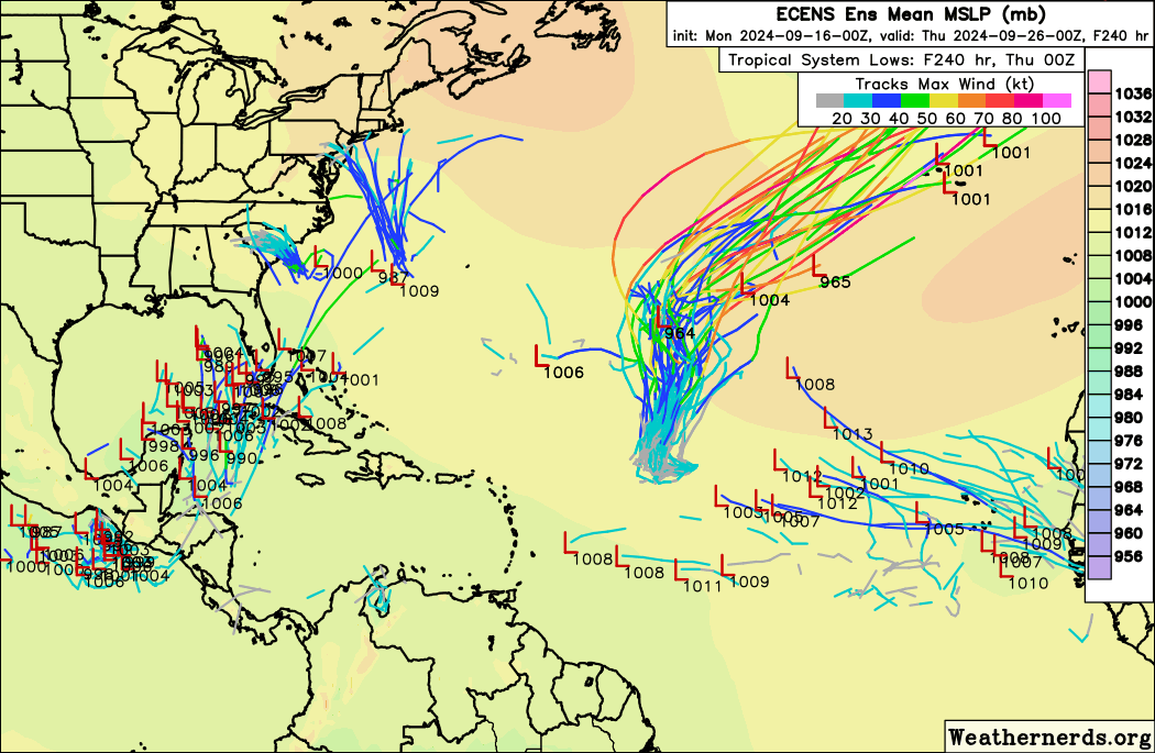
06Z AIFS run continues with this track. None of the other models show this solution, but the AIFS has nailed the tracks for recent storms. Have to see if it continues to show this.
https://i.imgur.com/2vu59di.gif
Europa non è lontana wrote:Both the 18z and 06z GFS runs have had a strong tropical storm forming in the Black Sea at around +180.
https://i.imgur.com/NyTsmtr.gif

WaveBreaking wrote:WaveBreaking wrote:00Z AIFS shows a massive storm with an Isidore-like track into the GOM and a minimum pressure of 965mb at the end of the run.
https://i.imgur.com/0c25zRg.gif
The main cause for this track is an omega block that the AIFS develops about a week from now. Also, the trough that most models show scooping the storm up to Florida instead stalls out in the Great Plains due to a stronger ridge.
https://i.imgur.com/se0zY1c.jpeg
06Z AIFS run continues with this track. None of the other models show this solution, but the AIFS has nailed the tracks for recent storms. Have to see if it continues to show this.
https://i.imgur.com/2vu59di.gif


Stratton23 wrote:ridge is much stronger on the 12z GFS, think we are seeing a trend here

Users browsing this forum: No registered users and 146 guests

