ATL: MILTON - Models
Moderator: S2k Moderators
-
South Texas Storms

- Professional-Met

- Posts: 4263
- Joined: Thu Jun 24, 2010 12:28 am
- Location: Houston, TX
-
Emmett_Brown

- Category 5

- Posts: 1433
- Joined: Wed Aug 24, 2005 9:10 pm
- Location: Sarasota FL


Re: ATL: INVEST 92L - Models
Oh boy, the models are gonna be fun to watch now that we have a designated Invest programmed into the equation. Btw, satellite floater is already on it  . I think I smell a video from Levi in the works.
0 likes
Andy D
(For official information, please refer to the NHC and NWS products.)
(For official information, please refer to the NHC and NWS products.)
-
Hypercane_Kyle

- Category 5
- Posts: 3465
- Joined: Sat Mar 07, 2015 7:58 pm
- Location: Cape Canaveral, FL
Re: ATL: INVEST 92L - Models
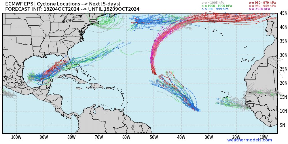
Two pretty clear solutions on the models - weaker, further south; or stronger and further north.
We'll see what happens. I give GFS a lot of credit after Helene, but hard to ignore the ICON/Euro/CMC solutions too.
We'll see what happens. I give GFS a lot of credit after Helene, but hard to ignore the ICON/Euro/CMC solutions too.
3 likes
My posts are my own personal opinion, defer to the National Hurricane Center (NHC) and other NOAA products for decision making during hurricane season.
Re: ATL: INVEST 92L - Models
Hypercane_Kyle wrote:Two pretty clear solutions on the models - weaker, further south; or stronger and further north.
We'll see what happens. I give GFS a lot of credit after Helene, but hard to ignore the ICON/Euro/CMC solutions too.
Which I find rather interesting. My first thought would tend to be "South - Stronger", and "North -Weaker".... simply assuming that the further north, the greater the shear. Clearly that does not seem to be the case
1 likes
Andy D
(For official information, please refer to the NHC and NWS products.)
(For official information, please refer to the NHC and NWS products.)
-
cycloneye

- Admin

- Posts: 149827
- Age: 69
- Joined: Thu Oct 10, 2002 10:54 am
- Location: San Juan, Puerto Rico
Re: ATL: INVEST 92L - Models

2 likes
Visit the Caribbean-Central America Weather Thread where you can find at first post web cams,radars
and observations from Caribbean basin members Click Here
and observations from Caribbean basin members Click Here
-
gatorcane

- S2K Supporter

- Posts: 23708
- Age: 48
- Joined: Sun Mar 13, 2005 3:54 pm
- Location: Boca Raton, FL
Re: ATL: INVEST 92L - Models
12Z EC-AIFS shifts north and is stronger, looks to come in just south of Tampa Bay (Sarasota area). The 06Z was into SW Florida (Fort Myers - Naples). For this storm, stronger looks to mean more to the left (i.e. north) in this case:
3 likes
-
SconnieCane
- Category 5
- Posts: 1013
- Joined: Thu Aug 02, 2018 5:29 pm
- Location: Madison, WI
Re: ATL: INVEST 92L - Models
This could be a further north version of "Wrong-Way Lenny" of 1999, one of the only other relatively recent examples of an Atlantic tropical cyclone that spent all or nearly all of its life moving from west to east.
4 likes

Re: ATL: INVEST 92L - Models
18Z GFS has just the weak low crossing the Everglades so the alarming earlier consensus for a hurricane isn't cast in stone yet.
1 likes
-
jlauderdal
- S2K Supporter
- Posts: 7240
- Joined: Wed May 19, 2004 5:46 am
- Location: NE Fort Lauderdale
- Contact:
Re: ATL: INVEST 92L - Models
Looks to be expanding on approach.gatorcane wrote:12Z EC-AIFS shifts north and is stronger, looks to come in just south of Tampa Bay (Sarasota area). The 06Z was into SW Florida (Fort Myers - Naples). For this storm, stronger looks to mean more to the left (i.e. north) in this case:
1 likes
-
toad strangler

- S2K Supporter
- Posts: 4546
- Joined: Sun Jul 28, 2013 3:09 pm
- Location: Earth
- Contact:
Re: ATL: INVEST 92L - Models
18z Euro 
1 likes
My Weather Station
https://www.wunderground.com/dashboard/pws/KFLPORTS603
https://www.wunderground.com/dashboard/pws/KFLPORTS603

-
chris_fit

- Category 5
- Posts: 3261
- Age: 43
- Joined: Wed Sep 10, 2003 11:58 pm
- Location: Tampa Bay Area, FL
Re: ATL: INVEST 92L - Models
toad strangler wrote:18z Euro
18z EPS similar to 12z.... Many hurricane members.
2 likes
-
AutoPenalti
- Category 5
- Posts: 4091
- Age: 29
- Joined: Mon Aug 17, 2015 4:16 pm
- Location: Ft. Lauderdale, Florida
Re: ATL: INVEST 92L - Models
I’m still in the consensus that this will probably be just a tad south of the big bend.
0 likes
The posts in this forum are NOT official forecasts and should not be used as such. They are just the opinion of the poster and may or may not be backed by sound meteorological data. They are NOT endorsed by any professional institution or STORM2K. For official information, please refer to products from the NHC and NWS.
Model Runs Cheat Sheet:
GFS (5:30 AM/PM, 11:30 AM/PM)
HWRF, GFDL, UKMET, NAVGEM (6:30-8:00 AM/PM, 12:30-2:00 AM/PM)
ECMWF (1:45 AM/PM)
TCVN is a weighted averaged
-
Emmett_Brown
- Category 5
- Posts: 1433
- Joined: Wed Aug 24, 2005 9:10 pm
- Location: Sarasota FL
Re: ATL: INVEST 92L - Models
chris_fit wrote:toad strangler wrote:18z Euro
18z EPS similar to 12z.... Many hurricane members.
I noticed one ensemble member down to 926 mb.
1 likes
-
ColdMiser123

- Professional-Met
- Posts: 905
- Age: 29
- Joined: Mon Sep 26, 2016 3:26 pm
- Location: Northeast US
Re: ATL: INVEST 92L - Models
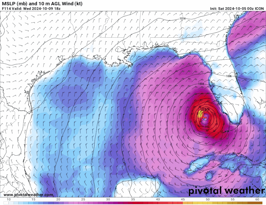
GFS has a significant hurricane by Monday evening.
0 likes
B.S., M.S., Meteorology & Atmospheric Science
Re: ATL: INVEST 92L - Models
0z GFS strengthening quickly so far, gets to 960mb at 81 hours.

0 likes

Re: ATL: INVEST 92L - Models
That would be a slap to the face to the west coast of FL if the latest GFS comes to fruition.
0 likes
Who is online
Users browsing this forum: No registered users and 4 guests