ATL: MILTON - Models
Moderator: S2k Moderators
-
tolakram
- Admin

- Posts: 20179
- Age: 62
- Joined: Sun Aug 27, 2006 8:23 pm
- Location: Florence, KY (name is Mark)
Re: ATL: MILTON - Models
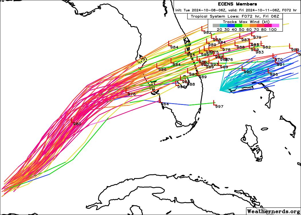
The ensembles will continue to show more south as any northerly solutions run into the front. Every storm in this situation seems to have an ensemble discussion like this, but I'm not sure how valuable it is.
1 likes
M a r k
- - - - -
Join us in chat: Storm2K Chatroom Invite. Android and IOS apps also available.
The posts in this forum are NOT official forecasts and should not be used as such. Posts are NOT endorsed by any professional institution or STORM2K.org. For official information and forecasts, please refer to NHC and NWS products.
-
skillz305
- Category 1

- Posts: 312
- Joined: Sat Sep 08, 2018 11:10 am
- Location: Miami, Florida --> Vero Beach, Florida
Re: ATL: MILTON - Models
TampaWxLurker wrote:SFLcane wrote:https://i.postimg.cc/CxpJ9Ntj/vvvv.png
What's the trend with these?
Definitely south…
4 likes
 Hurricanes: Andrew 1992 - Irene 1999 - Frances 2004 - Jeanne 2004 - Katrina 2005 - Wilma 2005 - Matthew 2016 - Irma 2017 - Ian 2022 - Nicole 2022 - Milton 2024
Re: ATL: MILTON - Models
12z icon, pretty much the same as 6z, maybe a hairline slightly left/north into the bay rather than Bradenton, exits in Atlantic by Cocoa Beach.

Last edited by BobHarlem on Tue Oct 08, 2024 10:15 am, edited 1 time in total.
0 likes

Re: ATL: MILTON - Models
And just like that the 12z ICON quiets the 06z Euro ensembles fans. If memory serves me correct they always seem to be biased left or right during a gulf coast landfall.
Will go into archives to verify.

Will go into archives to verify.
0 likes

Re: ATL: MILTON - Models
12z ICON almost identical to 06z ICON, but a bit stronger than maybe a tiny bit further north (but we're talking about a few miles at most).
0 likes
Re: ATL: MILTON - Models
kevin wrote:12z ICON almost identical to 06z ICON, but a bit stronger than maybe a tiny bit further north (but we're talking about a few miles at most).
Earlier 06z run never had it going up Tampa Bay.
0 likes
-
SFLcane

- S2K Supporter

- Posts: 10281
- Age: 48
- Joined: Sat Jun 05, 2010 1:44 pm
- Location: Lake Worth Florida
Re: ATL: MILTON - Models
NDG wrote:And just like that the 12z ICON quiets the 06z Euro ensembles fans. If memory serves me correct they always seem to be biased left or right during a gulf coast landfall.
Will go into archives to verify.
https://i.imgur.com/3d51rPa.gif
Icon quiets the 06z euro fans? Icon is not a product the NHC uses and yes i dont think the nhc is putting to much stock on any ensembles at the moment.
This is about the only thing left to really watch if i was a betting man i would say this comes in south of tampa always tricky at this angle.
NHC 11am discussion...
However, it is critical to remember that even at 36-48 hours away, NHC's track forecasts can be off by an average of 60-70 n mi, which means we still can't pinpoint an exact landfall location, especially if the hurricane wobbles as it approaches the coast.
2 likes

-
CycloysisNegative
- Tropical Low

- Posts: 28
- Joined: Fri Jul 05, 2024 11:36 am
- Location: Summerville, SC
Re: ATL: MILTON - Models
12z ICON is ~15mi south of bringing catastrophic storm surge into Pinellas/Tampa. Wobble watching will be gut wrenching.
0 likes
Re: ATL: MILTON - Models
SFLcane wrote:NDG wrote:And just like that the 12z ICON quiets the 06z Euro ensembles fans. If memory serves me correct they always seem to be biased left or right during a gulf coast landfall.
Will go into archives to verify.
https://i.imgur.com/3d51rPa.gif
Icon quites the 06z euro fans? Icon is not a product the NHC uses and yes i dont think the nhc is putting to much stock on any ensembles at the moment.
This is about the only thing left to really watch if i was a betting man i would say this comes in south of tampa always tricky at this angle.
NHC 11am discussion...
However, it is critical to remember that even at 36-48 hours away, NHC's track forecasts can be off by an average of 60-70 n mi, which means we still can't pinpoint an exact landfall location, especially if the hurricane wobbles as it approaches the coast.
My point was that many thought, and including on X, that the 06z Euro ensembles was the start of trend to the south by the rest of the models.
ICON usually sniffs that pretty well, but it didn't.
0 likes
-
tolakram
- Admin
- Posts: 20179
- Age: 62
- Joined: Sun Aug 27, 2006 8:23 pm
- Location: Florence, KY (name is Mark)
Re: ATL: MILTON - Models
GFS trend

0 likes
M a r k
- - - - -
Join us in chat: Storm2K Chatroom Invite. Android and IOS apps also available.
The posts in this forum are NOT official forecasts and should not be used as such. Posts are NOT endorsed by any professional institution or STORM2K.org. For official information and forecasts, please refer to NHC and NWS products.
- - - - -
Join us in chat: Storm2K Chatroom Invite. Android and IOS apps also available.
The posts in this forum are NOT official forecasts and should not be used as such. Posts are NOT endorsed by any professional institution or STORM2K.org. For official information and forecasts, please refer to NHC and NWS products.
Re: ATL: MILTON - Models
12z GFS landfall at or just north of Bradenton. A hair south of 06z, but we're talking a difference of pixels. Not caving to the Euro so far.


0 likes
Re: ATL: MILTON - Models
12z GFS is slightly weaker so it is slightly south of previous 06z run.
0 likes
-
Mouton
- S2K Supporter
- Posts: 222
- Age: 80
- Joined: Sat Jul 30, 2011 8:13 am
- Location: Amelia Island Florida
Re: ATL: MILTON - Models
Id be careful to not put much stock into model paths that show a west due east path for a storm of this strength landfall. I don't recall any storm doing that.
The last few sat images do show a slight jog south east but I doubt that lasts. It could if it continues for a while, bring Milt a tad south of TBay.
Looking ahead, the water vapor shows a definite line going WSW to ENE but over the past few runs that line seems to be trending a tad north on the east edge of the view.
On a separate idea, gas is going to become hard to find.
0 likes
-
tolakram
- Admin
- Posts: 20179
- Age: 62
- Joined: Sun Aug 27, 2006 8:23 pm
- Location: Florence, KY (name is Mark)
Re: ATL: MILTON - Models
trend

0 likes
M a r k
- - - - -
Join us in chat: Storm2K Chatroom Invite. Android and IOS apps also available.
The posts in this forum are NOT official forecasts and should not be used as such. Posts are NOT endorsed by any professional institution or STORM2K.org. For official information and forecasts, please refer to NHC and NWS products.
- - - - -
Join us in chat: Storm2K Chatroom Invite. Android and IOS apps also available.
The posts in this forum are NOT official forecasts and should not be used as such. Posts are NOT endorsed by any professional institution or STORM2K.org. For official information and forecasts, please refer to NHC and NWS products.
Re: ATL: MILTON - Models
12z GFS very similar to 6z, on entry and exit. Bay/Bradenton landfall, over Orlando then to Titusville/Playalinda beach exit. TIming the same.

1 likes
Re: ATL: MILTON - Models
Wobble watching will be huge if it's coming into either bradenton or st pete. But, model trends south have been ongoing for over 24 hours now. I wouldn't be least bit surprised if it goes venice or port charlotte.
0 likes
Re: ATL: MILTON - Models
Mike33534 wrote:Wobble watching will be huge if it's coming into either bradenton or st pete. But, model trends south have been ongoing for over 24 hours now. I wouldn't be least bit surprised if it goes venice or port charlotte.
Yes, this will likely be the most intense and contentious wobble watching session ever because of Tampa, just wait until it's in TPA radar range. Only this time everyone loses
Last edited by BobHarlem on Tue Oct 08, 2024 11:04 am, edited 3 times in total.
1 likes

Who is online
Users browsing this forum: No registered users and 6 guests