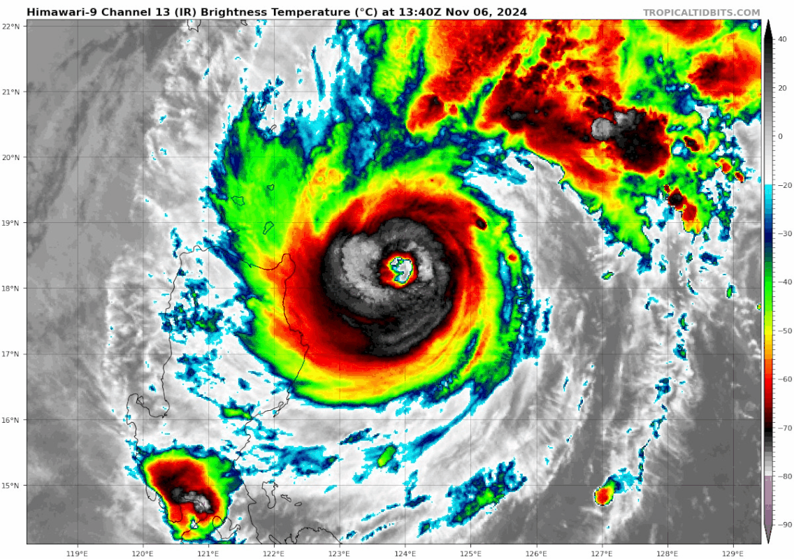
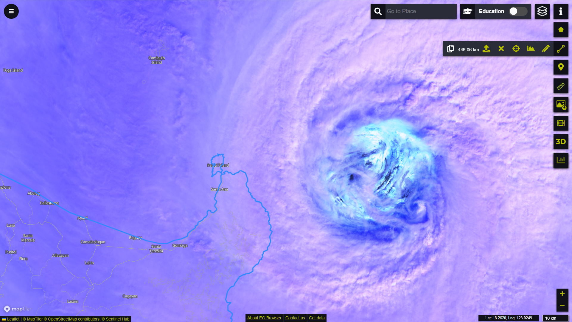
T2422(Yinxing)
Issued at 2024/11/05 00:45 UTC
Analysis at 11/05 00 UTC
Grade TY
Scale -
Intensity -
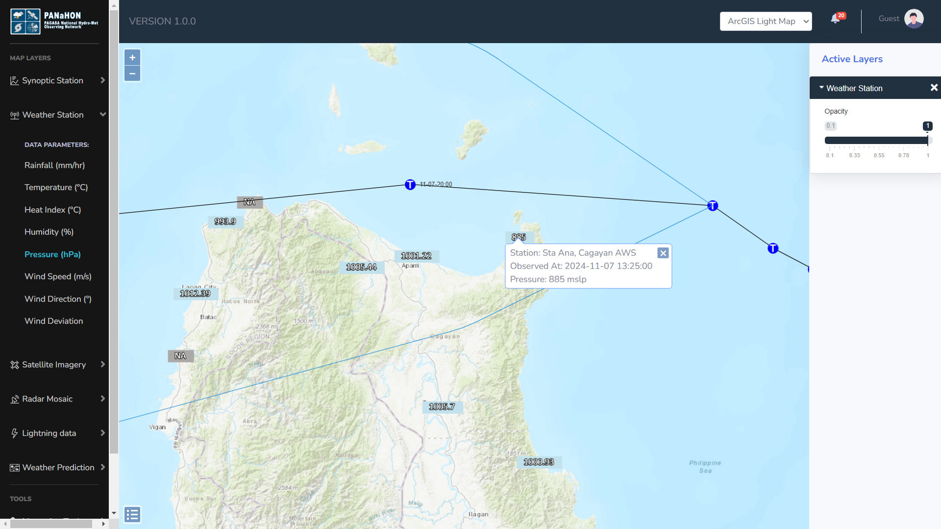
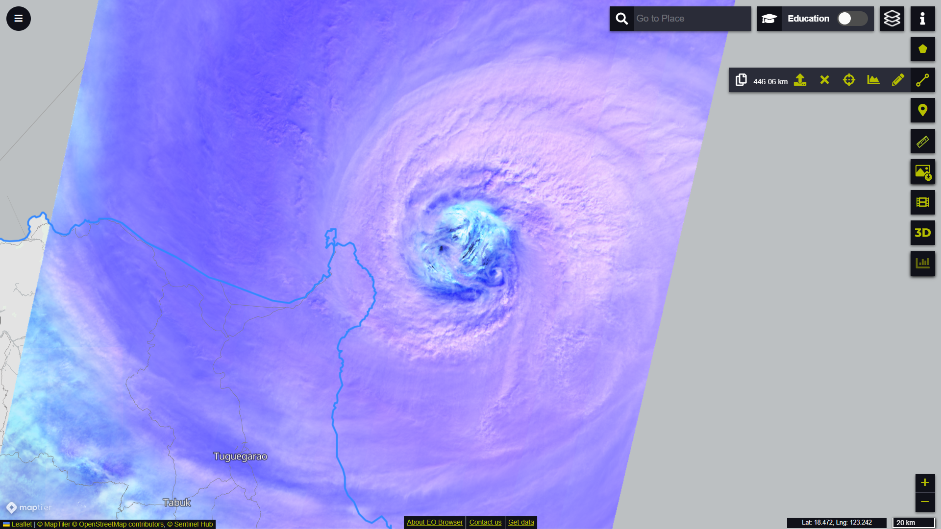
Center position N16°10′ (16.2°)
E127°35′ (127.6°)
Direction and speed of movement WNW 30 km/h (16 kt)
Central pressure 980 hPa
Maximum sustained wind speed near center 35 m/s (65 kt)
Maximum wind gust speed 50 m/s (95 kt)
Radius of 50-kt wind area 55 km (30 NM)
Radius of 30-kt wind area N390 km (210 NM)
S330 km (180 NM)
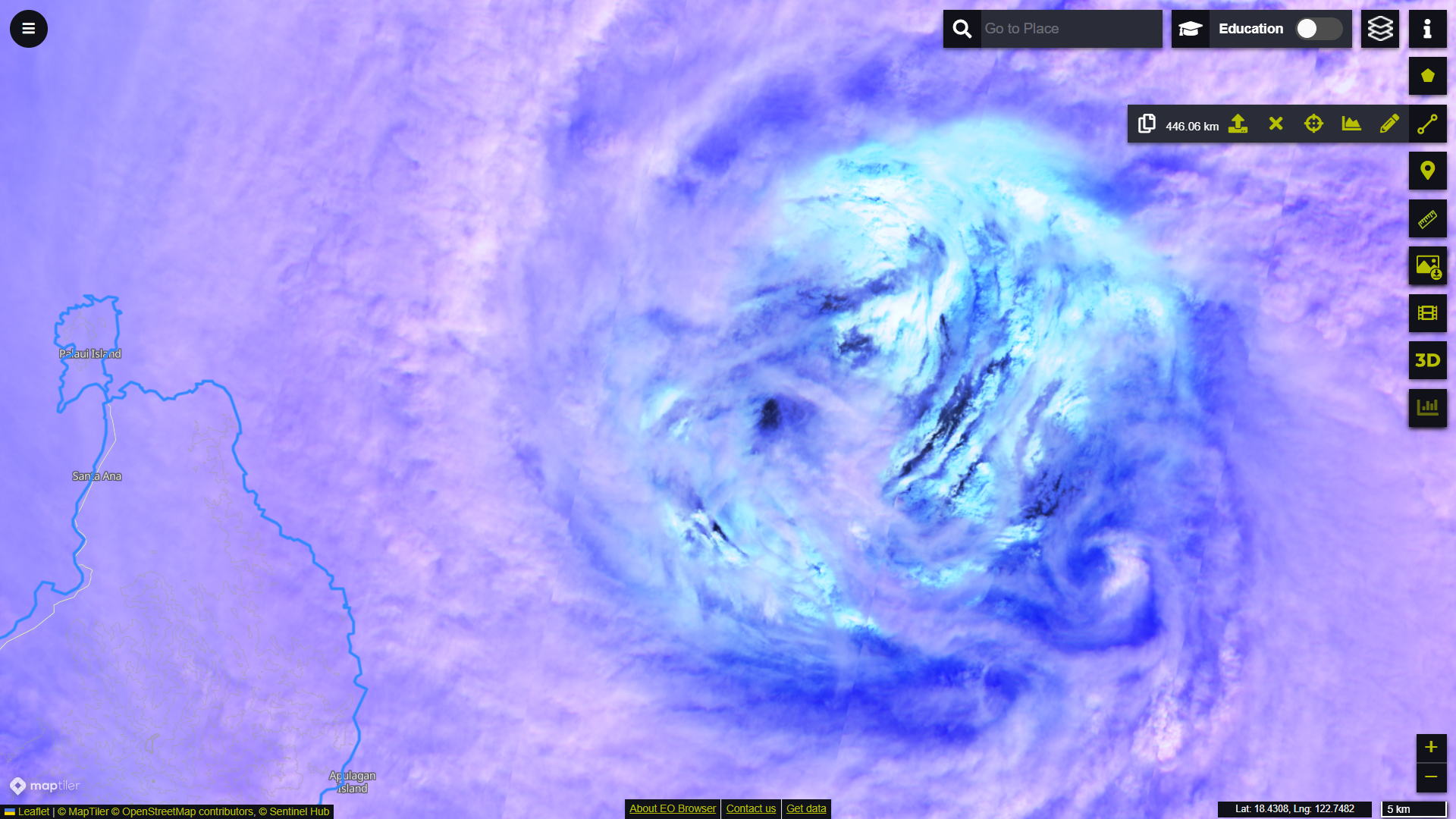
Issued at 2024/11/05 00:45 UTC
Analysis at 11/05 00 UTC
Grade TY
Scale -
Intensity -
Center position N16°10′ (16.2°)
E127°35′ (127.6°)
Direction and speed of movement WNW 30 km/h (16 kt)
Central pressure 980 hPa
Maximum sustained wind speed near center 35 m/s (65 kt)
Maximum wind gust speed 50 m/s (95 kt)
Radius of 50-kt wind area 55 km (30 NM)
Radius of 30-kt wind area N390 km (210 NM)
S330 km (180 NM)