 The posts in this forum are NOT official forecast and should not be used as such. They are just the opinion of the poster and may or may not be backed by sound meteorological data. They are NOT endorsed by any professional institution or

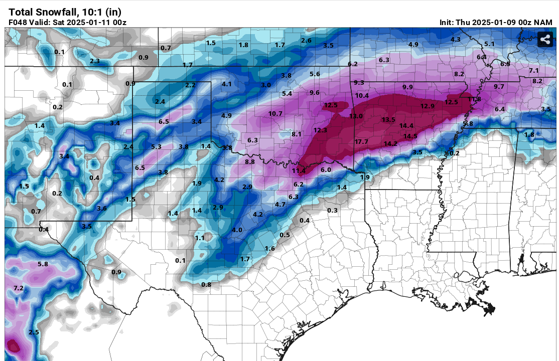
SnowintheFalls wrote:Iceresistance wrote:Well, I got absolutely NAM'ed
https://s7.gifyu.com/images/SXVBL.png
https://s7.gifyu.com/images/SXVBL.png
I would take this and run with it.
I'm still like
 that would be the biggest storm I've seen here and right after i saw 11 inches in Kansas City
 There's no doubts our trends clearly have been up though... It's just how much up
It's 24 degrees here


