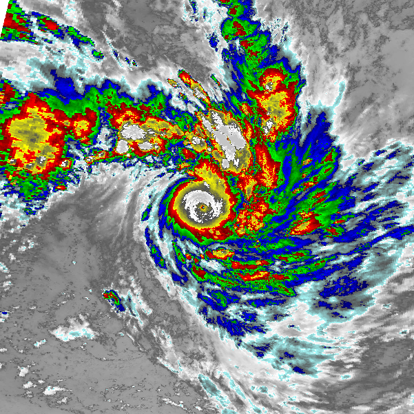
kevin wrote:Hurricane2000 wrote:What do you think of Gaemi 2024?
That's a very interesting one. At some point it might be better for me to make my own thread for these analyses (especially of non–recon typhoons). I've thought about that before and would also make it a bit more rigorous than what I'm doing now, but who knows. Anyways, let's make this the last of its kind for now so I don't spam this thread.
ADT
2024JUL23 220000 5.0 948.5 90.0 5.0 6.1 6.6 1.3T/6hr OFF OFF OFF OFF -26.86 -78.00 EYE/P -99 IR 41.8 23.13 -123.32 ARCHER HIM-9 33.4
2024JUL24 053000 6.0 927.2 115.0 5.9 6.0 6.0 NO LIMIT ON OFF OFF OFF -23.86 -73.28 EYE -99 IR 61.0 24.10 -122.54 ARCHER HIM-9 34.7
Raw T# peaked at 6.6 with a CI# peak of 6.0. I'm going with CI and thus 115 kt, 919 mb for the ADT intensity estimate.
AiDT
20240724 050000 115 112 120
20240724 053000 115 113 120
20240724 060000 115 113 125
20240724 063000 115 113 125
20240724 070000 115 114 125
During the same time period AiDT peaked at 114 kt.
AMSU
WP, 05, 202407240258, 30, AMSU, IP, , 2384N, 12320E, , 2, 152, 1, 896, 1, MEAS, , , , , , , , , , , , 9, , W, CIMS, , , , , , , , 896, , NOAA18, , , , , , , , , , , , , , , , , , , ,
AMSU peaked at 152 kt and 896 mb on the 24th of July.
D-MINT
20240724 0512 UTC AMSR2 930 hPa 128 kts 121 kts 135 kts
D-MINT had a peak intensity of 128 kt, 930 mb.
D-PRINT
20240724 0900 UTC 923 hPa 125 kts 118 kts 132 kts
At a similar time as D-MINT, D-PRINT peaked at 125 kt, 923 mb.
SATCON
2024 WP 05 206.167 2024JUL24 040000 23.97 -122.84 3 914 137
SATCON peaked at 137 kt, 914 mb.
Wind blend
All of the above estimates show a peak intensity in the morning of July 24 with a blend of 129 kt, 916 mb.
KZC relationship
Now before continuing I have to add that this is a very difficult storm to estimate. ADT/AiDT are significantly lower than the other estimates and these 2 methods are known to have difficulty handling pinhole eye systems, especially when the eye fixes are a little bit off. For example hurricane Wilma would only be 135 kt, 932 mb according to the automated ADT due to this issue. I still have to think of a good way to take this into account for these analyses since it is a common issue with short-lived pinhole systems. But for now, in this case, I'm leaning towards discarding both ADT and AiDT for the intensity blend. This results in a blend of of 136 kt, 916 mb.
Now I use the KZC relationship to find a potentially more accurate pressure value associated with the wind speed of 135 kt (rounded down from 136 kt since we usually work in steps of 5 kt). For this I used the following input values during peak intensity around 06:00z.
Vmax = 135 kt
C = 8 kt
R34 = 182 nm
Lat = 24.2 deg
Background pressure = 998 mb
This then results in a pressure estimate of 907 mb.
Conclusion
The official peak intensity for typhoon Gaemi is 125 kt, 919 mb. Based on a blend of all available satellite estimates and the KZC relationship, I estimate that Gaemi's peak intensity was significantly stronger at 135 kt, 907 mb in the early hours of July 24. However, as mentioned before, I have to note that Gaemi is an exceptionally difficult storm to estimate. The AMSU sounder for example shows high confidence (an uncertainty of only 12 kt) for a peak strength of a whopping 152 kt, while even the high-end uncertainty window for D-PRINT already ends at 132 kt. Such large discrepancies are unusual and the result of Gaemi's, at times, pinhole eye combined with the fact that the eye never cleared for a prolonged period of time. Since the eye is so important for the satellite fixes, the different algorithms behave in a very different manner.
Just after Gaemi passed I also made an intensity estimate (https://www.storm2k.org/phpbb2/viewtopic.php?f=95&t=124162&start=60#p3076141) where I estimated 140 kt, 901 mb after some fixes to the gale radius. Since then, more accurate values for the translational speed and R34 have become available which have nudged the estimate down a bit. And in hindsight I think I was a bit overreliant on the 152 kt AMSU data to push my estimate to 140 kt. 140 kt might be possible, but looking at the data now months later I wouldn't pull the trigger on it myself. Other estimates such as ATMS (133 kt) and SSMIS (133 kt) also hint at an intensity around 130 - 135 kt, while estimates such as CIRA ATMS (101 kt) show the difficulty to analyze Gaemi. A gradient wind balance estimate I found even showed a peak intensity in the 880s mb, so in conclusion I'd put less confidence in my estimate (or any other estimate) than usual.
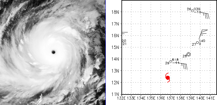
Here's a good one, Cyclone Gavin of 1997 looks extremely impressive. Very underrated storm (in my opinion) what do you think?


