snownado wrote:https://x.com/NWSSPC/status/1917581976019558535?t=BQsemUmBwhvi5Af2ELFy4g&s=19
Tornado Watch in effect east of DFW until 5pm.
Moderator: S2k Moderators

snownado wrote:https://x.com/NWSSPC/status/1917581976019558535?t=BQsemUmBwhvi5Af2ELFy4g&s=19
snownado wrote:rwfromkansas wrote:The SPC is only a slight risk tomorrow so seems like the hype is overblown.
Will see.
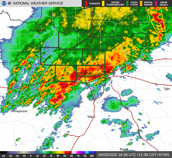
06z CAMs give a bit more clarity, indicating a one-and-one squall line around midday/early afternoon (most likely from the current QLCS west of Wichita Falls).
Storms will likely be sub-severe though due to extensive cloud cover and surface temps only in the low/mid 70s. The messy storm mode should also keep tornado threat in check.
That said, with a decent amount of elevated instability, hail and flash flood threat still seems legit.


South Texas Storms wrote:Yall finally happy up there? Really good soaking today across DFW. Hope yall can share some with us farther south later this week.

Ntxw wrote:Very heavy rain, lots of waiting but it finally came.

South Texas Storms wrote:Yall finally happy up there? Really good soaking today across DFW. Hope yall can share some with us farther south later this week.
Ntxw wrote:1.92" and a southern batch coming through probably over 2" for the airport today.


