This is something I looked into a few years ago, and there are primarily three factors in the differences: (1) variability in data input, (2) gridded resolution, and (3) interpolation used to determine missing gridded values/correction algorithms to biases.
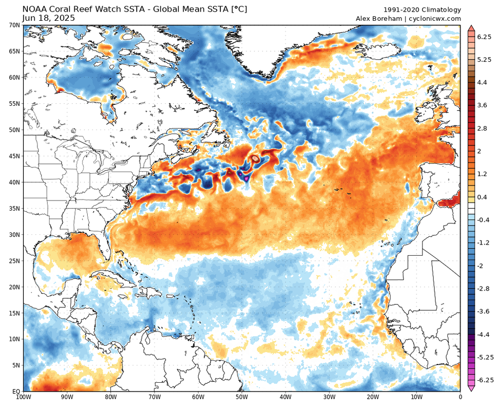
Coral Reef Watch (CRW)Data input - This is derived using primarily SST data from thermal infrared sensors on nine polar-orbiting satellites (also known as the real-time Geo-Polar Blended SST) and all of the in situ data contained within the the International Comprehensive Ocean-Atmosphere Data Set (ICOADS).
Resolution - The CRW product has a 5km resolution (0.05 degree spatial resolution).
Processing/algorithms - Gaps are filled using optimal interpolation, with bias corrections based on the OSTIA (Operational Sea Surface Temperature and Sea Ice Analysis) dataset.
This is also only a nighttime product, from NOAA's methodology section:
The CoralTemp SST provides a measurement of the nighttime ocean temperature at the sea surface, calibrated to 0.2 meters depth. Nighttime-only satellite SST observations are used to reduce the influence of daytime warming caused by solar heating at and near the sea surface and to avoid contamination from solar glare. Furthermore, at night, water temperatures at and near the sea surface are more vertically uniform.
https://coralreefwatch.noaa.gov/product/5km/methodology.php#sst
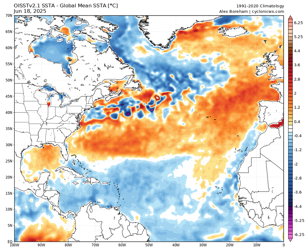
- OISST employs optimal interpolation to combine satellite data (primarily AVHRR), in situ measurements (ships, buoys, Argo floats), and proxy SSTs from sea ice concentrations. Essentially, it uses a more comprehensive range of data sources.
Resolution - OISST uses a much coarser resolution at 25km (0.25 degree spatial resolution).
Processing/algorithms - OISST incorporates both daytime and nighttime observations, which can introduce differences due to diurnal warming effects. It uses a broader range of data sources and applies bias corrections relative to buoy data, with monthly adjustments to ship and satellite data.
 TL;DROISST’s
 inclusion of in situ data and broader interpolation techniques may smooth out anomalies over larger areas, while
CRW’s higher-resolution, satellite-focused approach captures finer-scale variations.
CRW focuses heavily on resolution since the product was designed to examine abrupt SST departures/thermal stresses and coral reef monitoring.
OISST is considered a more general-purpose climate data product; its coarser resolution and broader data integration prioritize global consistency over localized precision (like ENSO monitoring).
Official documentationCRW -
https://coastwatch.noaa.gov/cwn/products/noaa-geo-polar-blended-global-sea-surface-temperature-analysis-level-4.htmlOISST -
https://www.ncei.noaa.gov/products/optimum-interpolation-sst