#4 Postby TallyTracker » Mon Jul 14, 2025 1:00 pm
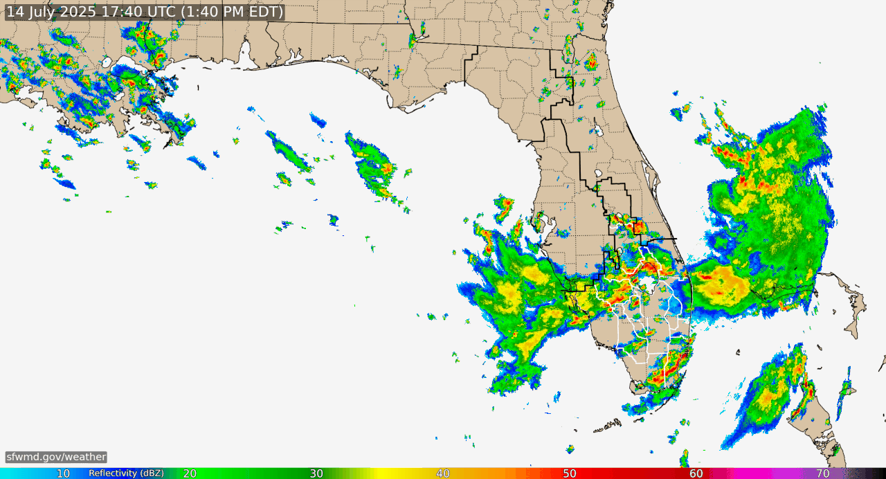
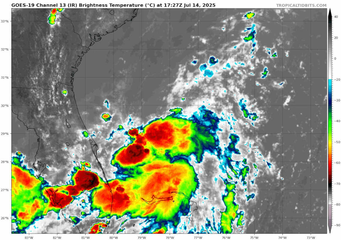
Just looking at the overall environment and current condition of the disturbance in marginal conditions, I think the development potential is much higher than 30%. The models don’t seem to have a good grasp on this one. I’d say it’s got at least a 50% chance of development. Even the NHC is saying conditions look favorable for development despite the 30%. The ICON’s prediction of a TS to Cat 1 Hurricane seems a reasonable outcome.
2 likes
Fran '96, Georges '98, Gordon '00, Gabrielle '01, Charley '04, Frances '04, Jeanne '04, Barry '07, Fay '08, Debby '12, Matthew '16, Emily '17, Irma '17, Michael ‘18, Elsa ‘21, Fred ‘21, Mindy ‘21, Nicole ‘22, Idalia ‘23, Debby ‘24, Helene ‘24