Tropical Wave Over the Far Eastern Atlantic: (Is Invest 97L)
Moderator: S2k Moderators
Forum rules
The posts in this forum are NOT official forecasts and should not be used as such. They are just the opinion of the poster and may or may not be backed by sound meteorological data. They are NOT endorsed by any professional institution or STORM2K. For official information, please refer to products from the National Hurricane Center and National Weather Service.
-
OuterBanker
- S2K Supporter

- Posts: 1761
- Joined: Wed Feb 26, 2003 10:53 am
- Location: Nags Head, NC
- Contact:
Re: Tropical Wave has emerged from the West Coast of Africa
Models are all over the place. GFS alone went from TX landfall to OTS around 70 w from 12 z to 18z. What's that some couple thousand mile difference.
Euro also all over the place including the Euro AI.
Thank God they all have moved away from the nightmare scenario OBX to Boston hitting the east coast heavily populated major cities.
Euro also all over the place including the Euro AI.
Thank God they all have moved away from the nightmare scenario OBX to Boston hitting the east coast heavily populated major cities.
1 likes
- REDHurricane
- Category 1

- Posts: 438
- Age: 28
- Joined: Sun Jul 03, 2022 2:36 pm
- Location: Northeast Pacific Ocean
Re: Tropical Wave has emerged from the West Coast of Africa
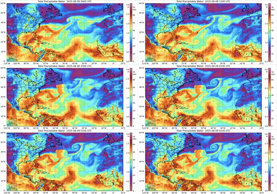
I see a pretty formidable moisture envelope headed out into the most favorable MDR conditions we've seen to date and a decent-looking low-level vorticity already... maybe it won't develop quite as rapidly as the GFS is forecasting, but I'd guess that this one has better odds than not of eventually becoming our first hurricane this year.


2 likes
- cycloneye
- Admin

- Posts: 149686
- Age: 69
- Joined: Thu Oct 10, 2002 10:54 am
- Location: San Juan, Puerto Rico
Re: Tropical Wave has emerged from the West Coast of Africa
ASCAT captures a good circulation around 10N.


7 likes
Visit the Caribbean-Central America Weather Thread where you can find at first post web cams,radars
and observations from Caribbean basin members Click Here
and observations from Caribbean basin members Click Here
- StormWeather
- Category 1

- Posts: 477
- Joined: Wed Jun 05, 2024 2:34 pm
Re: Tropical Wave has emerged from the West Coast of Africa
If it already has a circulation getting going, that’s not good.
0 likes
Just an average cyclone tracker
The posts in this forum are NOT official forecasts and should not be used as such. They are just the opinion of the poster and may or may not be backed by sound meteorological data. They are NOT endorsed by any professional institution or storm2k.org. For official information, please refer to the NHC and NWS products
The posts in this forum are NOT official forecasts and should not be used as such. They are just the opinion of the poster and may or may not be backed by sound meteorological data. They are NOT endorsed by any professional institution or storm2k.org. For official information, please refer to the NHC and NWS products
Re: Tropical Wave has emerged from the West Coast of Africa
Haha that 12Z GFS puts a 933 Cat 5 into West end of Galveston on Aug 22nd them the 18Z sends it OTS…talk about opposite runs… 
2 likes
- cycloneye
- Admin

- Posts: 149686
- Age: 69
- Joined: Thu Oct 10, 2002 10:54 am
- Location: San Juan, Puerto Rico
Re: Tropical Wave has emerged from the West Coast of Africa

1 likes
Visit the Caribbean-Central America Weather Thread where you can find at first post web cams,radars
and observations from Caribbean basin members Click Here
and observations from Caribbean basin members Click Here
Re: Tropical Wave has emerged from the West Coast of Africa
StormWeather wrote:
If it already has a circulation getting going, that’s not good.
Not necessarily because a stronger system might tend to recurve sooner. That’s not always the case by any means but it’s often the case. A weaker system in the E ATL might portend more danger to the W ATL.
1 likes
Personal Forecast Disclaimer:
The posts in this forum are NOT official forecasts and should not be used as such. They are just the opinion of the poster and may or may not be backed by sound meteorological data. They are NOT endorsed by any professional institution or storm2k.org. For official information, please refer to the NHC and NWS products.
The posts in this forum are NOT official forecasts and should not be used as such. They are just the opinion of the poster and may or may not be backed by sound meteorological data. They are NOT endorsed by any professional institution or storm2k.org. For official information, please refer to the NHC and NWS products.
Re: Tropical Wave has emerged from the West Coast of Africa
I personally think some of the models are strengthening this too quickly.
3 likes
-
SconnieCane
- Category 5

- Posts: 1013
- Joined: Thu Aug 02, 2018 5:29 pm
- Location: Madison, WI
Re: Tropical Wave has emerged from the West Coast of Africa
No posts dismissing it as the "happy hour run" when it doesn't show a high-impact outcome...
1 likes
-
Keldeo1997
- Category 2

- Posts: 688
- Joined: Fri Oct 11, 2019 11:35 pm
Re: Tropical Wave has emerged from the West Coast of Africa
New GFS is running and the ridge is much stronger this run. Storm way further south than 18Z at 132 H and looks like it might take a Irma path
Last edited by Keldeo1997 on Fri Aug 08, 2025 11:17 pm, edited 1 time in total.
0 likes
Re: Tropical Wave has emerged from the West Coast of Africa
0Z UK has it again and it’s stronger (TS) though it’s further N:
NEW TROPICAL CYCLONE FORECAST TO DEVELOP AFTER 132 HOURS
FORECAST POSITION AT T+132 : 22.0N 54.6W
LEAD CENTRAL MAXIMUM WIND
VERIFYING TIME TIME POSITION PRESSURE (MB) SPEED (KNOTS)
-------------- ---- -------- ------------- -------------
1200UTC 14.08.2025 132 22.0N 54.6W 1010 30
0000UTC 15.08.2025 144 23.3N 57.2W 1009 30
1200UTC 15.08.2025 156 25.5N 59.1W 1007 41
0000UTC 16.08.2025 168 26.8N 61.6W 1006 44
0 likes
Personal Forecast Disclaimer:
The posts in this forum are NOT official forecasts and should not be used as such. They are just the opinion of the poster and may or may not be backed by sound meteorological data. They are NOT endorsed by any professional institution or storm2k.org. For official information, please refer to the NHC and NWS products.
The posts in this forum are NOT official forecasts and should not be used as such. They are just the opinion of the poster and may or may not be backed by sound meteorological data. They are NOT endorsed by any professional institution or storm2k.org. For official information, please refer to the NHC and NWS products.
-
Keldeo1997
- Category 2

- Posts: 688
- Joined: Fri Oct 11, 2019 11:35 pm
Re: Tropical Wave has emerged from the West Coast of Africa

Now sure how this thing avoids land this run.
2 likes
-
AxaltaRacing24
- Category 5

- Posts: 1774
- Age: 25
- Joined: Wed Jul 27, 2016 11:14 am
- Location: Jupiter, FL
Re: Tropical Wave has emerged from the West Coast of Africa
Keldeo1997 wrote:https://cdn.discordapp.com/attachments/1311237382682447893/1403595840945393725/Screenshot_2025-08-08_232826.png?ex=68981ffe&is=6896ce7e&hm=b54b66a7551be41696a19478856a43343bfa84a7161b85407e1fa5c71773c00b&
Now sure how this thing avoids land this run.
Idk if anybody has noticed, but these runs have been hinting at a slight WSW dip before the islands. A scaled down version of the motion of an "I" storm in 2017.
Last edited by AxaltaRacing24 on Fri Aug 08, 2025 11:34 pm, edited 1 time in total.
1 likes
Re: Tropical Wave has emerged from the West Coast of Africa
yeah, just a touch more South and stronger at 204 than the 06/12z runs, albeit both those having two completely different scenarios GOM v. coast rider/OTSKeldeo1997 wrote:New GFS is running and the ridge is much stronger this run. Storm way further south than 18Z at 132 H and looks like it might take a Irma path
0 likes
Once I see the REDS and GREENS Converge on a Base Velocity. ... I'm There!!
This is NOT an Official Forecast....Just my Opinion. For official information, please refer to the NHC and NWS products.
HIGHLIGHTS : '13 El Reno Tornado : 2013 Storm Chaser Tour, Joaquin; SC flood event, Matthew '16, Lowcountry Snow storm Jan '18
This is NOT an Official Forecast....Just my Opinion. For official information, please refer to the NHC and NWS products.
HIGHLIGHTS : '13 El Reno Tornado : 2013 Storm Chaser Tour, Joaquin; SC flood event, Matthew '16, Lowcountry Snow storm Jan '18
- Hurricaneman
- Category 5

- Posts: 7404
- Age: 45
- Joined: Tue Aug 31, 2004 3:24 pm
- Location: central florida
Re: Tropical Wave has emerged from the West Coast of Africa
The 0z GFS seems to be starting the turn in or near the Bahamas this run, possibly even similar to the 12z Euro
0 likes
Re: Tropical Wave has emerged from the West Coast of Africa
Doubt North Carolina is getting out of this run unscathed.
2 likes
Re: Tropical Wave has emerged from the West Coast of Africa
0z GFS into NC after turning north near the Bahamas. Welcome back Fran.
0 likes
- Hurricaneman
- Category 5

- Posts: 7404
- Age: 45
- Joined: Tue Aug 31, 2004 3:24 pm
- Location: central florida
Re: Tropical Wave has emerged from the West Coast of Africa
Actually it’s not far off from the 12zEuro especially if it doesn’t take that suspicious NNW bend on the 0zGFS
the 0zGFS seems very Gloria or Floyd like, this will need to be watched the next few days and see if we can hone in on potential locations especially the northern lesser Antilles
Turns east at the end of the run and misses the New York and New England area
the 0zGFS seems very Gloria or Floyd like, this will need to be watched the next few days and see if we can hone in on potential locations especially the northern lesser Antilles
Turns east at the end of the run and misses the New York and New England area
0 likes
Re: Tropical Wave Over the Far Eastern Atlantic
It's not going to take any other previous storm's path. No two snowflakes are alike.
1 likes
List of 79 tropical cyclones intercepted by Richard Horodner:
http://www.canebeard.com/page/page/572246.htm
former storm2k screenname Beoumont 2009+
http://www.canebeard.com/page/page/572246.htm
former storm2k screenname Beoumont 2009+
- Category5Kaiju
- Category 5

- Posts: 4345
- Joined: Thu Dec 24, 2020 12:45 pm
- Location: Seattle during the summer, Phoenix during the winter
Re: Tropical Wave Over the Far Eastern Atlantic
Most recent GFS run is very ugly for North Carolina and Virginia.
0 likes
Unless explicitly stated, all information in my posts is based on my own opinions and observations. Tropical storms and hurricanes can be extremely dangerous. Refer to an accredited weather research agency or meteorologist if you need to make serious decisions regarding an approaching storm.
Who is online
Users browsing this forum: No registered users and 204 guests


