
deep mind

Moderator: S2k Moderators


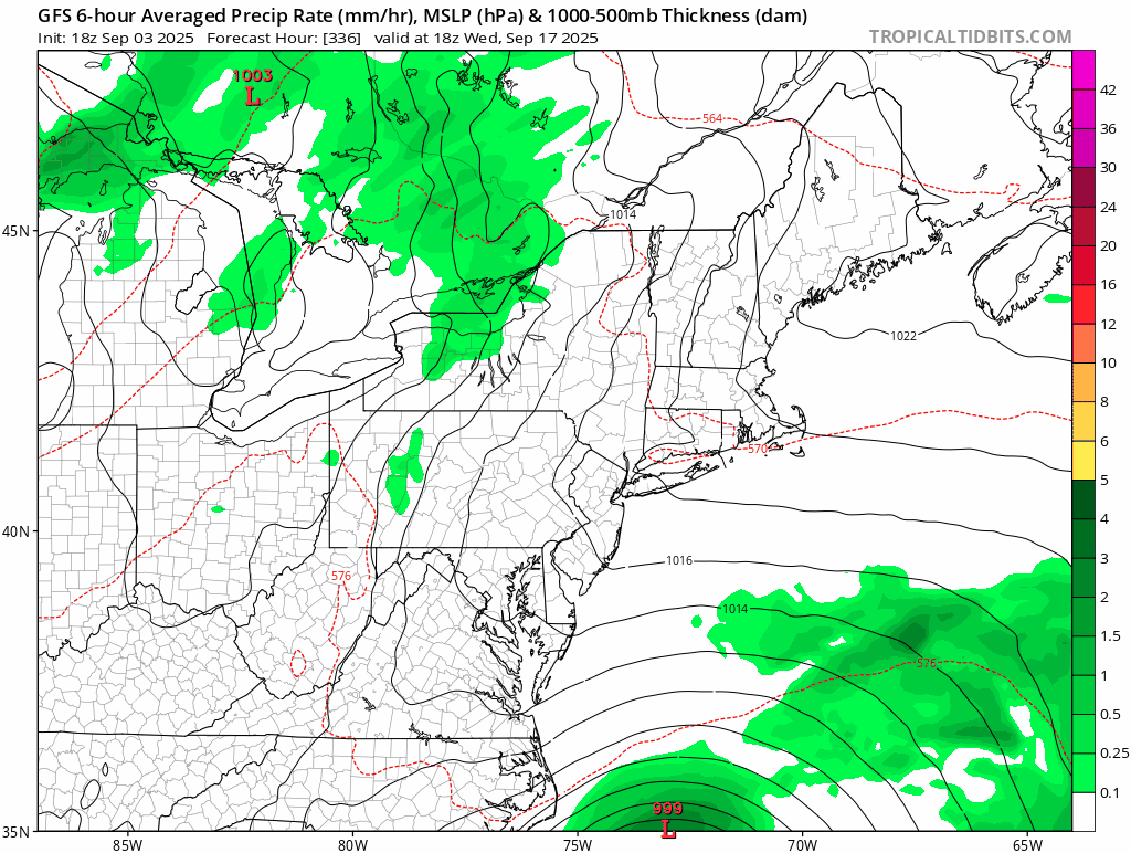
BobHarlem wrote:12z GFS Ensembles, not even close to the operational.
https://i.imgur.com/fSRFOUS.png
deep mind
https://i.imgur.com/hFqFOXz.png

The AI models in a couple of years will eat this uncertainty for lunch but for now, default is recurve.MEANINGLESS_NUMBERS wrote:BobHarlem wrote:12z GFS Ensembles, not even close to the operational.
https://i.imgur.com/fSRFOUS.png
deep mind
https://i.imgur.com/hFqFOXz.png
It's all about the timing of that trough which dictates recurve vs CONUS. At this range you might as well flip a coin.
jlauderdal wrote:The AI models in a couple of years will eat this uncertainty for lunch but for now, default is recurve.MEANINGLESS_NUMBERS wrote:BobHarlem wrote:12z GFS Ensembles, not even close to the operational.
https://i.imgur.com/fSRFOUS.png
deep mind
https://i.imgur.com/hFqFOXz.png
It's all about the timing of that trough which dictates recurve vs CONUS. At this range you might as well flip a coin.
Sent from my Pixel 9 using Tapatalk

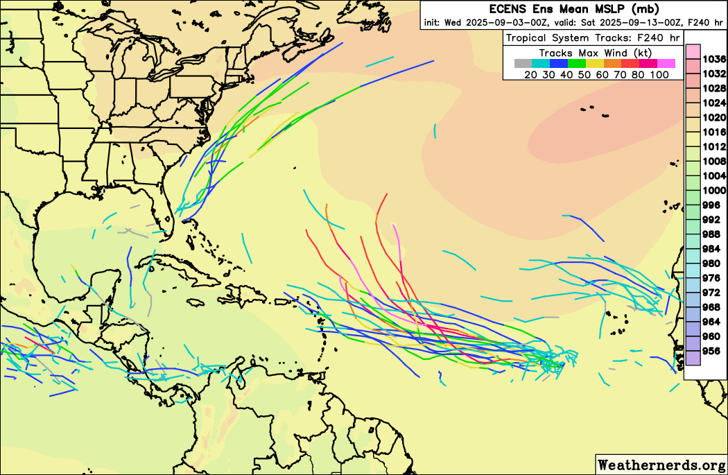


Stratton23 wrote:GFS barely misses NC but absolutely pounds the NE US on this run


MEANINGLESS_NUMBERS wrote:Stratton23 wrote:GFS barely misses NC but absolutely pounds the NE US on this run
TheLong IslandCape Cod Express
Users browsing this forum: No registered users and 207 guests


