I guess in a certain sense, it would be very natural to watch an invest like 91L (with multiple models consistently showing significant development of the system, only to abruptly drop it even as it reached 60/90% chance of formation per NHC, all during the month of September), and begin to question the season's potential and if there's something strange going on with the basin.
However, in this case I think it would be wise to take a step back and look at the broad picture to have a better understanding of what may be happening. What do we know? Well, we know that the Atlantic currently is in an unfavorable MJO pattern. This has been talked about quite a bit for the past days/weeks since Erin departed the picture. That, or something related, may be the reason why there's so much dry air, shear, and stability/sinking motion associated with the deep tropics and why despite initial model excitement for 91L, there were, retrospectively, red flags for such to really amount to anything huge.
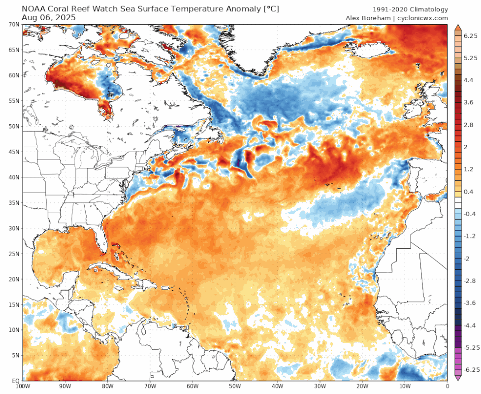
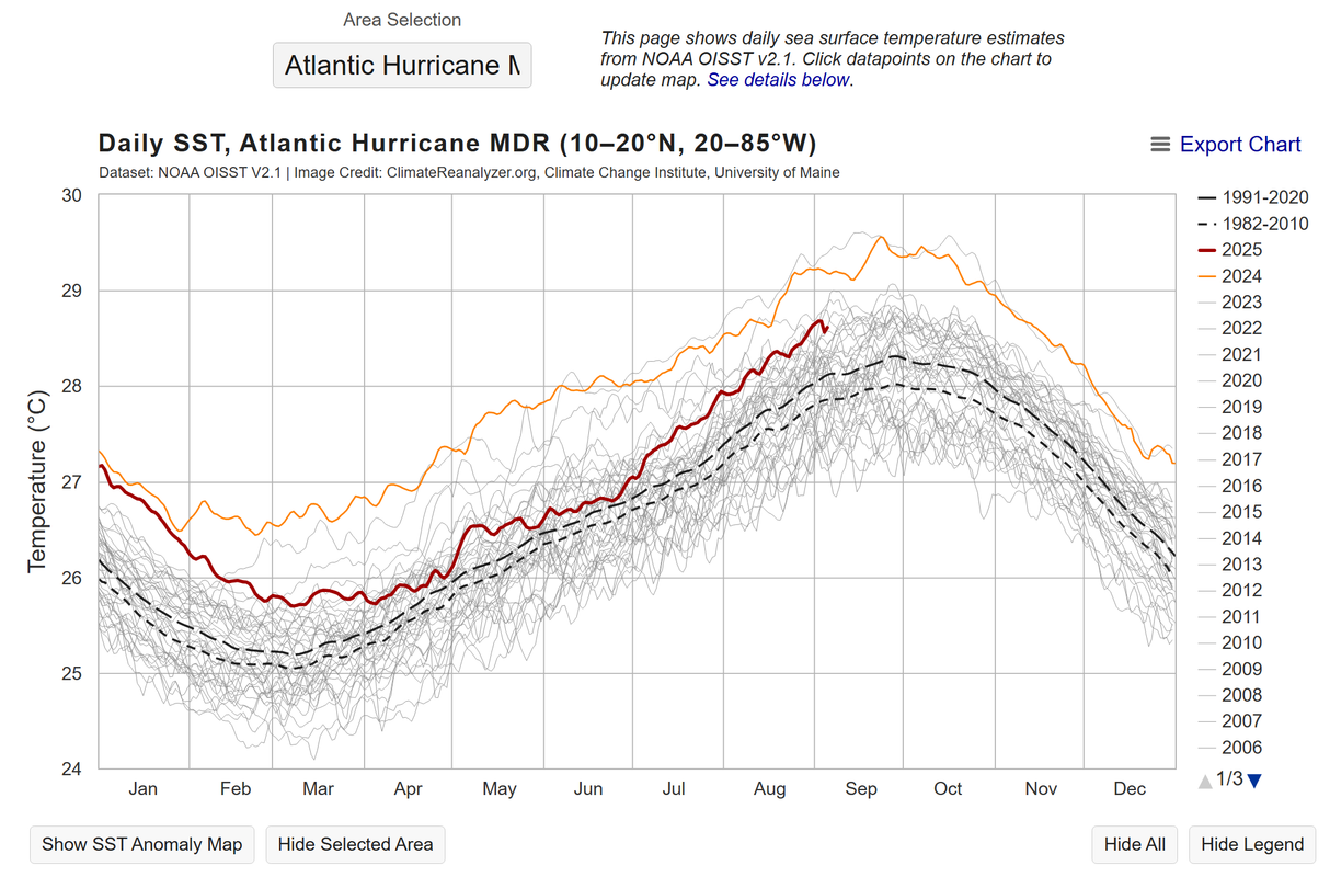
However, what we do know is that the deep tropics are still very warm, the Nino 3-4 region is starting to exhibit signs that it may enter some degree of La Nina or cool neutral for this winter, and a more favorable MJO pulse is expected to enter the basin by mid-month. These are all key ingredients to possibly fueling late season action, and as we've learned from 2022 and 2024, sometimes early September can look radically different from late September. Instability naturally increases as we enter fall can really do wonders to facilitate tropical cyclogenesis.
Also...as I type this, the 00z GFS and CMC are both spitting out another wave into the MDR that looks to become a trackable feature/system around the September 12th timeframe (so basically a week from now). It remains to be seen if this is a phantom or now, but unlike 91L, this theoretical system would actually coincide with the predicted favorable MJO pulse, and by then who knows if whatever negative factors caused 91L's demise are still around....or not? My point in all this is, while 91L's bust was certainly eyebrow-raising, at this point in time, I don't think it was indicative of some larger, underlying problem that will plague the basin for the forseeable future. If we still struggle with producing tropical cyclones throughout this month, then yes I would reconsider my stance on this, but for now I guess our eyes should shift to long-range models for mid-September. As a reminder, even the abysmal 2013 season saw its two hurricanes during September, and the 1914 season saw its only storm during September. We say "September Remember" for a reason.

Unless explicitly stated, all information in my posts is based on my own opinions and observations. Tropical storms and hurricanes can be extremely dangerous. Refer to an accredited weather research agency or meteorologist if you need to make serious decisions regarding an approaching storm.