Moderator: S2k Moderators


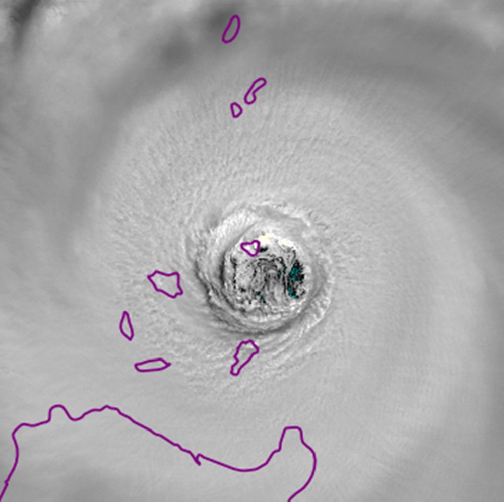
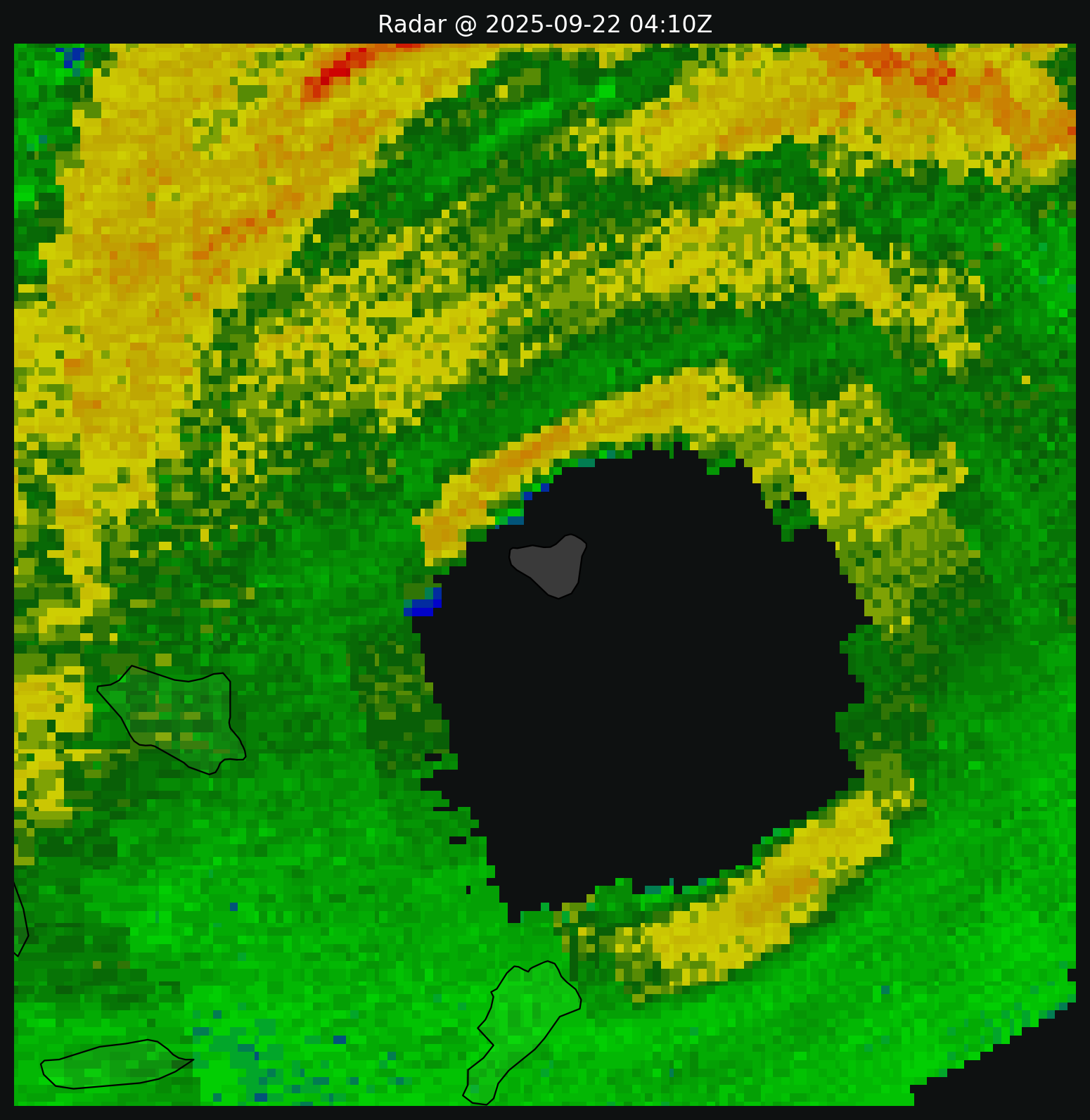


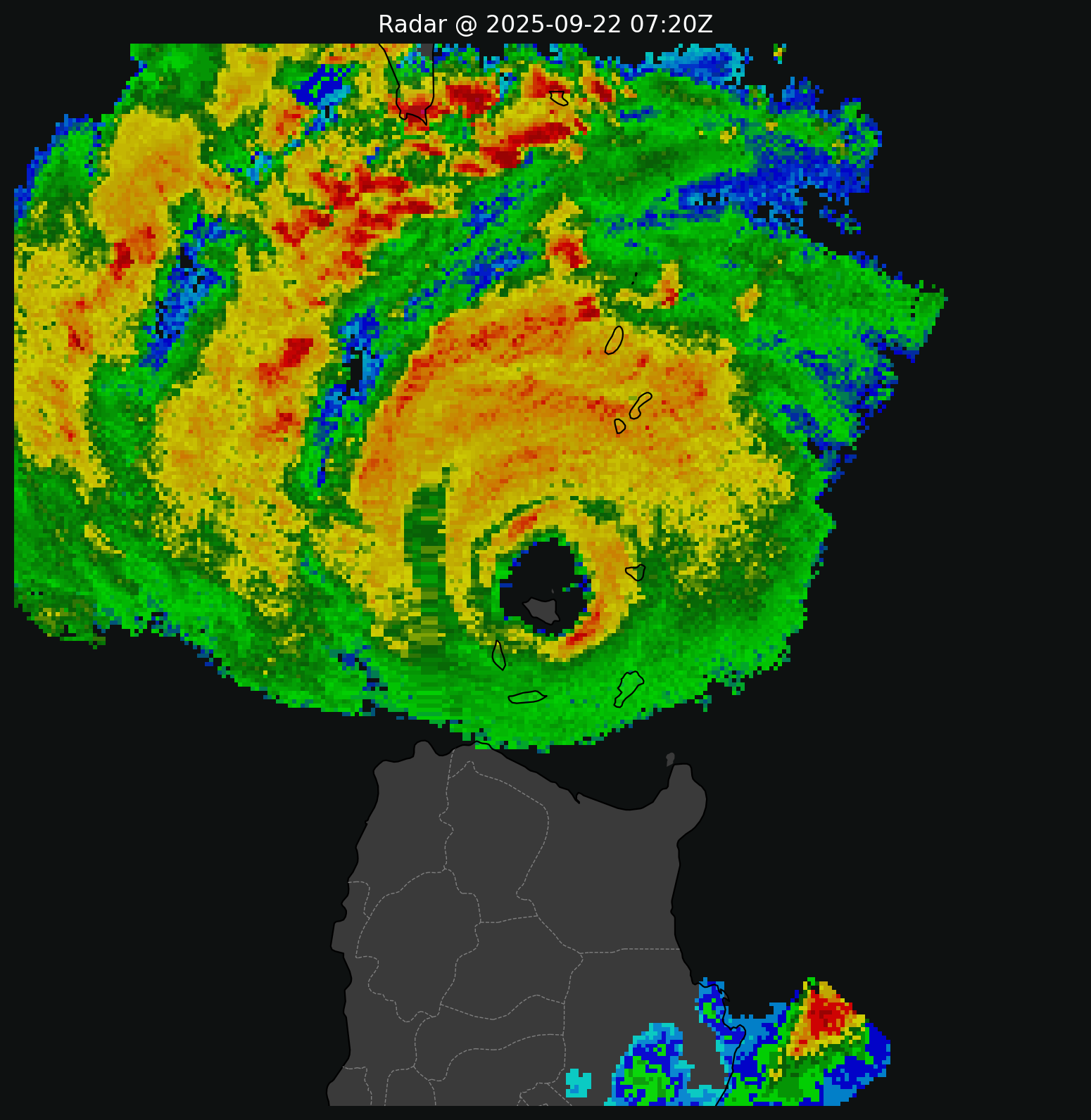
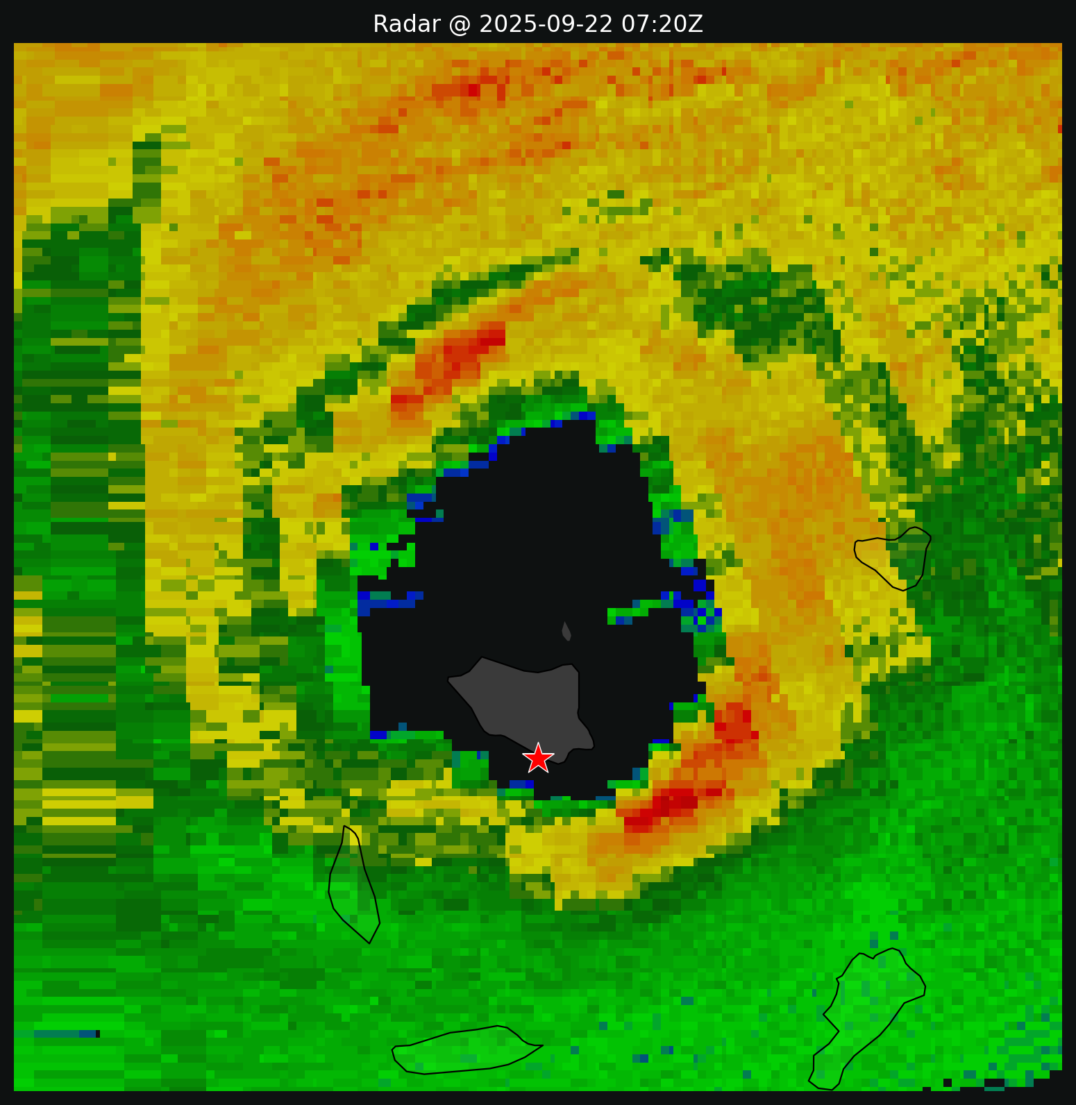
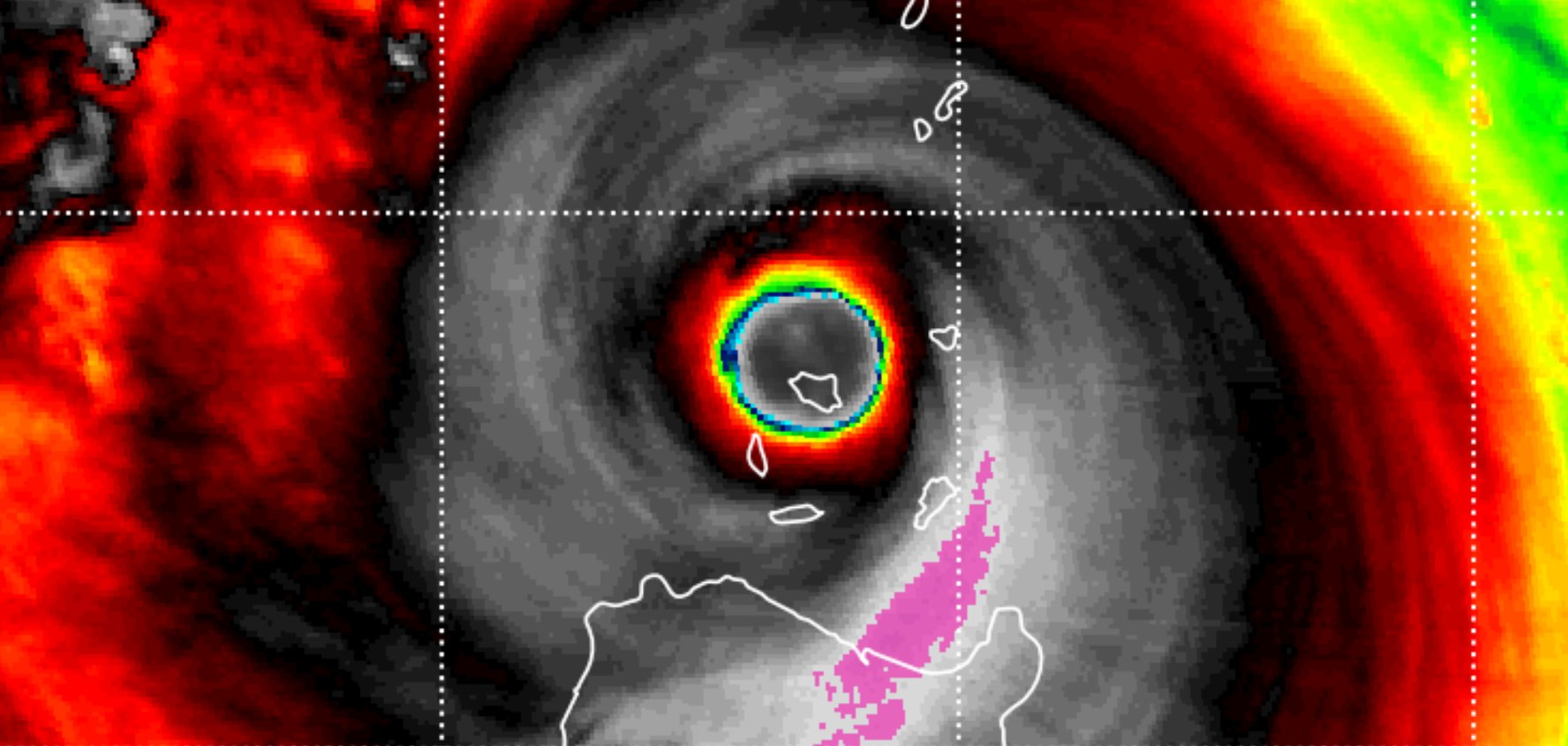

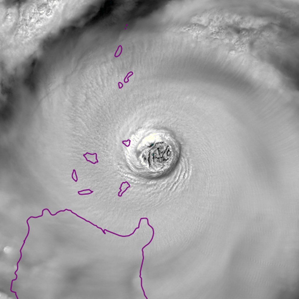
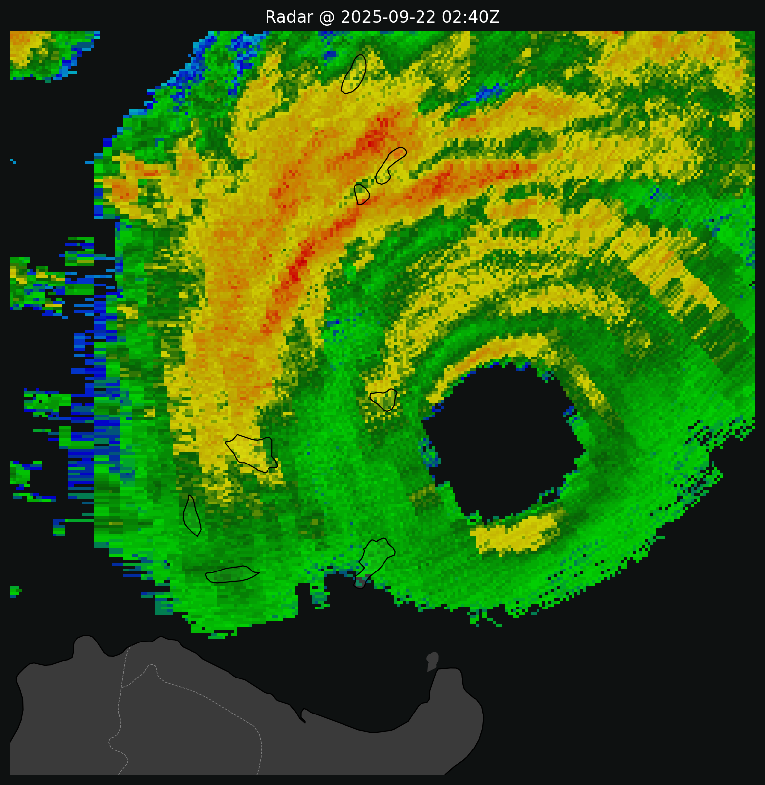
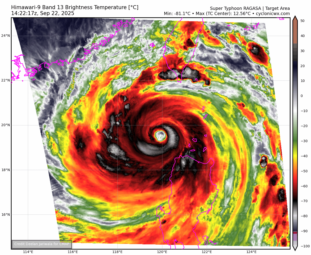
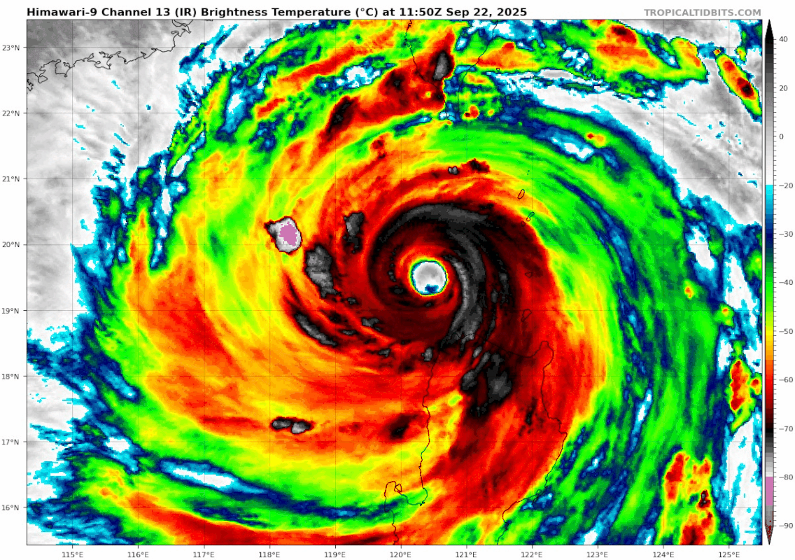
Hayabusa wrote:Finally new data from 98133 Calayan to GTS at 0500z it recorded an MSLP of 954.3mb and 26mps(50kts) sustained windSNPH20 RPMM 220500 RRA
AAXX 22051
98133 41430 83226 10/// 20/// 39528 49543 5//// 76366
8572/ 333 5699/ 85717 88458=


 |  |
Users browsing this forum: No registered users and 63 guests


