WPAC: RAGASA - Post-Tropical

Moderator: S2k Moderators

Message
Author
User avatar
doomhaMwx
Category 5
Category 5
Posts: 2467
Age: 26
Joined: Tue Apr 18, 2017 4:01 am
Location: Baguio/Benguet, Philippines
Contact:

Re: WPAC: RAGASA - Typhoon

#161 Postby doomhaMwx » Sun Sep 21, 2025 9:58 pm

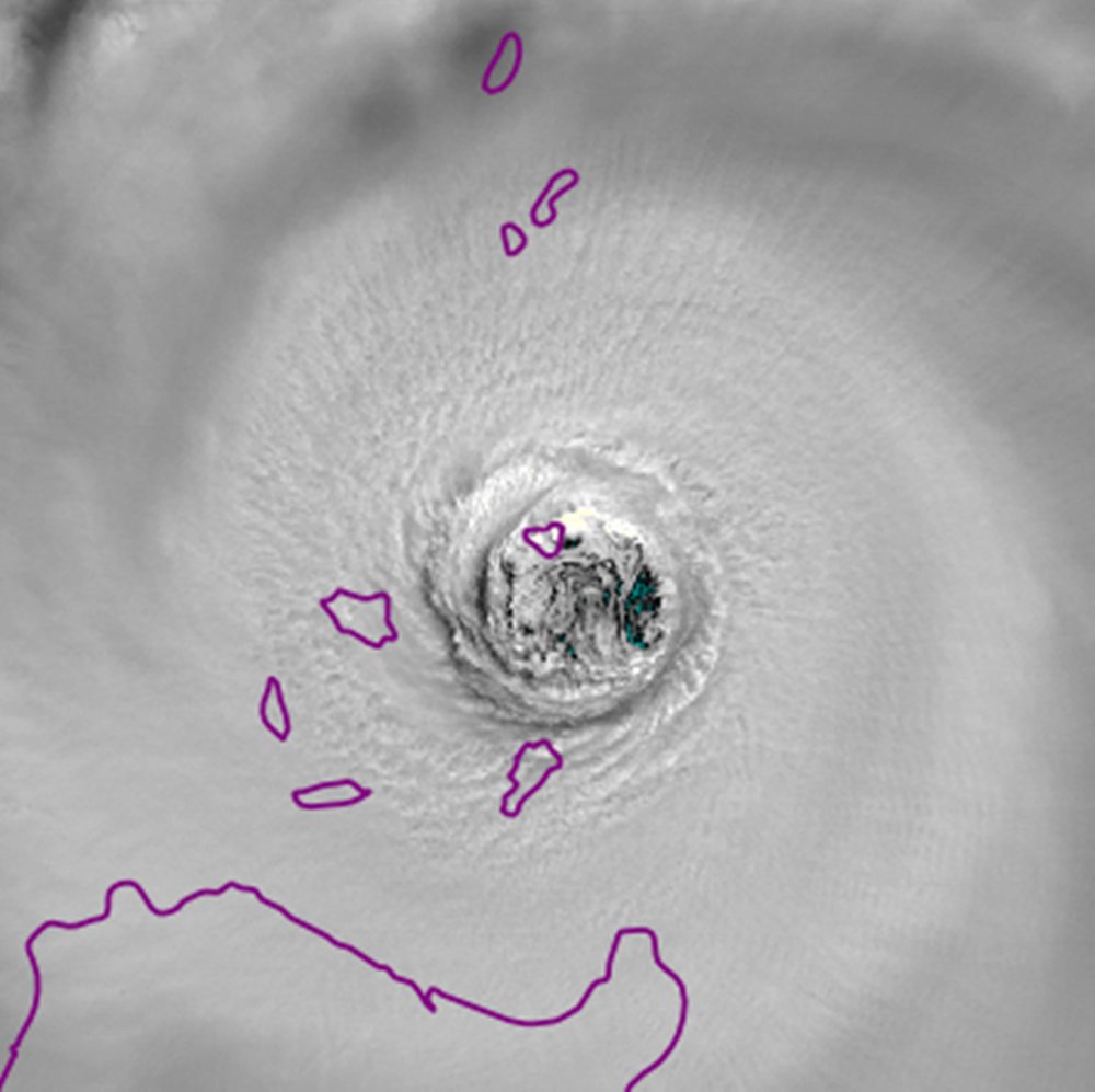
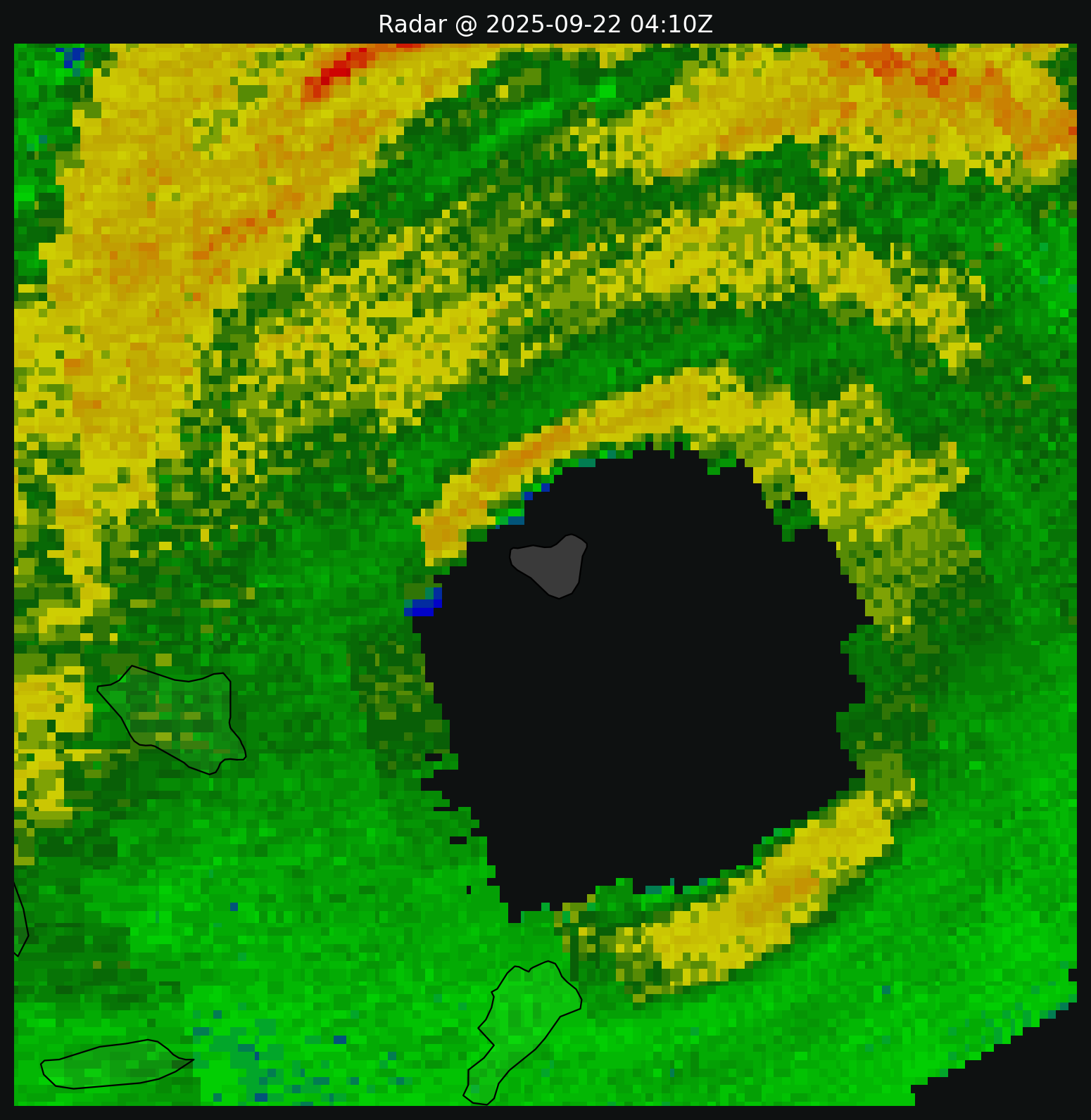
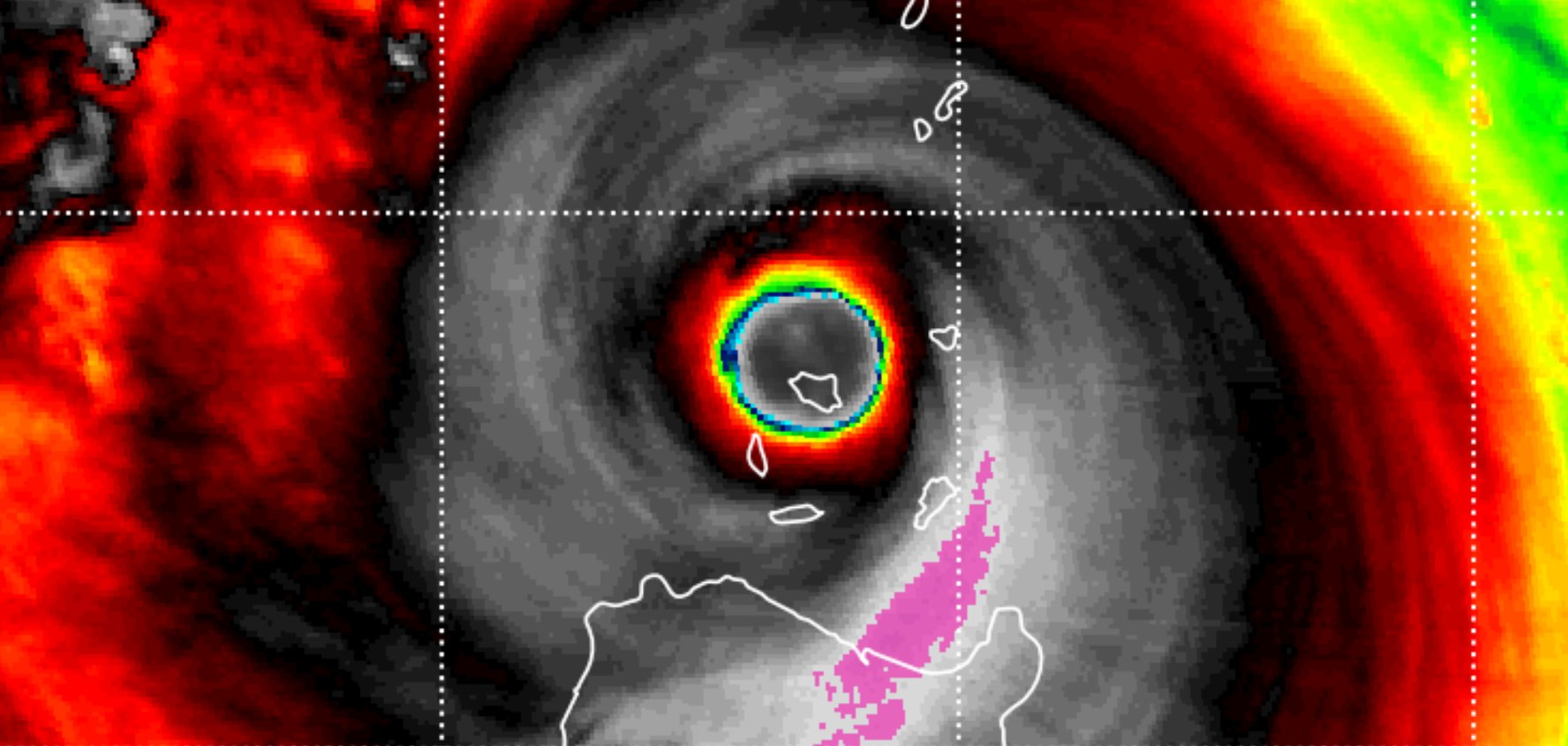
Babuyan Island is now being hammered. It won't be long now before the island enters the eye!

Image
Image
1 likes   

User avatar
doomhaMwx
Category 5
Category 5
Posts: 2467
Age: 26
Joined: Tue Apr 18, 2017 4:01 am
Location: Baguio/Benguet, Philippines
Contact:

Re: WPAC: RAGASA - Typhoon

#162 Postby doomhaMwx » Sun Sep 21, 2025 11:24 pm

Babuyan Island right inside the eye of an intense category 5 supertyphoon!

Image
Image
1 likes   

User avatar
WaveBreaking
Category 2
Category 2
Posts: 623
Joined: Sun Jun 30, 2024 11:33 am
Location: US

Re: WPAC: RAGASA - Typhoon

#163 Postby WaveBreaking » Mon Sep 22, 2025 12:52 am

Image
1 likes   
I am NOT a professional meteorologist, so take all of my posts with a grain of salt. My opinions are mine and mine alone.

User avatar
ElectricStorm
Category 5
Category 5
Posts: 5095
Age: 24
Joined: Tue Aug 13, 2019 11:23 pm
Location: Skiatook, OK / Norman, OK

Re: WPAC: RAGASA - Typhoon

#164 Postby ElectricStorm » Mon Sep 22, 2025 2:03 am

24W RAGASA 250922 0600 19.3N 121.7E WPAC 140 916
0 likes   
B.S Meteorology, University of Oklahoma '25

Please refer to the NHC, NWS, or SPC for official information.

User avatar
doomhaMwx
Category 5
Category 5
Posts: 2467
Age: 26
Joined: Tue Apr 18, 2017 4:01 am
Location: Baguio/Benguet, Philippines
Contact:

Re: WPAC: RAGASA - Typhoon

#165 Postby doomhaMwx » Mon Sep 22, 2025 2:43 am

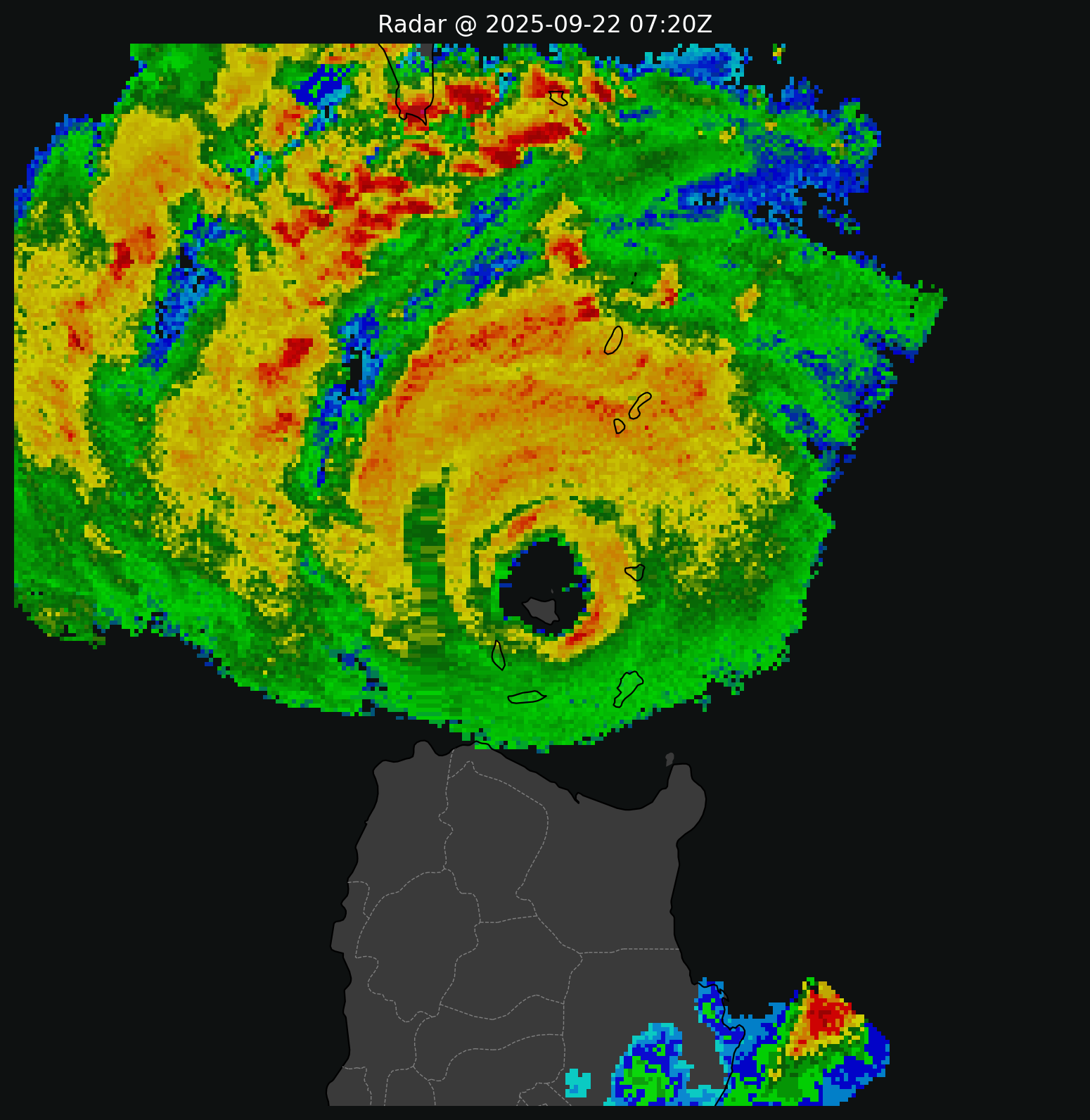
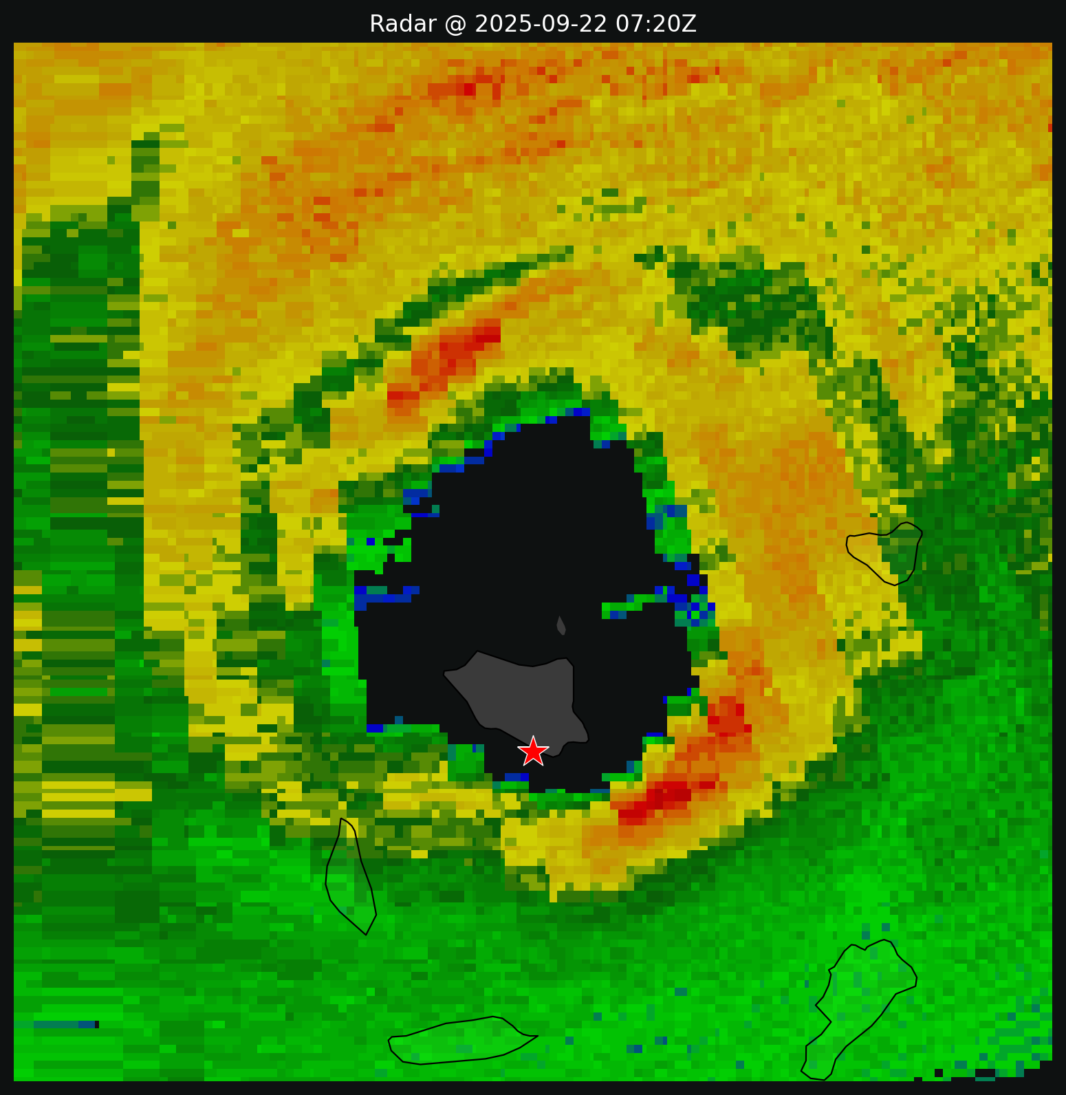
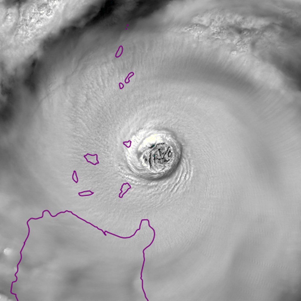
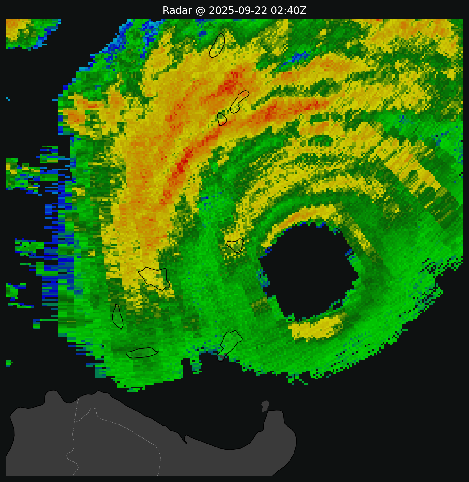
Eye now passing over Calayan Island. The weather station (★ WMO 98133) on the south side of the island stopped transmitting obs after 21Z, unfortunately, so we'll have to wait for PAGASA to release the data.

Image
Image
Image
1 likes   

User avatar
Hayabusa
Category 5
Category 5
Posts: 4610
Joined: Sun Sep 16, 2018 1:05 pm

Re: WPAC: RAGASA - Typhoon

#166 Postby Hayabusa » Mon Sep 22, 2025 4:01 am

Finally new data from 98133 Calayan to GTS at 0500z it recorded an MSLP of 954.3mb and 26mps(50kts) sustained wind
SNPH20 RPMM 220500 RRA

AAXX 22051

98133 41430 83226 10/// 20/// 39528 49543 5//// 76366

8572/ 333 5699/ 85717 88458=
0 likes   
ヤンデレ女が寝取られるているのを見たい!!!
ECMWF ensemble NWPAC plots: https://ecmwfensnwpac.imgbb.com/
Multimodel NWPAC plots: https://multimodelnwpac.imgbb.com/
GFS Ensemble NWPAC plots (16 & 35 day forecast): https://gefsnwpac.imgbb.com/
Plots updated automatically

User avatar
mrbagyo
Category 5
Category 5
Posts: 3804
Age: 33
Joined: Thu Apr 12, 2012 9:18 am
Location: 14.13N 120.98E
Contact:

Re: WPAC: RAGASA - Typhoon

#167 Postby mrbagyo » Mon Sep 22, 2025 5:01 am

1 likes   
The posts in this forum are NOT official forecast and should not be used as such. They are just the opinion of the poster and may or may not be backed by sound meteorological data. They are NOT endorsed by any professional institution or storm2k.org. For official information, please refer to RSMC, NHC and NWS products.

User avatar
doomhaMwx
Category 5
Category 5
Posts: 2467
Age: 26
Joined: Tue Apr 18, 2017 4:01 am
Location: Baguio/Benguet, Philippines
Contact:

Re: WPAC: RAGASA - Typhoon

#168 Postby doomhaMwx » Mon Sep 22, 2025 6:02 am

Hayabusa wrote:Finally new data from 98133 Calayan to GTS at 0500z it recorded an MSLP of 954.3mb and 26mps(50kts) sustained wind
SNPH20 RPMM 220500 RRA

AAXX 22051

98133 41430 83226 10/// 20/// 39528 49543 5//// 76366

8572/ 333 5699/ 85717 88458=

The station at that time was ~25 nmi from the eye of Ragasa. Using RMW of 22-23 nmi (calculated by @JoshuaCAgar), Schloemer equation outputs central pressure estimates between 915-920 mb.
0 likes   

User avatar
cycloneye
Admin
Admin
Posts: 147296
Age: 69
Joined: Thu Oct 10, 2002 10:54 am
Location: San Juan, Puerto Rico

Re: WPAC: RAGASA - Typhoon

#169 Postby cycloneye » Mon Sep 22, 2025 6:13 am

Wow, spectacular view from the ISS.

 https://x.com/WxNB_/status/1970040041968660833

1 likes   
Visit the Caribbean-Central America Weather Thread where you can find at first post web cams,radars
and observations from Caribbean basin members Click Here

User avatar
mrbagyo
Category 5
Category 5
Posts: 3804
Age: 33
Joined: Thu Apr 12, 2012 9:18 am
Location: 14.13N 120.98E
Contact:

Re: WPAC: RAGASA - Typhoon

#170 Postby mrbagyo » Mon Sep 22, 2025 10:43 am

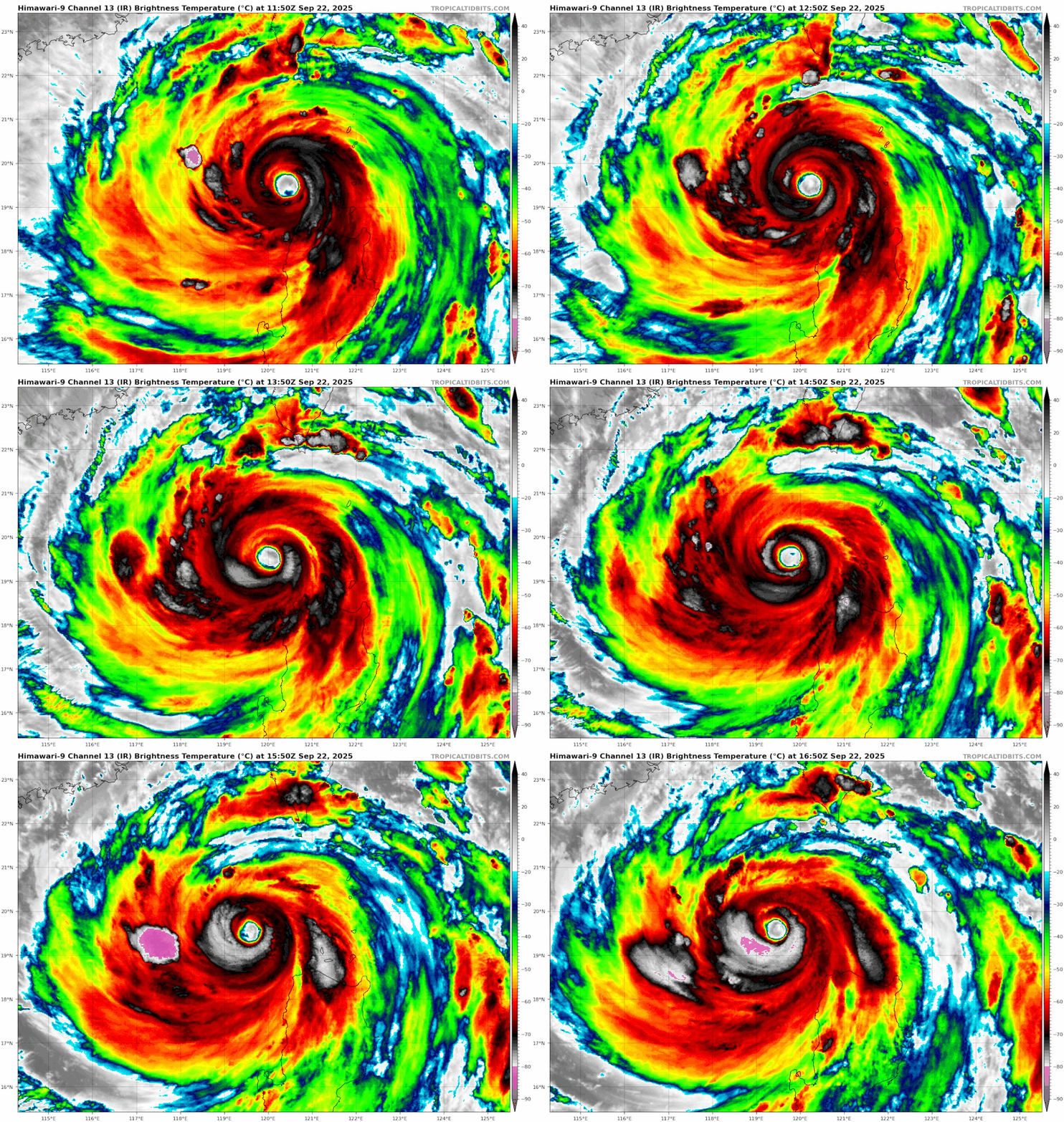
Convection is starting flare again
Image
1 likes   
The posts in this forum are NOT official forecast and should not be used as such. They are just the opinion of the poster and may or may not be backed by sound meteorological data. They are NOT endorsed by any professional institution or storm2k.org. For official information, please refer to RSMC, NHC and NWS products.

User avatar
WaveBreaking
Category 2
Category 2
Posts: 623
Joined: Sun Jun 30, 2024 11:33 am
Location: US

Re: WPAC: RAGASA - Typhoon

#171 Postby WaveBreaking » Mon Sep 22, 2025 10:59 am

1 likes   

I am NOT a professional meteorologist, so take all of my posts with a grain of salt. My opinions are mine and mine alone.

User avatar
Teban54
Category 5
Category 5
Posts: 3463
Joined: Sat May 19, 2018 1:19 pm

Re: WPAC: RAGASA - Typhoon

#172 Postby Teban54 » Mon Sep 22, 2025 12:12 pm

Image
1 likes   

User avatar
Teban54
Category 5
Category 5
Posts: 3463
Joined: Sat May 19, 2018 1:19 pm

Re: WPAC: RAGASA - Typhoon

#173 Postby Teban54 » Mon Sep 22, 2025 2:18 pm

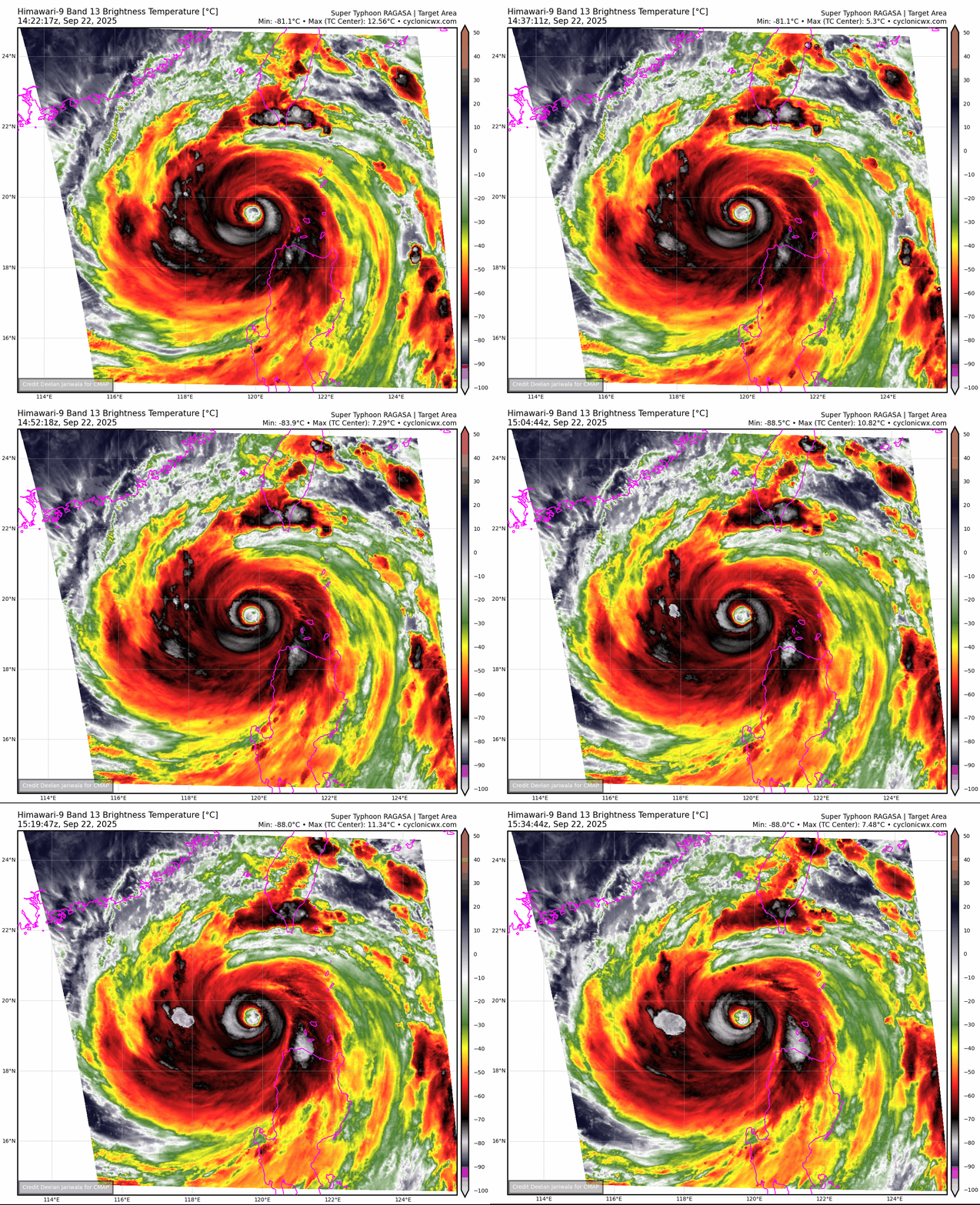
That escalated quickly...

Image
4 likes   

User avatar
sasha_B
Tropical Storm
Tropical Storm
Posts: 171
Age: 24
Joined: Sun Jun 30, 2024 4:32 pm
Location: Charleston, SC

Re: WPAC: RAGASA - Typhoon

#174 Postby sasha_B » Mon Sep 22, 2025 2:31 pm

It does seem like intensity has recovered a little since this morning, despite the JTWC best track indicating that pressure has filled in to 930 hPa as of the latest fix.
0 likes   

User avatar
sasha_B
Tropical Storm
Tropical Storm
Posts: 171
Age: 24
Joined: Sun Jun 30, 2024 4:32 pm
Location: Charleston, SC

Re: WPAC: RAGASA - Typhoon

#175 Postby sasha_B » Mon Sep 22, 2025 2:51 pm

The latest subjective fixes (at 18z) were T6.0 but ADT numbers over the past 2 hours have climbed back over 6.5. If the trend holds, I wonder if Ragasa might not regain super typhoon status this evening.
0 likes   

Fancy1002
Tropical Storm
Tropical Storm
Posts: 200
Joined: Sun Dec 25, 2022 3:47 pm

Re: WPAC: RAGASA - Typhoon

#176 Postby Fancy1002 » Mon Sep 22, 2025 3:19 pm

How big is Ragasa compare to other typhoons?
0 likes   

User avatar
cycloneye
Admin
Admin
Posts: 147296
Age: 69
Joined: Thu Oct 10, 2002 10:54 am
Location: San Juan, Puerto Rico

Re: WPAC: RAGASA - Typhoon

#177 Postby cycloneye » Mon Sep 22, 2025 3:50 pm

Hong Kong may get a good deal of bad weather.

Image
0 likes   
Visit the Caribbean-Central America Weather Thread where you can find at first post web cams,radars
and observations from Caribbean basin members Click Here

User avatar
Yellow Evan
Professional-Met
Professional-Met
Posts: 16197
Age: 27
Joined: Fri Jul 15, 2011 12:48 pm
Location: Henderson, Nevada/Honolulu, HI
Contact:

Re: WPAC: RAGASA - Typhoon

#178 Postby Yellow Evan » Mon Sep 22, 2025 5:14 pm

Microwave has an outer eyewall still. Hard to re-intensify with that structure.
2 likes   

User avatar
cycloneye
Admin
Admin
Posts: 147296
Age: 69
Joined: Thu Oct 10, 2002 10:54 am
Location: San Juan, Puerto Rico

Re: WPAC: RAGASA - Typhoon

#179 Postby cycloneye » Mon Sep 22, 2025 7:01 pm

0 likes   
Visit the Caribbean-Central America Weather Thread where you can find at first post web cams,radars
and observations from Caribbean basin members Click Here

User avatar
Travorum
Category 2
Category 2
Posts: 528
Joined: Tue Sep 05, 2023 9:36 am
Location: Dunedin, FL

Re: WPAC: RAGASA - Typhoon

#180 Postby Travorum » Mon Sep 22, 2025 7:49 pm

As has been said before, an outer eyewall has been present on microwave imagery:

ImageImage
2 likes   


Return to “2025”

Who is online

Users browsing this forum: No registered users and 47 guests