


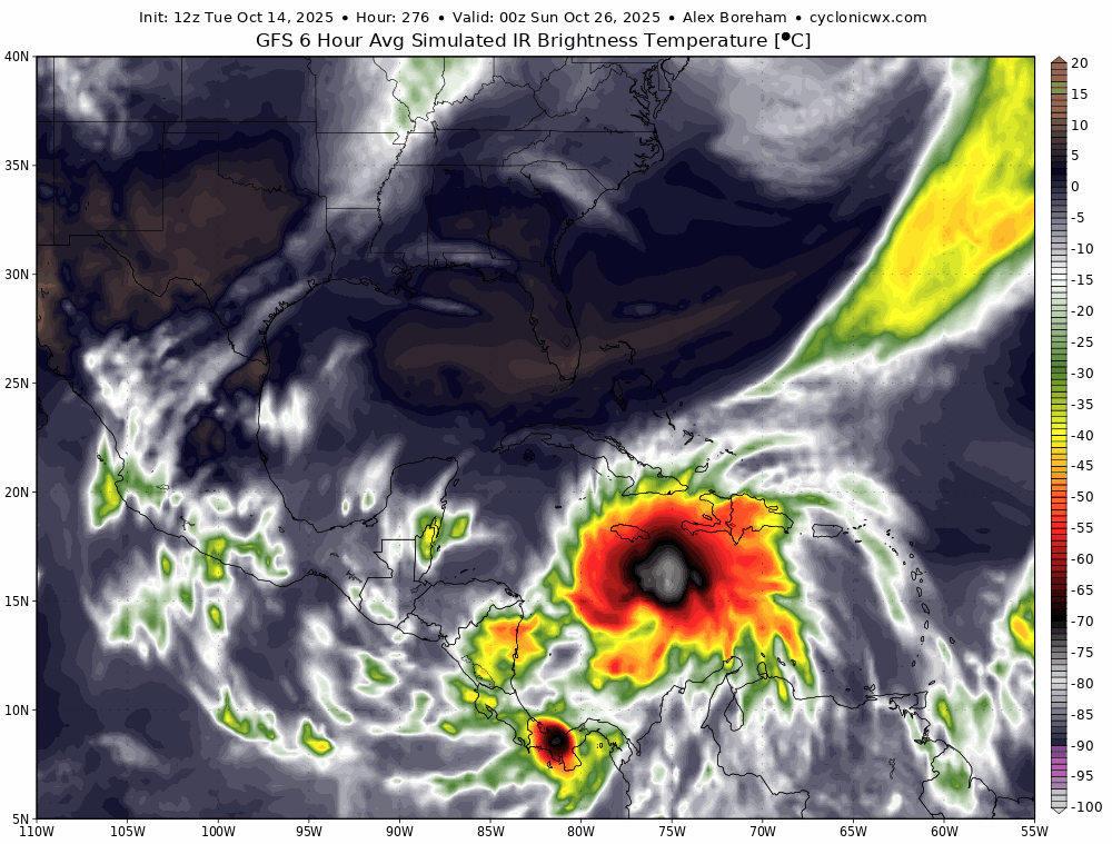
caneman wrote:blp wrote:LarryWx wrote:
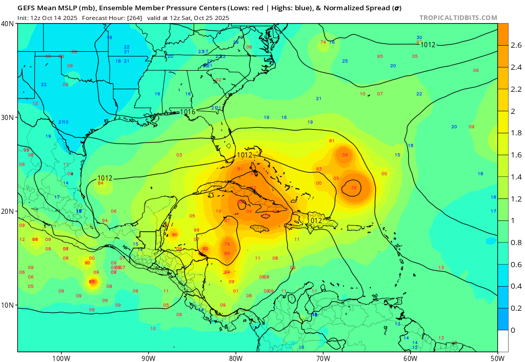
But Euro strongest is TS vs 70 mb lower MH GFS
Yes I edited my post. Land interaction otherwise would have ramped up to MH.
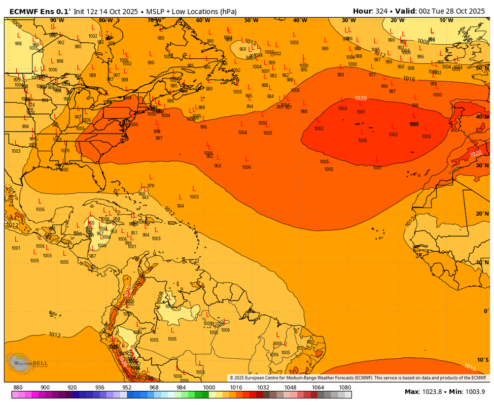
So far out, any lifting North or avoiding the Yuc could still mean hurricane
Yes the ensemble trend today which one should use either way this far out in time was away from CA but could go the other way tonight. Model consensus is for trofiness across the southeast for the most part if we have a strong identity in the NW carib it could very well get yanked northward which puts cuba,keys fl and risk.
we shall see.


