

Flwxguy86 wrote:I've personally got a real concern that the Gulf is being written off too prematurely, I know nobody is saying its completely off the table, but I think the real threat is there. It's still tilted and weak and will likely stay that way till Saturday night/Sunday morning. The models are all over the place. If that trough over Southern Georgia/Northern Florida is as strong as some models do show it in 120H, I would think from that position it only has 2 options, keep going west into central america or Northeast towards Florida. I just am not ready to buy into it crossing over into the atlantic yet. I can see why the models think that, but if we are gonna see rapid intensification around the cayman islands area..how does it not get into the gulf even if that means only clipping southern Florida. I am worried that this could be like michael where you walk up on sunday to the gulf suddenly being in play as the news media pretends it won't happen now because the models don't show it, but I think the pattern supports that. Obviously not 100% guarantee but a possibility that isn't being talked about enough, but I understand it, why scare the hell out of people a week out, but to pretend its almost a zero sum chance just erodes people's trust in the NHC and forecasting. I can see the talk of "weather modification" happening all over social media if that were to happen. I do know this is all dependent on it continuing WNW like it has so far and that through over southern georgia/Northern Florida where its forecasted now, just saying crazier things have happened..
There will be a second digging October trough, the only reason Melisa isn't being picked up now is that she isn't well organized enough to be steered. If the current trough had just been a little stronger and dug a little deeper into the Caribbean we might have had a naked swirl on the dry side of the front.
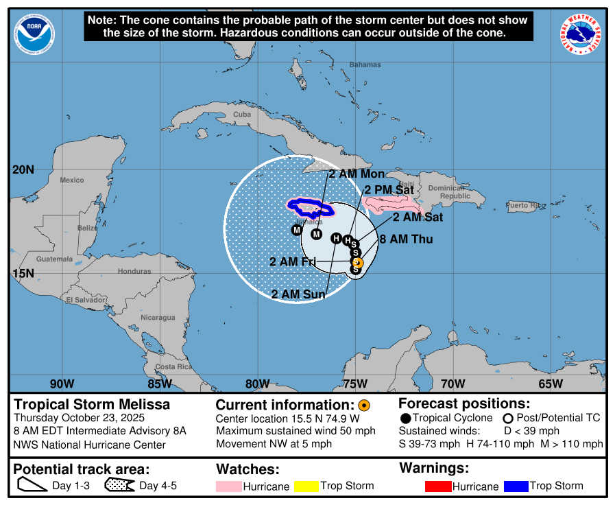
Neither Euro nor GFS have changed their guidance through the 6z today.


