

Not only the Caribbean is feeding this but the EPAC as well
https://rammb-data.cira.colostate.edu/t ... 251500.png
NATL: MELISSA - Aftermath - Discussion
Moderator: S2k Moderators
-
Hypercane_Kyle

- Category 5

- Posts: 3465
- Joined: Sat Mar 07, 2015 7:58 pm
- Location: Cape Canaveral, FL
Re: NATL: MELISSA - Tropical Storm - Discussion
HUGE hot tower just went off. We saw something similar right before Milton rapidly intensified.
6 likes
My posts are my own personal opinion, defer to the National Hurricane Center (NHC) and other NOAA products for decision making during hurricane season.


Re: NATL: MELISSA - Tropical Storm - Discussion
Would be shocked if she’s not a hurricane now. I feel like before too long Melissa is going to one of those hurricanes that ‘skips’ category 3.
4 likes
Re: NATL: MELISSA - Tropical Storm - Discussion
Usually when a strong RI occurs a EWRC quickly ensues right after.
Wonder if one will be underway before Jamaica.
Praying that it does.
Wonder if one will be underway before Jamaica.
Praying that it does.
0 likes
-
ScottNAtlanta

- Category 5
- Posts: 2535
- Joined: Sat May 25, 2013 3:11 pm
- Location: Atlanta, GA
Re: NATL: MELISSA - Tropical Storm - Discussion
GCANE wrote:Usually when a strong RI occurs a EWRC quickly ensues right after.
Wonder if one will be underway before Jamaica.
Praying that it does.
Not always. Laura never had an EWRC, and several other intense hurricanes have not had one. It will depend on the structure of the eye once it forms.
2 likes
The posts in this forum are NOT official forecast and should not be used as such. They are just the opinion of the poster and may or may not be backed by sound meteorological data. They are NOT endorsed by any professional institution or storm2k.org. For official information, please refer to the NHC and NWS products.
-
ScottNAtlanta
- Category 5
- Posts: 2535
- Joined: Sat May 25, 2013 3:11 pm
- Location: Atlanta, GA
Re: NATL: MELISSA - Tropical Storm - Discussion
Last frames on satellite definitely are showing more of a Western motion
https://weather.cod.edu/satrad/?parms=m ... =undefined
https://weather.cod.edu/satrad/?parms=m ... =undefined
0 likes
The posts in this forum are NOT official forecast and should not be used as such. They are just the opinion of the poster and may or may not be backed by sound meteorological data. They are NOT endorsed by any professional institution or storm2k.org. For official information, please refer to the NHC and NWS products.
Re: NATL: MELISSA - Tropical Storm - Discussion
ScottNAtlanta wrote:GCANE wrote:Usually when a strong RI occurs a EWRC quickly ensues right after.
Wonder if one will be underway before Jamaica.
Praying that it does.
Not always. Laura never had an EWRC, and several other intense hurricanes have not had one. It will depend on the structure of the eye once it forms.
Not to mention, Melissa still has 48+ hours over water… she could potentially even complete multiple cycles by then.
3 likes
Re: NATL: MELISSA - Tropical Storm - Discussion
Tower is tightening up the eyewall
Likely a pinhole in 24 hrs.
https://metservice.gov.jm/daily-forecast/radar/
Likely a pinhole in 24 hrs.
https://metservice.gov.jm/daily-forecast/radar/
3 likes
-
TheHurricaneGod
- Tropical Storm

- Posts: 165
- Age: 23
- Joined: Thu Apr 16, 2020 6:19 pm
- Location: Fort Lauderdale
Re: NATL: MELISSA - Tropical Storm - Discussion
I think that's 3 sustained hot towers going at once, near the center. There she goes
1 likes
-
cheezyWXguy

- Category 5
- Posts: 6282
- Joined: Mon Feb 13, 2006 12:29 am
- Location: Dallas, TX
Re: NATL: MELISSA - Tropical Storm - Discussion
He is good.
Hope he finds a safe place when the going gets rough.
https://x.com/iCyclone/status/1982103189685244193
Hope he finds a safe place when the going gets rough.
https://x.com/iCyclone/status/1982103189685244193
1 likes
-
cheezyWXguy
- Category 5
- Posts: 6282
- Joined: Mon Feb 13, 2006 12:29 am
- Location: Dallas, TX
Re: NATL: MELISSA - Tropical Storm - Discussion
I’m not sold on the contraction to pinhole eye though, that eye looks about average sized. Good news is that probably means a Milton or Wilma-level explosion isn’t as likely, but bad news is a larger core won’t collapse as quickly into an ewrc upon reaching peak. Could still undergo one, but would probably stabilize for a while first. Won’t matter much either way though, it’s hard to bet against a cat5 peak at this point so Jamaica better be taking this seriously
3 likes
Re: NATL: MELISSA - Tropical Storm - Discussion
Not going to see an eye for a while.
Cirrus spewing from the hot towers will obscure it.
Probably a high-end Cat 1 within the hour.
Cirrus spewing from the hot towers will obscure it.
Probably a high-end Cat 1 within the hour.
1 likes
-
cycloneye

- Admin

- Posts: 149703
- Age: 69
- Joined: Thu Oct 10, 2002 10:54 am
- Location: San Juan, Puerto Rico
Re: NATL: MELISSA - Tropical Storm - Discussion
cheezyWXguy wrote:I’m not sold on the contraction to pinhole eye though, that eye looks about average sized. Good news is that probably means a Milton or Wilma-level explosion isn’t as likely, but bad news is a larger core won’t collapse as quickly into an ewrc upon reaching peak. Could still undergo one, but would probably stabilize for a while first. Won’t matter much either way though, it’s hard to bet against a cat5 peak at this point so Jamaica better be taking this seriously
The worse part is that it will move very slow to prolong the effects for 48 hours or more on the island.
3 likes
Visit the Caribbean-Central America Weather Thread where you can find at first post web cams,radars
and observations from Caribbean basin members Click Here
and observations from Caribbean basin members Click Here
-
ScottNAtlanta
- Category 5
- Posts: 2535
- Joined: Sat May 25, 2013 3:11 pm
- Location: Atlanta, GA
Re: NATL: MELISSA - Tropical Storm - Discussion
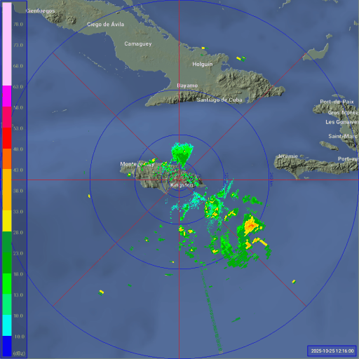
Radar is showing a west movement
https://zoom.earth/places/jamaica/#map=radar
https://zoom.earth/places/jamaica/#map=radar
1 likes
The posts in this forum are NOT official forecast and should not be used as such. They are just the opinion of the poster and may or may not be backed by sound meteorological data. They are NOT endorsed by any professional institution or storm2k.org. For official information, please refer to the NHC and NWS products.
-
MHC Tracking
- Tropical Storm
- Posts: 203
- Joined: Mon Mar 15, 2021 10:05 am
Re: NATL: MELISSA - Tropical Storm - Discussion
GCANE wrote:Usually when a strong RI occurs a EWRC quickly ensues right after.
Wonder if one will be underway before Jamaica.
Praying that it does.
An EWRC would likely exacerbate the situation by broadening the radius of hurricane-force winds and in turn increasing surge
1 likes
-
MHC Tracking
- Tropical Storm
- Posts: 203
- Joined: Mon Mar 15, 2021 10:05 am
Re: NATL: MELISSA - Tropical Storm - Discussion
cheezyWXguy wrote:I’m not sold on the contraction to pinhole eye though, that eye looks about average sized. Good news is that probably means a Milton or Wilma-level explosion isn’t as likely, but bad news is a larger core won’t collapse as quickly into an ewrc upon reaching peak. Could still undergo one, but would probably stabilize for a while first. Won’t matter much either way though, it’s hard to bet against a cat5 peak at this point so Jamaica better be taking this seriously
I'm not "downcasting" but I remain a bit doubtful of a Cat 5 peak. Downsloping from Jamaica has interfered with the development of hurricanes in the past (see: Grace 2021), it feels possible that it does so here as well.
0 likes
Who is online
Users browsing this forum: No registered users and 68 guests