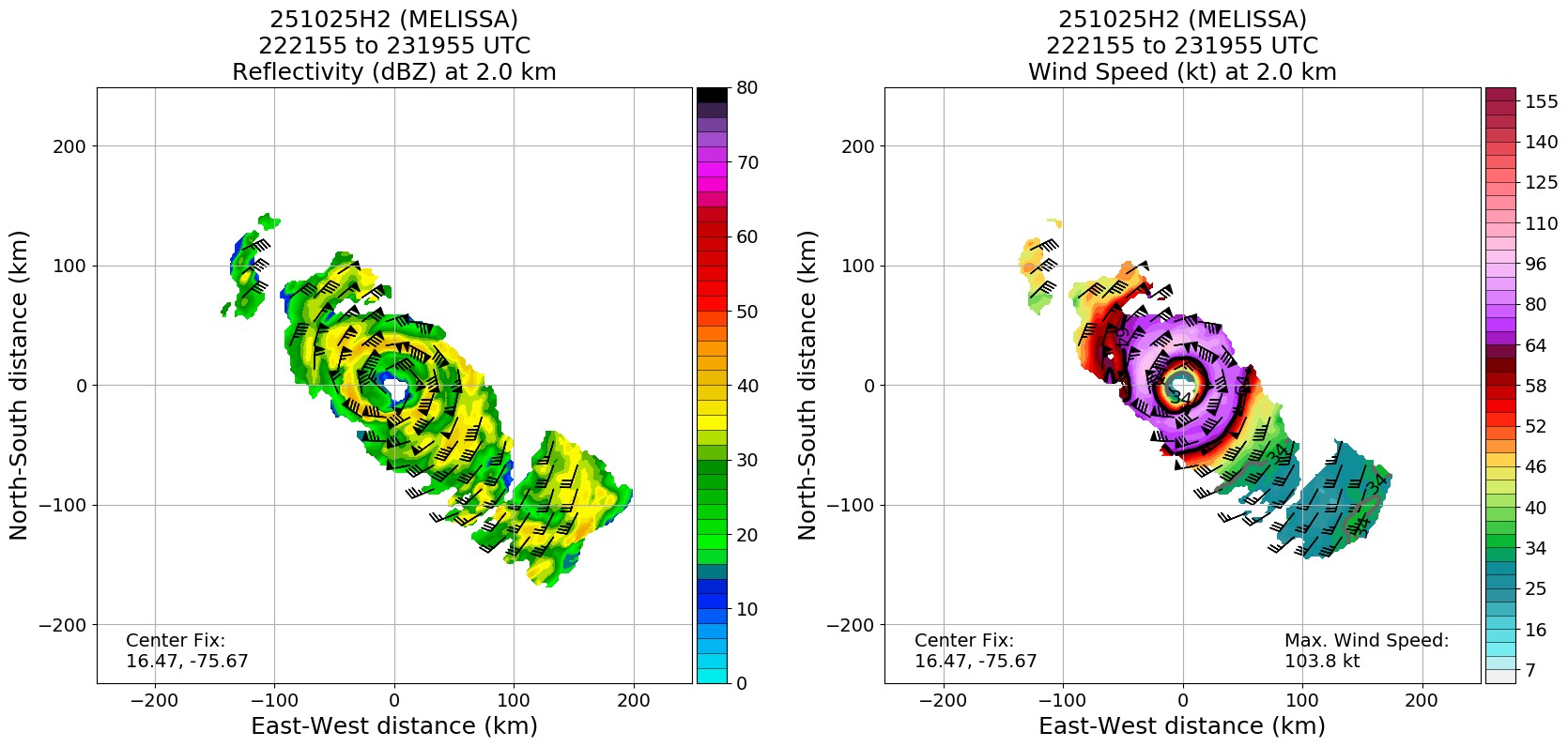
Dropsonde supports 971mb.
Moderator: S2k Moderators


GCANE wrote:107 knot winds at 907mb
65 knots at surface
Drop at max wind band


Blown Away wrote:GCANE wrote:107 knot winds at 907mb
65 knots at surface
Drop at max wind band
What’s your prediction for Melissa’s peak surface winds??
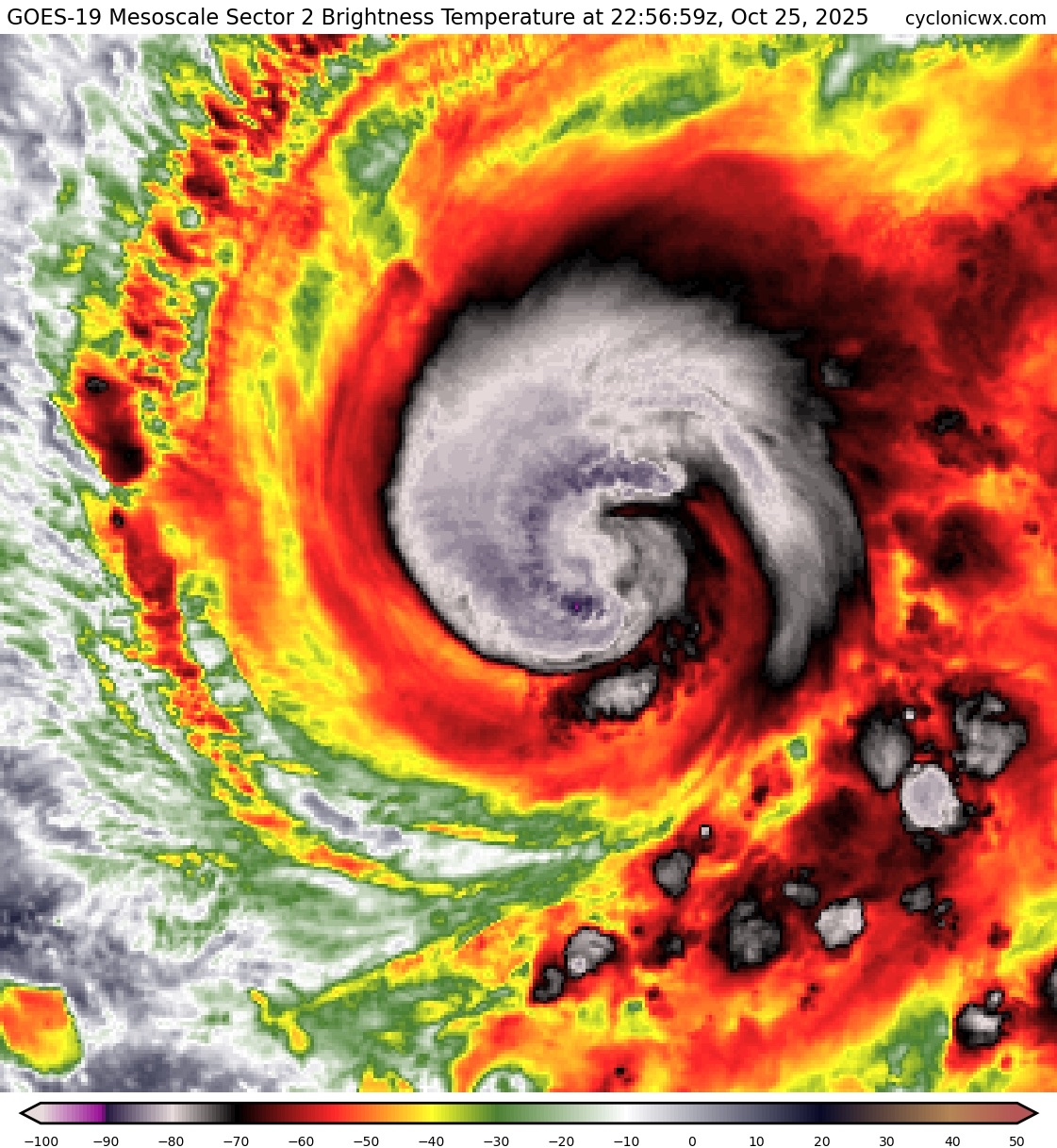
zzzh wrote:Notice that both NOAA and AF report double wind maxima in the SE.
zzzh wrote:https://i.imgur.com/Lf0OfaD.png
Dropsonde supports 971mb.
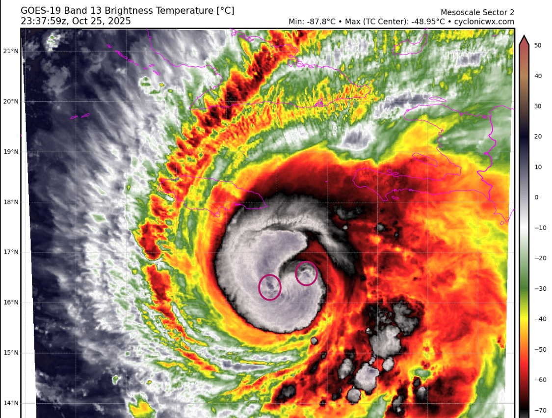
GCANE wrote:Also, appears to be just one eyewall tower.
Usually see two towers at opposite sides of the eye for a TC to really take off.
GCANE wrote:GCANE wrote:Also, appears to be just one eyewall tower.
Usually see two towers at opposite sides of the eye for a TC to really take off.
Alex is saying he sees two towers
https://x.com/cyclonicwx/status/1982225900478357792
Users browsing this forum: No registered users and 58 guests