
F. CLOSED
G. C12
G. C12
Moderator: S2k Moderators


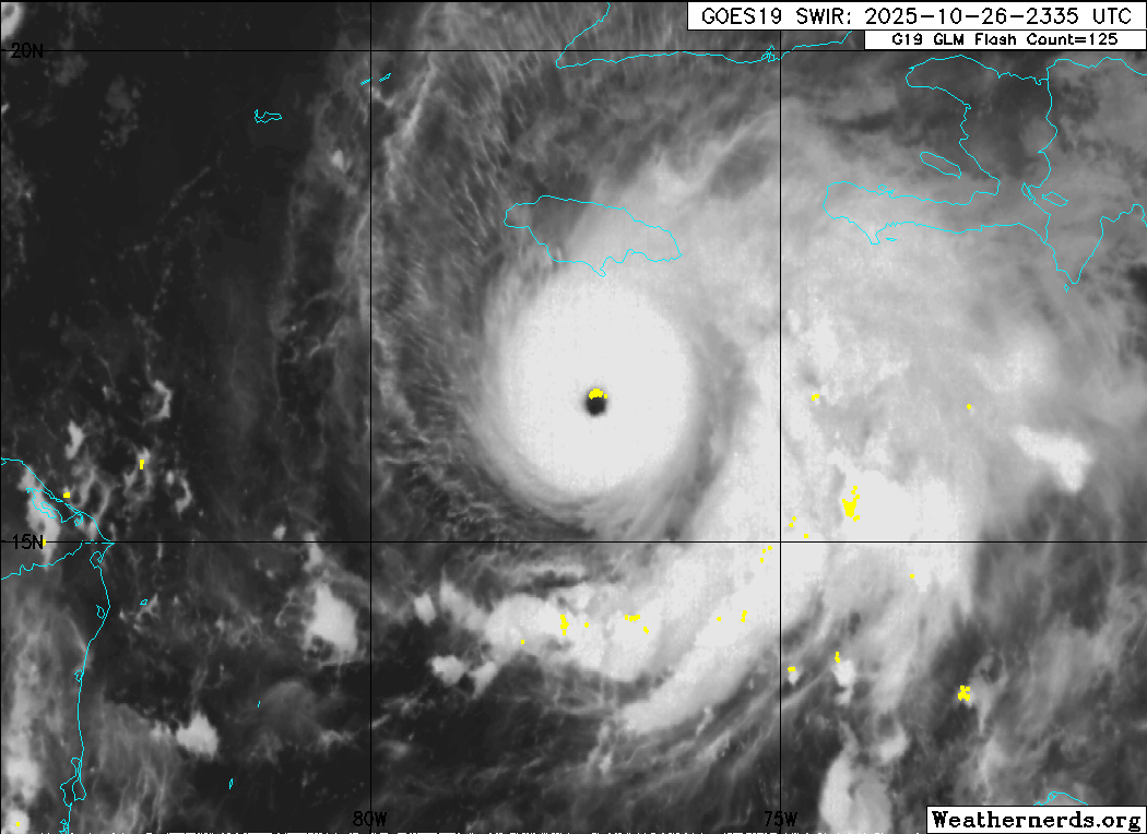
Teban54 wrote:Is there something with Melissa's eye that makes the NOAA aircraft keep missing it, or is it just a streak of bad luck? This time, extrapolated pressure bottomed out at 934.0 mb with 39 kt FL winds. I don't even know if they did an eye drop at all; current data looks like they have skipped it.
Peak FL winds of 124 kt in both SE and NW quads remain unimpressive relative to the appearance, though not atypical of storms that just went through an EWRC (or similar).
Regardless, Melissa still found a way to look more impressive on IR. Whether that translates to intensification is anyone's guess.
https://i.imgur.com/8My44S5.gif


cycloneye wrote:
We will find out in the overnight hours when AF plane makes the passes, but one thing that will help her will be the DMAX period.


cycloneye wrote:Let's see if the next overnight mission has winds up and the pressure down. Air Force plane departs at 11:15 PM EDT.
Users browsing this forum: No registered users and 38 guests


