#1357 Postby Blown Away » Mon Oct 27, 2025 6:44 am
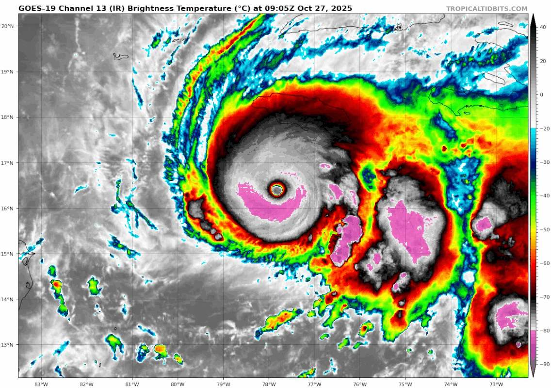
FORECAST POSITIONS AND MAX WINDS
INIT 27/0900Z 16.4N 77.8W 140 KT 160 MPH
12H 27/1800Z 16.6N 78.1W 145 KT 165 MPH
24H 28/0600Z 17.3N 78.1W 140 KT 160 MPH
36H 28/1800Z 18.5N 77.3W 115 KT 130 MPH...NORTH COAST OF JAMAICA
48H 29/0600Z 20.1N 76.0W 105 KT 120 MPH...OVER SE CUBA
60H 29/1800Z 22.1N 74.4W 90 KT 105 MPH...NEAR SE BAHAMAS
72H 30/0600Z 24.7N 72.3W 85 KT 100 MPH
96H 31/0600Z 32.3N 65.1W 80 KT 90 MPH...NEAR BERMUDA
120H 01/0600Z 41.4N 53.5W 60 KT 70 MPH...POST-TROP/EXTRATROP
Melissa is not predicted to go farther W than 78.1, she still looks solid WNW. I believe if she tracks farther W now that will result in a farther W landfall on Jamaica.
Last edited by
Blown Away on Mon Oct 27, 2025 6:49 am, edited 1 time in total.
0 likes
Hurricane Eye Experience: David 79, Irene 99, Frances 04, Jeanne 04, Wilma 05… Hurricane Brush Experience: Andrew 92, Erin 95, Floyd 99, Matthew 16, Irma 17, Ian 22, Nicole 22…


