

tolakram wrote:It hit the ridge, wobbled a bit, now stationary to just a bit of eastward motion IMO.
I wonder if the NNE motion is now starting with Melissa. She is a real monster tonight. Only good news is that if she continues to drift, she'll soon start upwelling cooler water. That's how Dorian started to weaken.


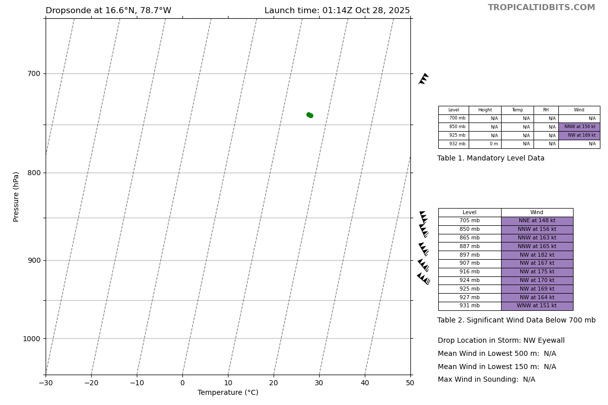


