 The posts in this forum are NOT official forecast and should not be used as such. They are just the opinion of the poster and may or may not be backed by sound meteorological data. They are NOT endorsed by any professional institution or


LearnedHat wrote:txtwister78 wrote:As I've been highlighting for the past few days this makes all the difference in terms of impacts for folks further south in particular regarding the potential for higher ice accumulations and so very important to keep tabs on this as I think the NWS offices further south along with local media in my area in particular may be playing a little catch up with this reality.
Arctic air especially when you're talking about a 1052 high centered across the midwest is going to push and arrive much faster. Just seen it far too many times and so globals (in particular Euro which many within media use) are not as helpful across the south when it comes to surface temps/shallow arctic air.
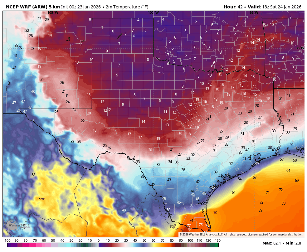
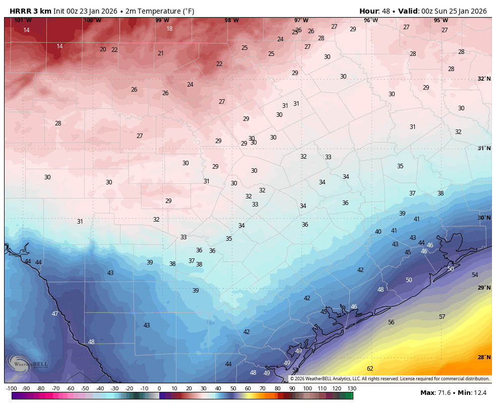
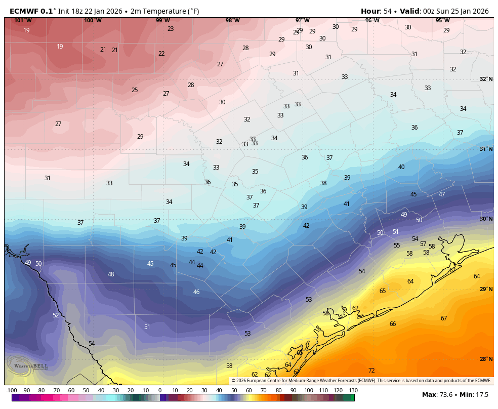
Below you can see already the comparison between the HRRR and Euro temps at 6PM Saturday. My guess is the HRRR will continue to trend colder by then in future runs in addition to other short range guidance such as the WRF-NSSL and ARW.
https://images.weatherbell.com/model/hrrr/austin/t2m_f/1769126400/1769299200-7Xm5MCKlpYw.png
https://images.weatherbell.com/model/ecmwf-deterministic/austin/t2m_f/1769104800/1769299200-jLboTTQ9Nmc.png
I am Where’s Waldo-ing the crap out of that but having trouble spotting the difference.
Surface temps are about 5-6 degrees colder on the HRRR at 6pm compared to the Euro and clearly below freezing in the southern HC meaning more time for ice to accumulate. I expect that trend to continue in future extended runs.


