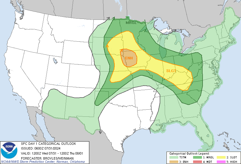
SPC Upgrades to medium Risk for severe outbreak later today!

U.S. & Caribbean Weather Discussions and Severe Weather Events

Moderator: S2k Moderators

Forum rules

The posts in this forum are NOT official forecast and should not be used as such. They are just the opinion of the poster and may or may not be backed by sound meteorological data. They are NOT endorsed by any professional institution or STORM2K.

Help Support Storm2K
Message
Author
Guest

SPC Upgrades to medium Risk for severe outbreak later today!

#1 Postby Guest » Tue Jul 13, 2004 2:00 am

As i mentioned earlier was a possibility in my S2K US update SPC has now decided to go with a moderate risk for severe weather for Today.

More on this later on.

Image
0 likes   

michaelwmoss
Category 2
Category 2
Posts: 558
Joined: Thu Mar 25, 2004 1:56 am
Location: New Whiteland, IN
Contact:

#2 Postby michaelwmoss » Tue Jul 13, 2004 2:15 am

That includes me here! Could be interesting!!

I just came from a trip to Minneapolis and it looks like they are going to get hit overnight!!
0 likes   

User avatar
wx247
S2K Supporter
S2K Supporter
Posts: 14279
Age: 41
Joined: Wed Feb 05, 2003 10:35 pm
Location: Monett, Missouri
Contact:

#3 Postby wx247 » Tue Jul 13, 2004 8:30 am

Quite an extensive area that stands the chance of seeing some big storms. Look out everyone in these areas!
0 likes   
Personal Forecast Disclaimer:
The posts in this forum are NOT official forecast and should not be used as such. They are just the opinion of the poster and may or may not be backed by sound meteorological data. They are NOT endorsed by any professional institution or storm2k.org. For official information, please refer to the NHC and NWS products.

michaelwmoss
Category 2
Category 2
Posts: 558
Joined: Thu Mar 25, 2004 1:56 am
Location: New Whiteland, IN
Contact:

#4 Postby michaelwmoss » Tue Jul 13, 2004 9:27 am

Looks more and more like it by the minute. The Cape is extremely high, the shear profiles are looking quite good as well.

I think we might see a rarely issued PDS Severe Thunderstorm Watch after Noon
0 likes   

User avatar
isobar
Category 5
Category 5
Posts: 2002
Joined: Thu Feb 06, 2003 9:05 am
Location: Louisville, KY

#5 Postby isobar » Tue Jul 13, 2004 11:27 am

Well, the word "Giant" when referring to hail is not encouraging and reminds me of Tokyo in "The Day After Tomorrow". :wink: Let's sure hope for nothing larger than nickels.

...UPPER MS VLY SEWD TO THE OH/TN VLYS...
RATHER ACTIVE SEVERE WEATHER DAY ANTICIPATED ACROSS THE REGION WITH
PARTICULARLY DAMAGING WIND GUSTS AND GIANT HAIL ACROSS THE MDT RISK
AREA.

0 likes   

User avatar
wx247
S2K Supporter
S2K Supporter
Posts: 14279
Age: 41
Joined: Wed Feb 05, 2003 10:35 pm
Location: Monett, Missouri
Contact:

#6 Postby wx247 » Tue Jul 13, 2004 11:30 am

*gulp*

What is their definition of giant? :eek:
0 likes   
Personal Forecast Disclaimer:
The posts in this forum are NOT official forecast and should not be used as such. They are just the opinion of the poster and may or may not be backed by sound meteorological data. They are NOT endorsed by any professional institution or storm2k.org. For official information, please refer to the NHC and NWS products.

michaelwmoss
Category 2
Category 2
Posts: 558
Joined: Thu Mar 25, 2004 1:56 am
Location: New Whiteland, IN
Contact:

#7 Postby michaelwmoss » Tue Jul 13, 2004 12:02 pm

That is what I would like to know. With the CAPE So High and storms possibly reaching over 60000 ft high, I would look for the possiblity of 3-4 inch hail today (Tennis Ball-Softball Size)

Sounds like Oklahoma don't it :)
0 likes   

User avatar
therock1811
Category 5
Category 5
Posts: 5163
Age: 39
Joined: Thu May 15, 2003 2:15 pm
Location: Kentucky
Contact:

#8 Postby therock1811 » Tue Jul 13, 2004 2:17 pm

I hope NOT! I'm right in that moderate risk area! This is a DANGEROUS situation for the OV and Great Lakes region as there COULD be rare overnight severe weather!
0 likes   

michaelwmoss
Category 2
Category 2
Posts: 558
Joined: Thu Mar 25, 2004 1:56 am
Location: New Whiteland, IN
Contact:

#9 Postby michaelwmoss » Tue Jul 13, 2004 2:26 pm

Definately looking more likely. I would venture to see a torando watch from Central Indiana to the watch already effect in Illinois. Probably a Severe T-storm Watch North Of That watch.
0 likes   

User avatar
StormCrazyIowan
Category 5
Category 5
Posts: 6599
Age: 42
Joined: Tue Feb 11, 2003 8:13 pm
Location: Quad Cities, IA
Contact:

#10 Postby StormCrazyIowan » Tue Jul 13, 2004 3:31 pm

We've been in a Tor Watch since this morning, but not a thing has happened in my area... we were under the MOD risk, but now only slight... the cold front is approaching, I'd say for me it's all over but the singing.... when a few supercells have been roaring for hours only about an hour away from here... *sigh* Why do I always have to be broke when these things happen?
0 likes   

User avatar
therock1811
Category 5
Category 5
Posts: 5163
Age: 39
Joined: Thu May 15, 2003 2:15 pm
Location: Kentucky
Contact:

#11 Postby therock1811 » Tue Jul 13, 2004 3:40 pm

michaelwmoss wrote:Definately looking more likely. I would venture to see a torando watch from Central Indiana to the watch already effect in Illinois. Probably a Severe T-storm Watch North Of That watch.


You hit the nail on the head! That's EXACTLY what just happened...details:

URGENT - IMMEDIATE BROADCAST REQUESTED
TORNADO WATCH NUMBER 623
NWS STORM PREDICTION CENTER NORMAN OK
330 PM CDT TUE JUL 13 2004

THE NWS STORM PREDICTION CENTER HAS ISSUED A
TORNADO WATCH FOR PORTIONS OF

CENTRAL ILLINOIS
CENTRAL AND SOUTHERN INDIANA

EFFECTIVE THIS TUESDAY AFTERNOON AND EVENING FROM 330 PM UNTIL
1000 PM CDT.

TORNADOES...HAIL TO 3 INCHES IN DIAMETER...THUNDERSTORM WIND GUSTS
TO 80 MPH...AND DANGEROUS LIGHTNING ARE POSSIBLE IN THESE AREAS.

THE TORNADO WATCH AREA IS ALONG AND 70 STATUTE MILES NORTH AND
SOUTH OF A LINE FROM 5 MILES WEST NORTHWEST OF SPRINGFIELD
ILLINOIS TO 45 MILES EAST SOUTHEAST OF INDIANAPOLIS INDIANA.

REMEMBER...A TORNADO WATCH MEANS CONDITIONS ARE FAVORABLE FOR
TORNADOES AND SEVERE THUNDERSTORMS IN AND CLOSE TO THE WATCH AREA.
PERSONS IN THESE AREAS SHOULD BE ON THE LOOKOUT FOR THREATENING
WEATHER CONDITIONS AND LISTEN FOR LATER STATEMENTS AND POSSIBLE
WARNINGS.

OTHER WATCH INFORMATION...CONTINUE...WW 619...WW 620...WW 621...WW
622...

DISCUSSION...INTENSE TORNADIC SUPERCELLS CENTRAL IL WILL CONTINUE TO
FEED ON THE EXTREMELY UNSTABLE AIR MASS FEEDING IN FROM THE W. WITH
THE APPROACH OF THE 50-60 KT MID LEVEL WIND MAX...SHEAR WILL BECOME
INCREASINGLY FAVORABLE FOR TORNADIC STORMS WHICH WILL INCLUDE VERY
LARGE HAIL AND DAMAGING WINDS

AVIATION...TORNADOES AND A FEW SEVERE THUNDERSTORMS WITH HAIL
SURFACE AND ALOFT TO 3 INCHES. EXTREME TURBULENCE AND SURFACE WIND
GUSTS TO 70 KNOTS. A FEW CUMULONIMBI WITH MAXIMUM TOPS TO 650.
MEAN STORM MOTION VECTOR 32030.
0 likes   

michaelwmoss
Category 2
Category 2
Posts: 558
Joined: Thu Mar 25, 2004 1:56 am
Location: New Whiteland, IN
Contact:

#12 Postby michaelwmoss » Tue Jul 13, 2004 3:59 pm

And with the Severe Weather Watch too :)

Those are two HUGE Supercells Approaching From The Northwest! They are classic looking Supercells (Very High in the Atmosphere, Very Large Heavy Rain/Hail Coverage, and A Hook with the Meso)

Hanging on Here!! I will try to keep updates on the weather. I also have an Audioblogger That I will post something if a Severe Storm Gets Close. You can hear acutal audio with that at:

http://indiegospelradio.blogspot.com/
0 likes   


Return to “USA & Caribbean Weather”

Who is online

Users browsing this forum: No registered users and 7 guests