Official 93L Invest thread=93L is not anymore at NRL

This is the general tropical discussion area. Anyone can take their shot at predicting a storms path.

Moderator: S2k Moderators

Forum rules

The posts in this forum are NOT official forecasts and should not be used as such. They are just the opinion of the poster and may or may not be backed by sound meteorological data. They are NOT endorsed by any professional institution or STORM2K. For official information, please refer to products from the National Hurricane Center and National Weather Service.

Help Support Storm2K
Message
Author
rockyman
Category 5
Category 5
Posts: 1967
Joined: Thu Jun 26, 2003 12:24 pm
Location: Dauphin Island, AL

#81 Postby rockyman » Sun Jul 31, 2005 9:55 am

skysummit wrote:That's the same image.


Here's the current image:

http://cimss.ssec.wisc.edu/tropic/real-time/atlantic/winds/wg8shr.html

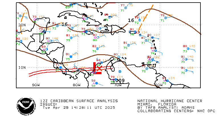
Yes...shear has decreased rather dramatically west of 70
0 likes   

User avatar
skysummit
S2K Supporter
S2K Supporter
Posts: 5305
Age: 49
Joined: Tue Aug 31, 2004 11:09 pm
Location: Ponchatoula, LA
Contact:

#82 Postby skysummit » Sun Jul 31, 2005 9:55 am

It sure does look a lot better. Thanks for the link.
0 likes   

User avatar
skysummit
S2K Supporter
S2K Supporter
Posts: 5305
Age: 49
Joined: Tue Aug 31, 2004 11:09 pm
Location: Ponchatoula, LA
Contact:

#83 Postby skysummit » Sun Jul 31, 2005 10:10 am

Is there a spin? I know the surface observations don't support it, but I'm looking closely at this area and I can kind of see the lower clouds rotating inward. Is it, or is it just a trick on my eyes? BTW, I'm using the NASA site....

http://wwwghcc.msfc.nasa.gov/GOES/goeseasthurr.html

Image
0 likes   

User avatar
stormchazer
Category 5
Category 5
Posts: 2462
Joined: Fri Aug 29, 2003 12:00 pm
Location: Lakeland, Florida
Contact:

#84 Postby stormchazer » Sun Jul 31, 2005 10:14 am

I guess not...Recon was cancelled.
0 likes   
The posts or stuff said are NOT an official forecast and my opinion alone. Please look to the NHC and NWS for official forecasts and products.

Model Runs Cheat Sheet:
GFS (5:30 AM/PM, 11:30 AM/PM)
HWRF, GFDL, UKMET, NAVGEM (6:30-8:00 AM/PM, 12:30-2:00 AM/PM)
ECMWF (1:45 AM/PM)
TCVN is a weighted averaged

Opinions my own.

User avatar
skysummit
S2K Supporter
S2K Supporter
Posts: 5305
Age: 49
Joined: Tue Aug 31, 2004 11:09 pm
Location: Ponchatoula, LA
Contact:

#85 Postby skysummit » Sun Jul 31, 2005 10:17 am

stormchazer wrote:I guess not...Recon was cancelled.


I know it was cancelled....earlier this morning. I just noticed this in the past few minutes.
0 likes   

User avatar
TS Zack
Category 4
Category 4
Posts: 925
Joined: Thu Jul 01, 2004 6:23 pm
Location: Louisiana
Contact:

#86 Postby TS Zack » Sun Jul 31, 2005 10:23 am

Maybe Mid-level but nothing at the surface as of now!

It looks very organized at this point but just lacking the one main part. A circulation. In general, the wave is very impressive.
0 likes   

User avatar
stormchazer
Category 5
Category 5
Posts: 2462
Joined: Fri Aug 29, 2003 12:00 pm
Location: Lakeland, Florida
Contact:

#87 Postby stormchazer » Sun Jul 31, 2005 10:26 am

skysummit wrote:
stormchazer wrote:I guess not...Recon was cancelled.


I know it was cancelled....earlier this morning. I just noticed this in the past few minutes.


Local obs are not showing any indication of a surface rotation. Pressures have been steady and winds blowing from East fairly steadily on all the buoys in the area. The last QUIKSCAT does not show signs of a circulation either. The Sat looks promising, I agree, but there is not anything brewing there.....yet.
0 likes   
The posts or stuff said are NOT an official forecast and my opinion alone. Please look to the NHC and NWS for official forecasts and products.

Model Runs Cheat Sheet:
GFS (5:30 AM/PM, 11:30 AM/PM)
HWRF, GFDL, UKMET, NAVGEM (6:30-8:00 AM/PM, 12:30-2:00 AM/PM)
ECMWF (1:45 AM/PM)
TCVN is a weighted averaged

Opinions my own.

clfenwi
Category 5
Category 5
Posts: 3331
Joined: Thu Jun 09, 2005 12:54 pm

#88 Postby clfenwi » Sun Jul 31, 2005 10:41 am

TGPY 311500Z 28004KT 1500 TS SHRA FEW010CB BKN015 25/25 Q1014 CB-N

Westerly wind in Grenada
0 likes   

User avatar
cycloneye
Admin
Admin
Posts: 148500
Age: 69
Joined: Thu Oct 10, 2002 10:54 am
Location: San Juan, Puerto Rico

#89 Postby cycloneye » Sun Jul 31, 2005 10:49 am

A TROPICAL WAVE NEAR THE SOUTHERN LESSER ANTILLES IS MOVING WESTWARD
AT 15 TO 20 MPH. THIS SYSTEM HAS CHANGED LITTLE SINCE YESTERDAY...
AND THE AIR FORCE RECONNAISSANCE MISSION TO INVESTIGATE THE AREA
LATER TODAY HAS BEEN CANCELLED. HOWEVER SOME SLOW DEVELOPMENT
REMAINS POSSIBLE...AND AN AIR FORCE RESERVE UNIT RECONNAISSANCE
AIRCRAFT IS SCHEDULED TO INVESTIGATE THE SYSTEM OVER THE EASTERN
CARIBBEAN SEA TOMORROW...IF NECESSARY.
0 likes   
Visit the Caribbean-Central America Weather Thread where you can find at first post web cams,radars
and observations from Caribbean basin members Click Here

User avatar
stormchazer
Category 5
Category 5
Posts: 2462
Joined: Fri Aug 29, 2003 12:00 pm
Location: Lakeland, Florida
Contact:

#90 Postby stormchazer » Sun Jul 31, 2005 11:02 am

Image


No sign of Circulation on this pass.
0 likes   

clfenwi
Category 5
Category 5
Posts: 3331
Joined: Thu Jun 09, 2005 12:54 pm

#91 Postby clfenwi » Sun Jul 31, 2005 11:05 am

stormchazer wrote:(snip)


No sign of Circulation on this pass.


Note the data pass timestamp ... 10:07... not exactly fresh and hot...
0 likes   

User avatar
Thunder44
Category 5
Category 5
Posts: 5922
Age: 44
Joined: Mon Jun 09, 2003 7:53 pm
Location: New York City

#92 Postby Thunder44 » Sun Jul 31, 2005 11:06 am

stormchazer wrote:Image


No sign of Circulation on this pass.


That's from early this morning. Look at the UTC time on the bottom.
0 likes   

User avatar
stormchazer
Category 5
Category 5
Posts: 2462
Joined: Fri Aug 29, 2003 12:00 pm
Location: Lakeland, Florida
Contact:

#93 Postby stormchazer » Sun Jul 31, 2005 11:13 am

I know this was earlier, I was just mentioning what the last observations were showing. As I said, it looks promising but the jury is still out right now, at least according to the NHC. I assume thats why they cancelled the Recon.
0 likes   
The posts or stuff said are NOT an official forecast and my opinion alone. Please look to the NHC and NWS for official forecasts and products.

Model Runs Cheat Sheet:
GFS (5:30 AM/PM, 11:30 AM/PM)
HWRF, GFDL, UKMET, NAVGEM (6:30-8:00 AM/PM, 12:30-2:00 AM/PM)
ECMWF (1:45 AM/PM)
TCVN is a weighted averaged

Opinions my own.

User avatar
cycloneye
Admin
Admin
Posts: 148500
Age: 69
Joined: Thu Oct 10, 2002 10:54 am
Location: San Juan, Puerto Rico

#94 Postby cycloneye » Sun Jul 31, 2005 11:15 am

Image

Image

Thanks dixie. :)
Last edited by cycloneye on Sun Jul 31, 2005 11:16 am, edited 1 time in total.
0 likes   

User avatar
Thunder44
Category 5
Category 5
Posts: 5922
Age: 44
Joined: Mon Jun 09, 2003 7:53 pm
Location: New York City

#95 Postby Thunder44 » Sun Jul 31, 2005 11:15 am

stormchazer wrote:I know this was earlier, I was just mentioning what the last observations were showing. As I said, it looks promising but the jury is still out right now, at least according to the NHC. I assume thats why they cancelled the Recon.


They cancelled the recon at about 9am this morning.
0 likes   

User avatar
stormchazer
Category 5
Category 5
Posts: 2462
Joined: Fri Aug 29, 2003 12:00 pm
Location: Lakeland, Florida
Contact:

#96 Postby stormchazer » Sun Jul 31, 2005 11:19 am

Thunder44 wrote:
stormchazer wrote:I know this was earlier, I was just mentioning what the last observations were showing. As I said, it looks promising but the jury is still out right now, at least according to the NHC. I assume thats why they cancelled the Recon.


They cancelled the recon at about 9am this morning.


Okay....and it is now 12:16pm....Do I win?

If it continues to develop, then I am sure we will hear about it from the NHC. 92L was almost a Depression, but now its gone. I am just waiting to see more. My opinion.
0 likes   
The posts or stuff said are NOT an official forecast and my opinion alone. Please look to the NHC and NWS for official forecasts and products.

Model Runs Cheat Sheet:
GFS (5:30 AM/PM, 11:30 AM/PM)
HWRF, GFDL, UKMET, NAVGEM (6:30-8:00 AM/PM, 12:30-2:00 AM/PM)
ECMWF (1:45 AM/PM)
TCVN is a weighted averaged

Opinions my own.

clfenwi
Category 5
Category 5
Posts: 3331
Joined: Thu Jun 09, 2005 12:54 pm

#97 Postby clfenwi » Sun Jul 31, 2005 11:30 am

15/16Z wind obs

Tobago TTCP 311600Z 25006KT
Grenada TGPY 311600Z 31005KT
St Vincent TVSV 311600Z 12011KT
St Lucia TLPL 311500Z 03012KT
Martinique TFFF 311500Z 06003KT

Not a monolithic easterly wind out there...
0 likes   

Matt-hurricanewatcher

#98 Postby Matt-hurricanewatcher » Sun Jul 31, 2005 11:41 am

It looks much better oreganized then 92L. The shear maps shows that it has a upper level high. In it has nice curving to the clouds. That data shows a west winds to the south of the cirulation. While farther up in the chain of islands I saw a northeast wind. tropical depression 9 of a few years ago was upgraded with one ship report that reported west wind. In later found to be Bs. This is a sure thing because you can't get 3 or 4 islands saying the same thing. I don't understand why a special statment is not coming out.
0 likes   

User avatar
Thunder44
Category 5
Category 5
Posts: 5922
Age: 44
Joined: Mon Jun 09, 2003 7:53 pm
Location: New York City

#99 Postby Thunder44 » Sun Jul 31, 2005 11:48 am

Matt-hurricanewatcher wrote:It looks much better oreganized then 92L. The shear maps shows that it has a upper level high. In it has nice curving to the clouds. That data shows a west winds to the south of the cirulation. While farther up in the chain of islands I saw a northeast wind. tropical depression 9 of a few years ago was upgraded with one ship report that reported west wind. In later found to be Bs. This is a sure thing because you can't get 3 or 4 islands saying the same thing. I don't understand why a special statment is not coming out.


Patience my friend. I'm sure they are aware and waiting for more obs to come in.
0 likes   

User avatar
stormchazer
Category 5
Category 5
Posts: 2462
Joined: Fri Aug 29, 2003 12:00 pm
Location: Lakeland, Florida
Contact:

#100 Postby stormchazer » Sun Jul 31, 2005 11:50 am

Image

Not monolithic I understand. I know its a few hours old but the winds were more from the East then west and reports have been fairly calm from most of the islands as far as winds with steady pressures.

TFFR 31/1600 29.94 82 79 89 140 7
TLPC 31/1600 29.97 79 75 89 90 12 6 FEW009 SCT016 OVC070 R-
TGPY 31/1600 29.94 79 77 94 310 5 1 FEW010 BKN015 RW
TAPA 31/1600 29.94 86 79 79 110 13 6 SCT022 BKN280


I am going to wait and see if something is trying to form. I am getting bored of this whole 24-48 hours of calm we have had since Franklin did its square-dance off the east coast.
0 likes   


Return to “Talkin' Tropics”

Who is online

Users browsing this forum: Hurricane2022 and 43 guests